File:Turkey time series analysis.png
Original file (2,362 × 1,764 pixels, file size: 2.7 MB, MIME type: image/png)
Summary
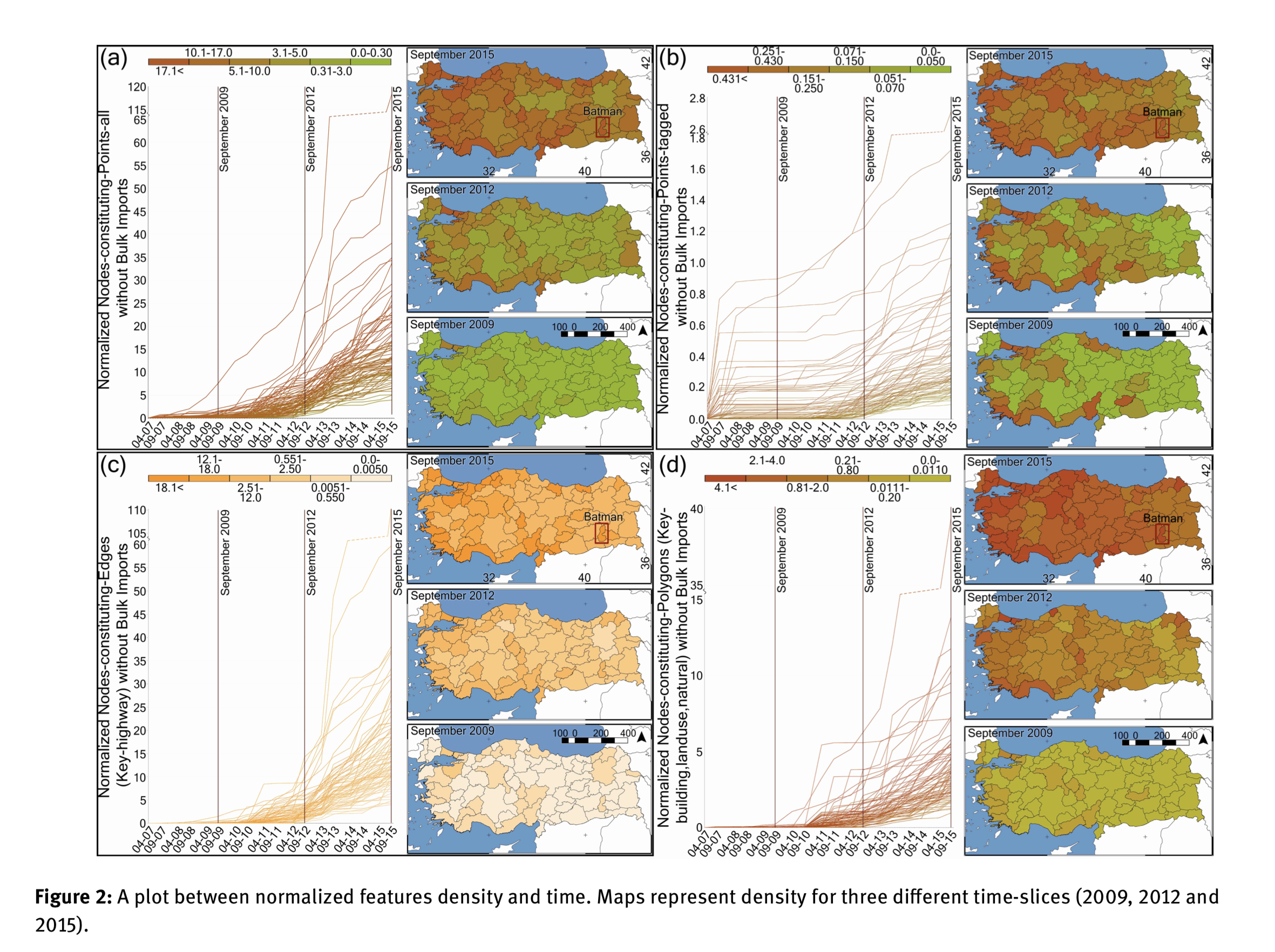
Growth of OpenStreetMap data density in Turkey, presented in a paper of various time series spatial analyses
The paper is called "Turkey OpenStreetMap Dataset - Spatial Analysis of Development and Growth Proxies" by Mohammed Zia of Heidelberg University, and Ziyadin Cakir & Dursun Zafer Seker of Istanbul Technical University.
This image is "Figure 2: A plot between normalized features density and time. Maps represent density for three different time-slices (2009, 2012 and 2015)."
- top-left (a) Nodes constituting points (all)
- top-right (b) Nodes constituting points (tagged)
- bottom-left (c) Nodes constituting edges (key-highway)
- bottom-right (d) Nodes constituting polygons (key-building,landuse-natural)
License
The full paper (presumably including all illustrations) is licensed as follows:
© 2019 Mohammed Zia et al., published by De Gruyter. This work is licensed under the Creative Commons Attribution alone 4.0 License.
![]()
![]()
Attribution: 2019 Mohammed Zia et al., published by De Gruyter
File history
Click on a date/time to view the file as it appeared at that time.
| Date/Time | Thumbnail | Dimensions | User | Comment | |
|---|---|---|---|---|---|
| current | 22:56, 21 April 2019 | | 2,362 × 1,764 (2.7 MB) | Harry Wood (talk | contribs) | Growth of OpenStreetMap data density in Turkey, presented in [https://www.degruyter.com/view/j/geo.2019.11.issue-1/geo-2019-0012/geo-2019-0012.xml a paper of various time series spatial analyses] |
You cannot overwrite this file.
File usage
The following 5 pages use this file: