Nanogis
Jump to navigation
Jump to search
| Nanogis | |
|---|---|
| License: | MIT License (free of charge) |
| Platforms: | Windows and Linux |
| Version: | 1.0.0 |
| Language: | English |
| Website: | https://github.com/storm-ptr/bark |
| Programming language: | C++ |
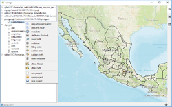
This program [1] can visualize (panning, zooming, reprojection on the fly) geometry and raster data, copy and query geometry that stored in databases:
The same is true for a variety of raster and vector file formats supported by GDAL/OGR.
Also available OpenStreetMap tilemaps.
Getting Started
- windows 10: download archive, extract and run
 ./nanogis/vc_redist.x64.exe
 ./nanogis/nanogis.exe
- ubuntu 20.04: download debian package and run
 sudo add-apt-repository -y ppa:beineri/opt-qt-5.12.9-focal
 sudo add-apt-repository -y ppa:ubuntugis/ubuntugis-unstable
 sudo apt-get update
 sudo dpkg -i ./nanogis.ubuntu.2004.deb
 sudo apt-get install -f
 nanogis
