Uploads by Balrog
Jump to navigation
Jump to search
This special page shows all uploaded files.
| Date | Name | Thumbnail | Size | Description | Versions |
|---|---|---|---|---|---|
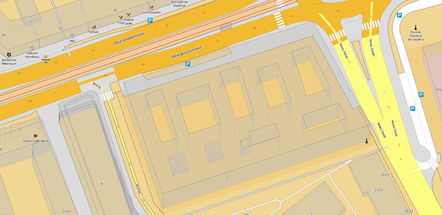
| 21:45, 13 October 2015 | Osmapa.pl-rendering.png (file) |  |
328 KB | Screenshot of the osmapa.pl OSM mapnik stylesheet with pseudo-3D buildings. The stylesheet is maintained at https://github.com/balrog-kun/OSMapa-Topo and was probably one of the first Topographic maps made with OSM (2011), with contours, colored hikin... | 1 |
| 01:22, 4 March 2011 | Siedlce-fireproof-josm.gif (file) |  |
1.41 MB | This is a simple rendering of the building:fireproof=<yes|no> tag on buildings in Siedlce. Virtually all of the data shown comes from the Siedlce municipality council's donation of geodesic data, of which some layers have been imported int | 1 |
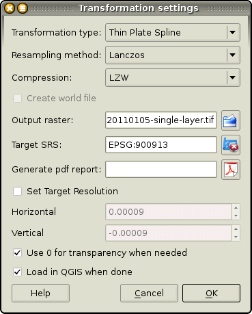
| 00:04, 10 February 2011 | Screen-qgis-xform-settings.png (file) |  |
28 KB | QuantimGIS' Georeferencer plugin's transformation settings dialog with the necessary values filled in. | 1 |
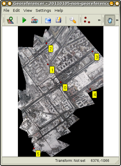
| 21:21, 9 February 2011 | Screen-qgis-georeferencer.png (file) |  |
219 KB | Control points added to a TIFF file in QuantumGIS Georeferencer plugin's window. | 1 |
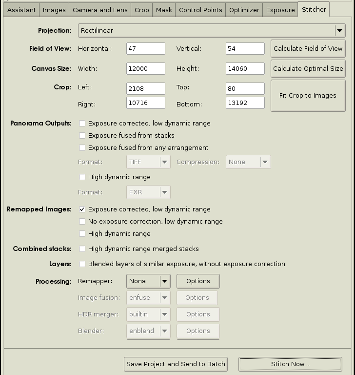
| 07:55, 28 January 2011 | Screen-hugin-output.png (file) |  |
54 KB | Screenshot of Hugin's output tab. | 1 |
| 07:25, 28 January 2011 | Screen-hugin-halfway-preview.png (file) |  |
153 KB | Screenshot of hugin's Fast Panorama Preview dialog showing the "Identify" feature. | 1 |
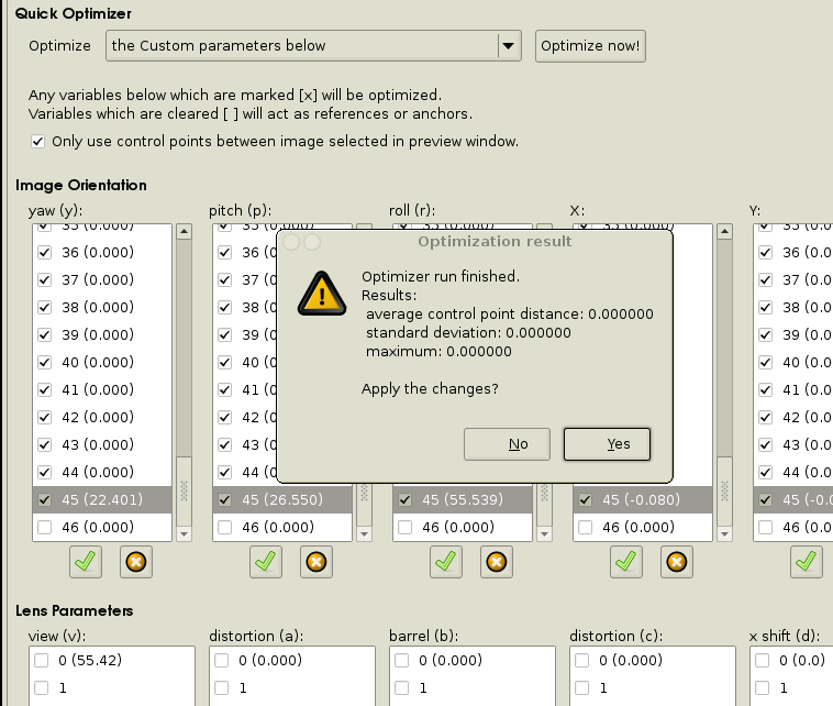
| 07:27, 27 January 2011 | Screen-hugin-pic45-optimised.png (file) |  |
49 KB | Hugin found the pitch, roll, yaw, X, Y and Z values for the camera based on 3 ground control points selected in the ''Control Points'' tab. Since there were exactly three points, Hugin can not detect the optimising error. Note that only picture 45's par | 1 |
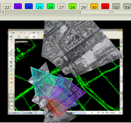
| 07:21, 27 January 2011 | Screen-hugin-pic45-gcps.png (file) |  |
237 KB | Ground Control Points marked on an aerial image loaded into Hugin. Minimum of 3 points per picture are required, and using just 3 GCPs for some reason also give the best results. | 1 |
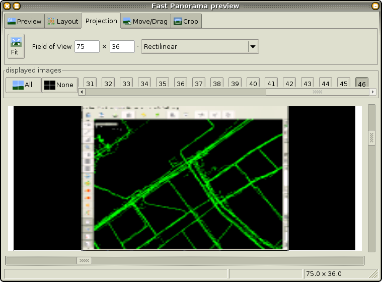
| 06:14, 27 January 2011 | Screen-hugin-ref-preview.png (file) |  |
80 KB | Hugin's "Fast preview" window with a JOSM screenshot loaded as reference. | 1 |
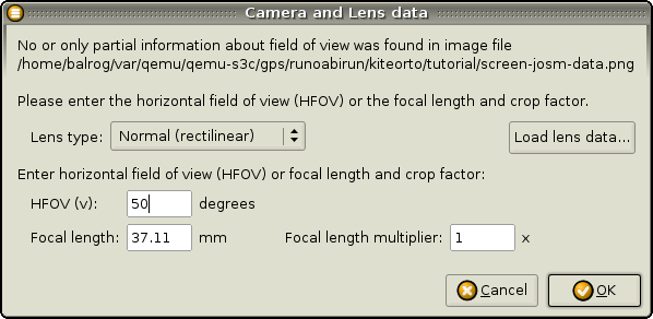
| 23:02, 19 January 2011 | Screen-hugin-ref-lens.png (file) |  |
23 KB | Screenshot of Hugin asking for the new image's lens parameters. | 1 |
| 22:52, 19 January 2011 | Screen-gimp-screen.png (file) |  |
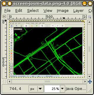
38 KB | Screenshot of GIMP showing a screenshot of JOSM with GPS data loaded. | 1 |
| 22:29, 19 January 2011 | Screen-hugin-loaded.png (file) |  |
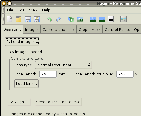
25 KB | Screenshot of Hugin showing the number of pictures loaded. | 1 |
| 04:04, 17 January 2011 | Gcp-madness.png (file) |  |
454 KB | Georectification of an aerial picture in Map Warper using 73 control points. Picture taken from Tim Waters' slides about OpenStreetMap found on slideshare.net. | 1 |
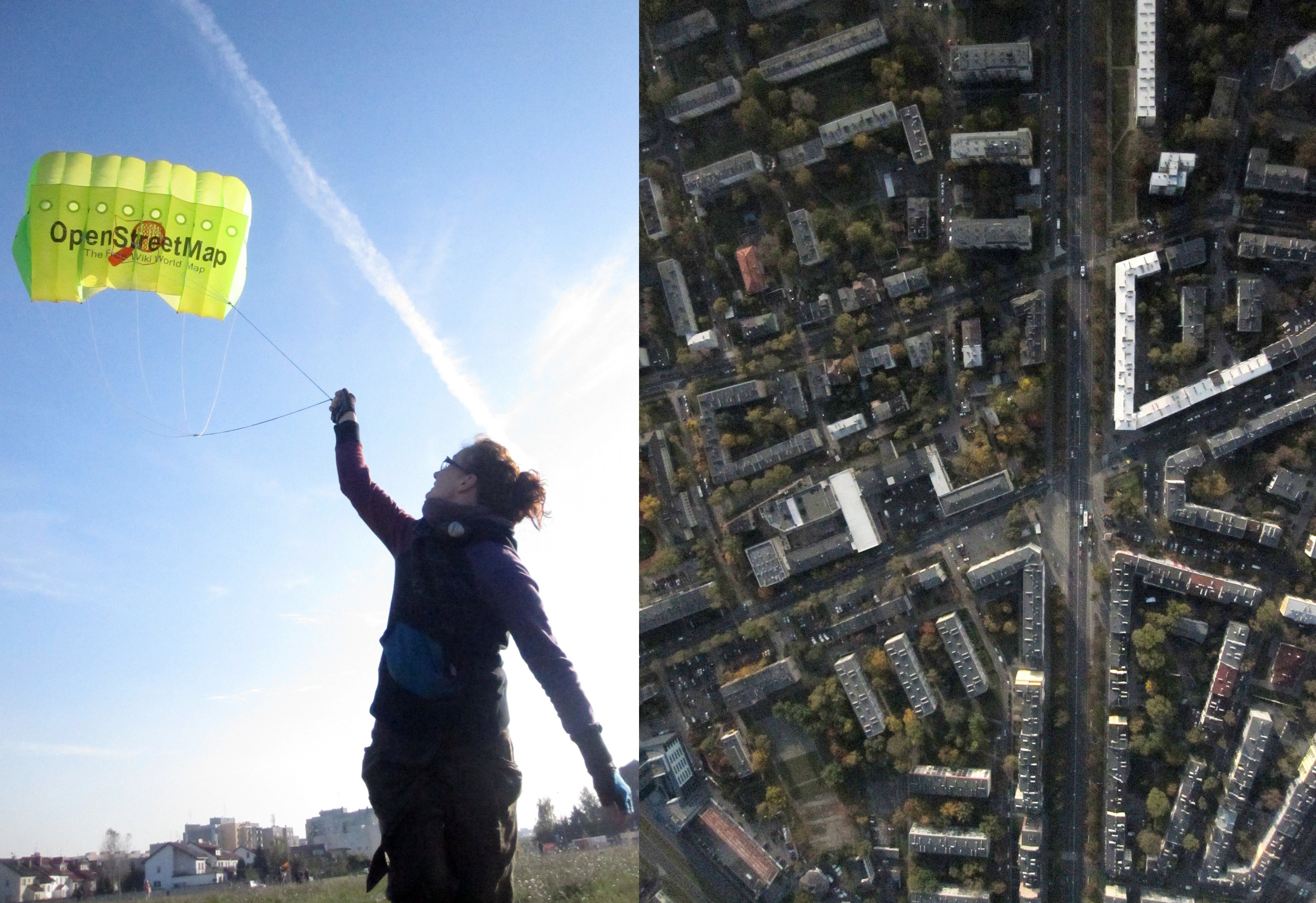
| 01:40, 25 October 2010 | Osmcopter-split-screen.jpg (file) |  |
1.7 MB | The OpenStreetMap logo printed on a 350cm (11.5ft) Sutton Flowform-type kite made for making aerial imagery. These kites are produced by IKAR in Poland (among others). On the right is an example picture taken on 2010-10-20 over Praga district of Warsaw | 1 |
| 14:38, 13 October 2010 | Mag map pl contained.svg (file) |  |
67 KB | OSM logo variation with the outline of Poland borders. Idea copied from Ian Dees' logo variation. | 1 |
| 14:37, 13 October 2010 | Mag map pl.svg (file) |  |
45 KB | OSM logo variation with the outline of Poland borders. Idea copied from Ian Dees' logo variation. | 1 |
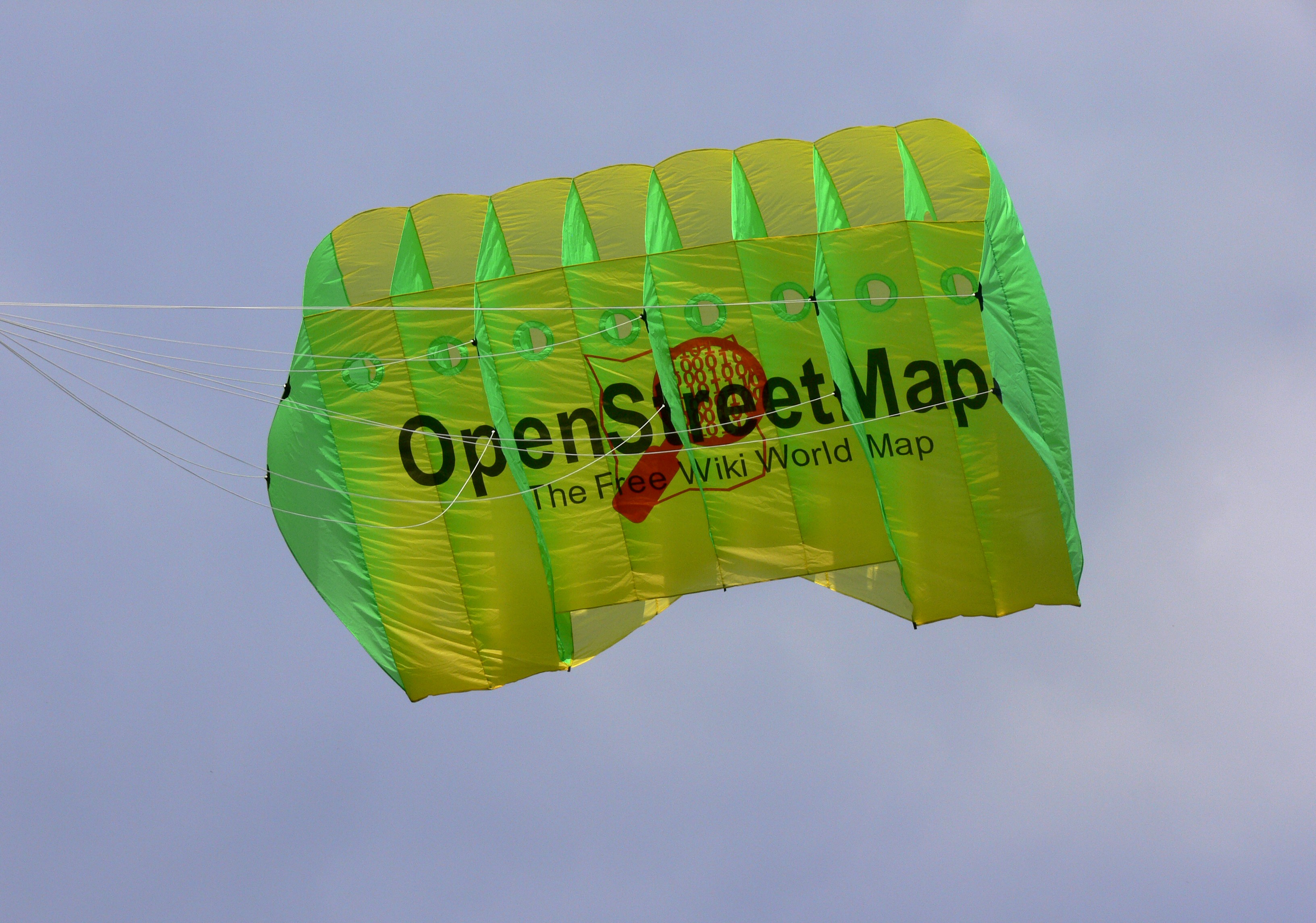
| 21:12, 26 September 2010 | The-osmcopter-at-linux-autumn-conf.jpg (file) |  |
1.23 MB | The OpenStreetMap logo printed on a 350cm (11.5ft) Sutton Flowform-type kite made for making aerial imagery. These kites are produced by IKAR, Poland | 1 |
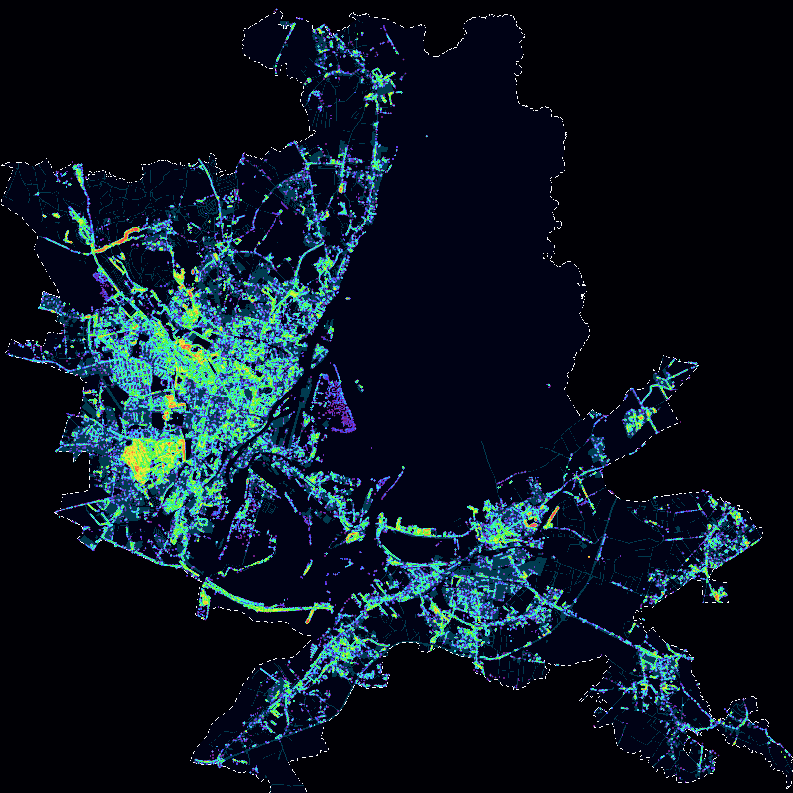
| 16:42, 30 May 2010 | Tree-density.png (file) |  |
761 KB | Heat map with natural=trees plotted in Szczecin. Data obtained from the [http://gis.um.szczecin.pl/ same source] as the [[File:Szczecin-gis-footprints.png|building outlines], by scanning the map for the tree icons. T | 1 |
| 01:20, 11 May 2010 | Szczecin-gis-footprints.png (file) |  |
151 KB | Building outlines, heights and addresses in [WikiProject_Poland/Szczecin|Szczecin] are being uploaded into OpenStreetMap. The tracing is done 75% automatically, from the buildings layer courtesy of the city's cadastre web service. The mapsurfer.net rend | 1 |
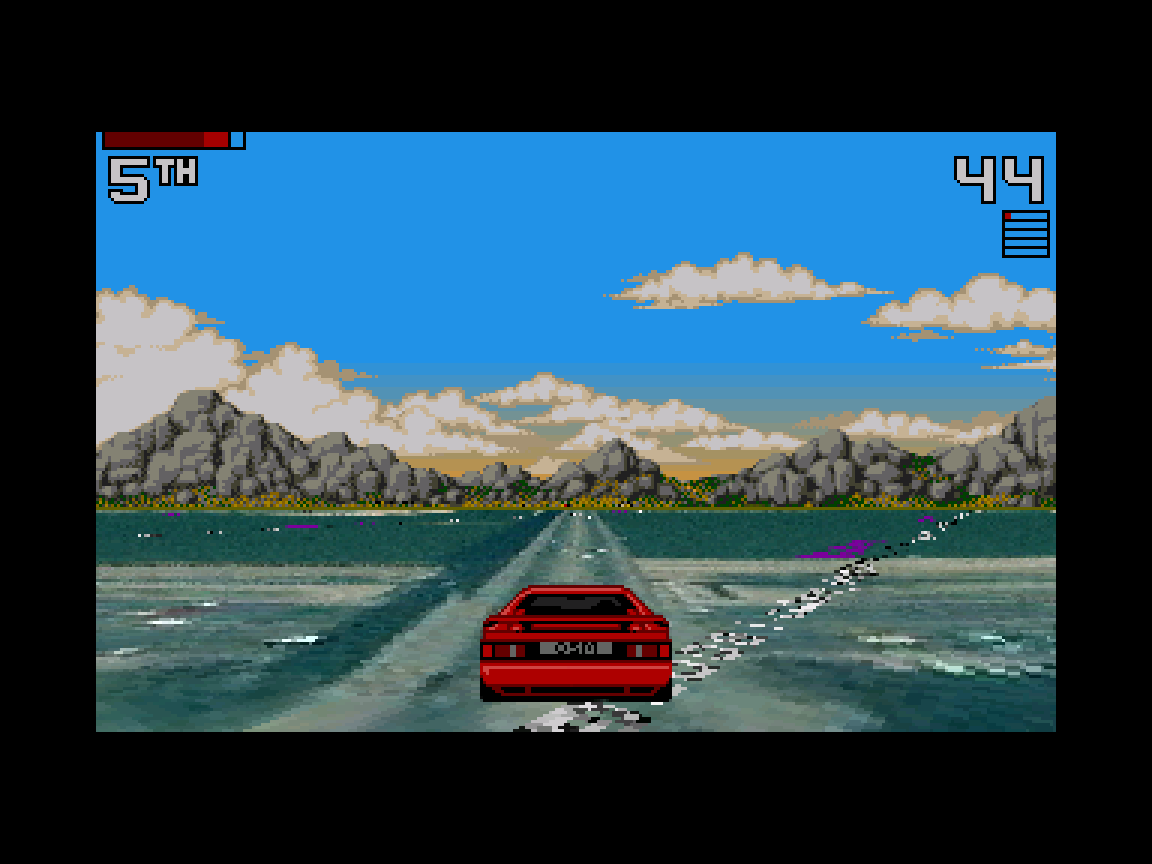
| 13:09, 4 January 2010 | Screenshot-wmsracer.png (file) |  |
46 KB | Screenshot of the WMS Turbo Challenge II plugin in use, on screen is an original Lotus Esprit musclecar at the banks of Vistula river preparing to cross the river on a railway bridge. The ground image is copyright Yahoo! | 1 |