Uploads by Rw
Jump to navigation
Jump to search
This special page shows all uploaded files.
| Date | Name | Thumbnail | Size | Description | Versions |
|---|---|---|---|---|---|
| 01:41, 1 December 2014 | Special GM 2014.pdf (file) |  |
227 KB | 1 | |
| 20:04, 1 November 2014 | Ago-tourism-toronto.jpg (file) |  |
799 KB | Art Gallery of Ontario, copyright tourism Toronto used by permission for Sotm 2015 Toronto bid | 1 |
| 19:42, 1 November 2014 | Tourism-toronto-logo.jpg (file) | 41 KB | Tourism toronto logo copyright tourism toronto, used by permission for sotm 2015 toronto bid | 1 | |
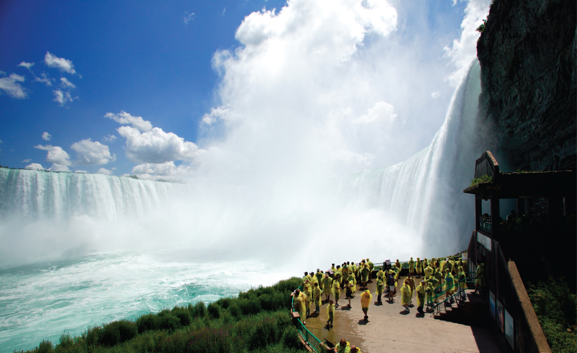
| 19:37, 1 November 2014 | Niagara-tourism-toronto.jpg (file) |  |
607 KB | niagara falls copyright toronto tourism used by permission for sotm 2015 toronto bid | 1 |
| 19:33, 1 November 2014 | Cottage-country-tourism-toronto.jpg (file) |  |
1.21 MB | copyright tourism toronto, used by permission for sotm 2015 toronto bid | 1 |
| 19:30, 1 November 2014 | Skyline-tourism-toronto.jpg (file) |  |
1.02 MB | copyright Tourism Toronto and used by permission for SotM 2015 Toronto bid. | 1 |
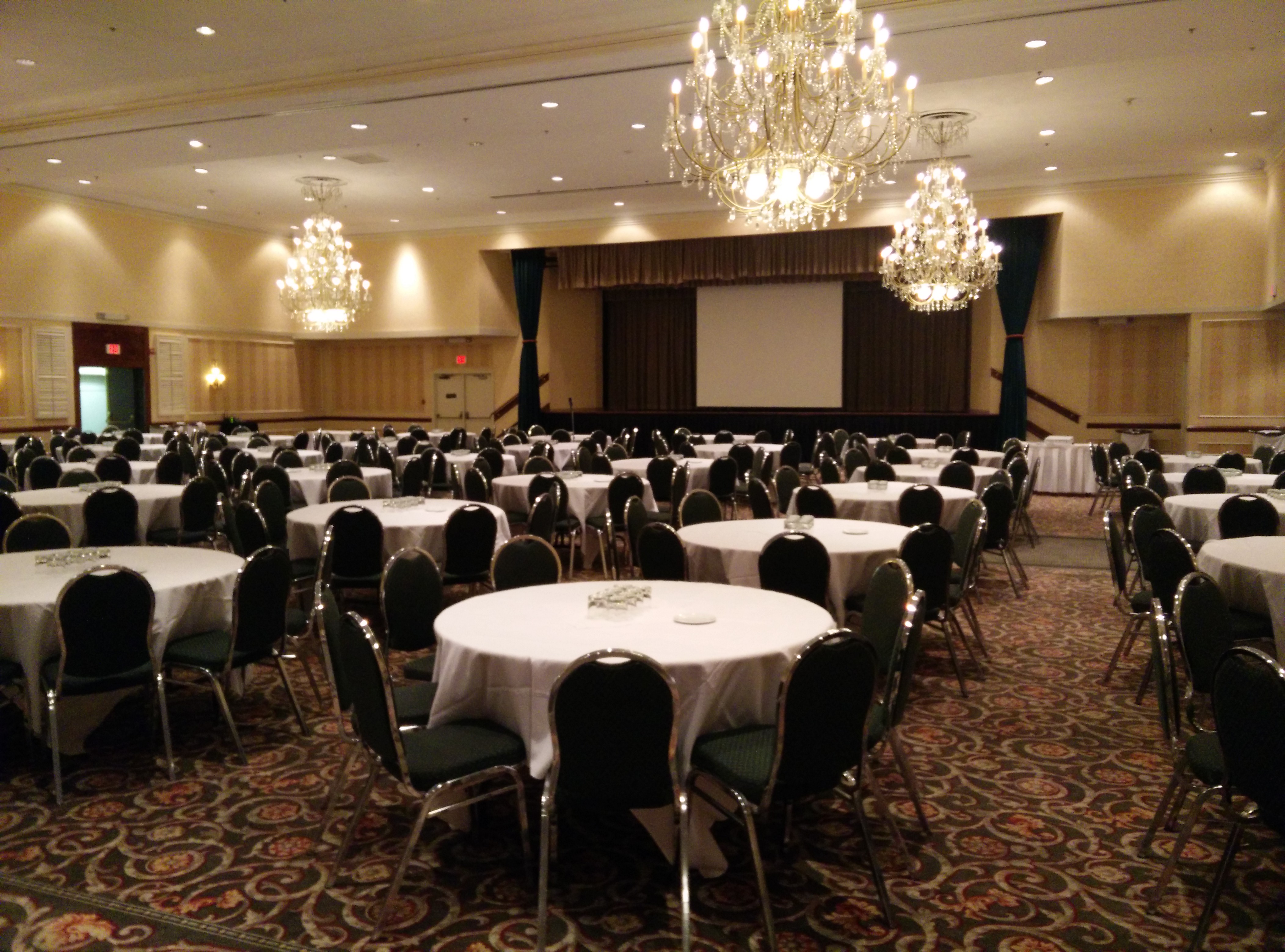
| 19:09, 1 November 2014 | Toronto-provisional-venue.jpg (file) |  |
2.19 MB | Photo of provisional conference venue main ballroom for State of the Map 2015 Toronto bid. Main room has capacity that is ideal for projected attendance and can adapt for potential growth. | 1 |
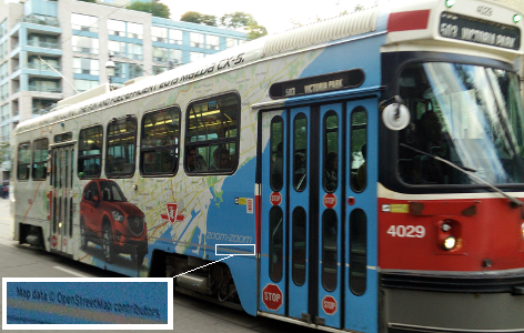
| 18:25, 24 September 2014 | Openstreetmap-streetcar-ad.png (file) |  |
300 KB | A Toronto streetcar is enveloped by an advertisement. The advertisement features a large map. OpenStreetMap data is properly credited on the streetcar. Good job. Obviously, they were thinking outside the box. | 1 |
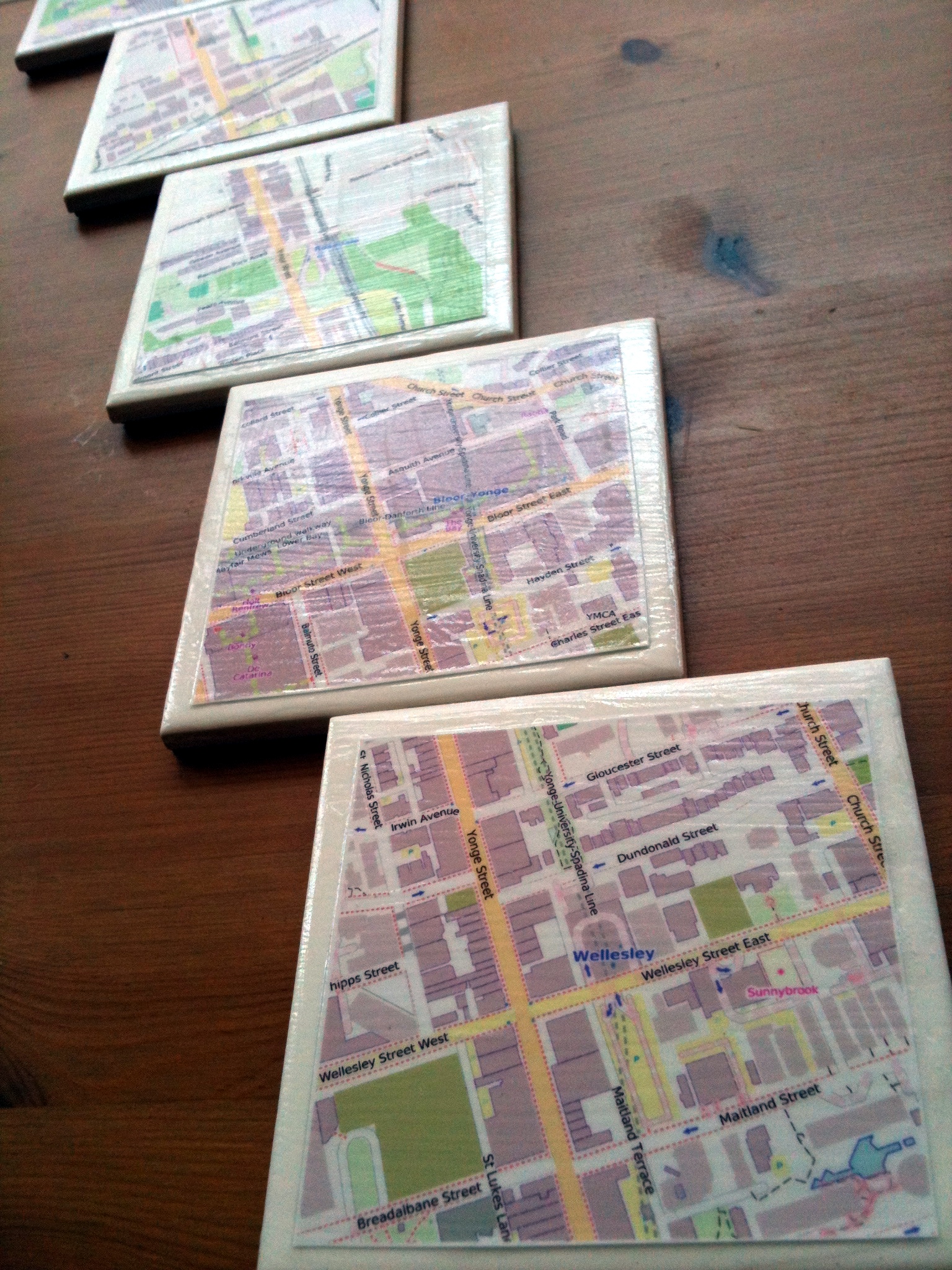
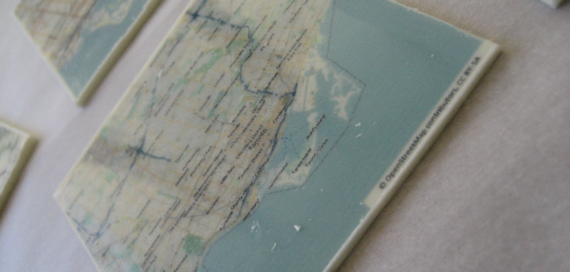
| 12:50, 10 August 2014 | Subwaytiles.jpg (file) |  |
1.29 MB | Ceramic tiles made into coasters to celebrate the tenth OpenStreetMap birthday. Toronto mappers rendered OpenStreetMap data for the neighbourhoods surrounding various subway stations. The resulting maps were printed on paper, then decoupaged onto the ... | 1 |
| 14:58, 14 August 2013 | Mini-cupcake-highway-shields.jpg (file) |  |
59 KB | Highway shields for Interstate (US) and Autoroute (Québec) routes, rendered in fondant as toppers for mini-cupcakes. The cupcake toppers were created for the OpenStreetMap ninth birthday celebration in August 2013, in Toronto. Also shown is a dior... | 1 |
| 14:54, 14 August 2013 | Osm-logo-mini-cupcakes.jpg (file) | 50 KB | OpenStreetMap logo, rendered in fondant, as cupcake toppers. These logo cupcakes were created for the OpenStreetMap ninth anniversary celebration held in Toronto in August 2013. Two variants show either an icing or fondant handle. The fondant nadled... | 1 | |
| 14:44, 14 August 2013 | Map-cupcakes.jpg (file) |  |
66 KB | A matrix of mini cupcakes with a map of a Toronto neighbourhood rendered in fondant. The map is the creation of NYC mapper Betsy, and the map data is ODbL ©OpenStreetMap Contributors. The cupcakes were made as part of the ninth OpenStreetMap annivers... | 1 |
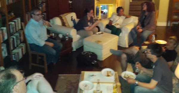
| 14:39, 14 August 2013 | Osm-anniversary-2013-Toronto.jpg (file) |  |
42 KB | Mappers at the OpenStreetMap ninth anniversary party in Toronto in August 2013 | 1 |
| 17:53, 16 September 2012 | UserStat0 1.png (file) |  |
124 KB | screen shot of v0.01 of UserStat | 1 |
| 02:23, 19 August 2012 | TorontoOSM8thBday-mappers.png (file) |  |
646 KB | Some of the Toronto mappers and edible maps at the OSM 8th birthday party. | 1 |
| 02:04, 19 August 2012 | TorontoOSM8thBday-tiled.png (file) |  |
622 KB | Giant cookie map tiles. Chocolate and cookie city maps. From the OpenStreetMap 8th Birthday party in Toronto. | 1 |
| 02:02, 19 August 2012 | TorontoOSM8thBday.png (file) |  |
493 KB | White chocolate plaque printed with OSM mapnik layer. Presented to attendees of OSM 8th Birthday party in Toronto. Attendees were invited to submit their "favourite city" with their RSVP. That city, in chocolate and as a cookie, was available for them | 1 |
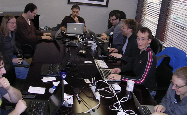
| 19:21, 17 March 2012 | OSM at PB3.png (file) |  |
296 KB | Toronto Hack participants. Talking at lunch. Photo by Michael Morrish. | 1 |
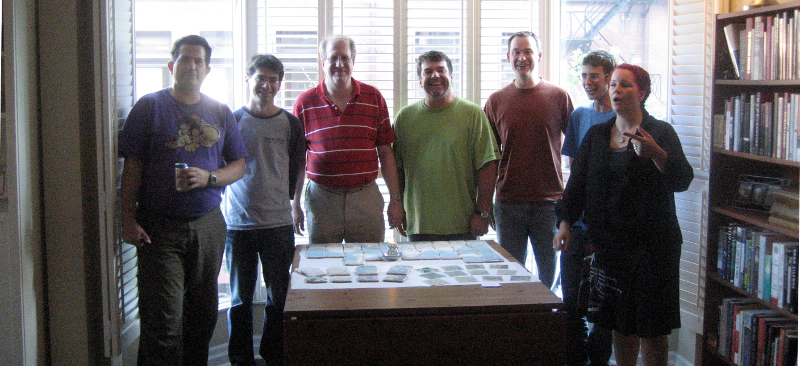
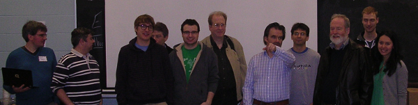
| 15:32, 17 March 2012 | TorontoHack.png (file) | 149 KB | Toronto OpenStreetMap developers in attendance, early on day one, for the first Toronto OSM Hack Weekend. 17 March 2012 | 1 | |
| 15:36, 19 February 2012 | OsmHackDC.png (file) |  |
415 KB | Day Two of the inaugural DC Hack Weekend. Ably organized by emacsen and generously hosted by ajturner. A good time was had by all. | 1 |
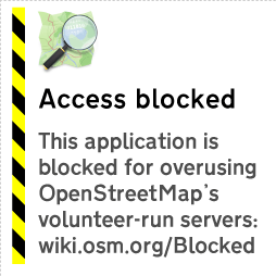
| 23:26, 31 October 2011 | Blocked userfacing.png (file) |  |
11 KB | new "blocked" tile for apps that overuse the tile server. | 1 |
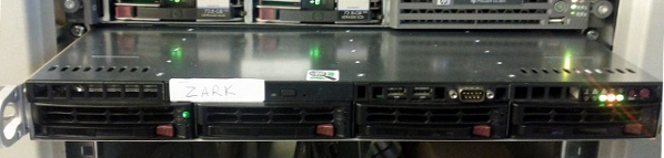
| 13:41, 20 September 2011 | Zark-installed.jpg (file) | 37 KB | zark, during installation. Photo by Firefishy. | 1 | |
| 20:32, 16 September 2011 | OSM-table-tent.pdf (file) |  |
1.89 MB | print this on card stock, or heavy paper. Useful as a "table tent" or self-supporting sign for your OSM meetups. use this so new members can find your local osm group, even if they don't recognize your faces. | 1 |
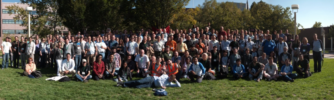
| 18:25, 12 September 2011 | Sotm11-group.png (file) |  |
744 KB | Thumbnail of giga pixel group photo from State of the Map - Denver. This one is cropped to include only one copy of the entertaining Peter Batty. See the original here http://www.gigapan.org/gigapans/86755/ | 1 |
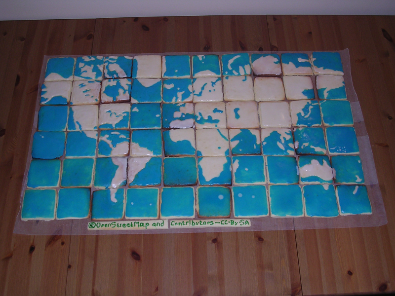
| 13:16, 21 August 2011 | Map-nik-cake-osm-7.png (file) |  |
698 KB | Map(nik) cake from the OSM 7th Birthday celebration in Toronto is a matrix of map tiles over one meter wide. Each tile is a sugar cookie, iced with land and sea areas. | 1 |
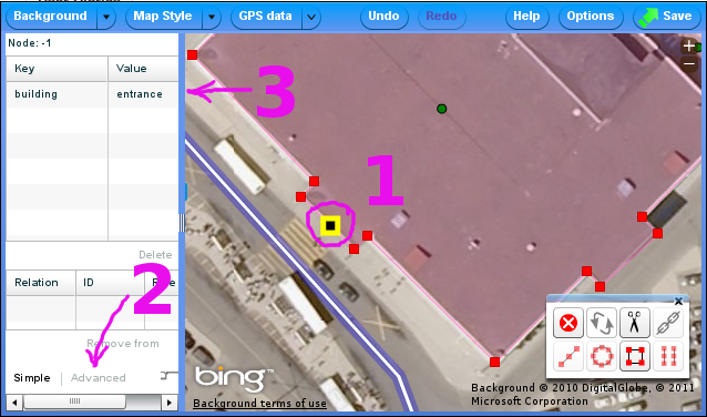
| 14:43, 24 March 2011 | Building-entrance.png (file) |  |
219 KB | adding a building entrance node with Potlatch2. Bing background imagery is included. CC-By-SA. | 2 |
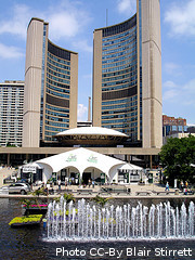
| 16:11, 27 February 2011 | Toronto-ccby-BlairStirrett.jpg (file) |  |
32 KB | Toronto City Hall and fountain during jazz festival. Photo CC-By, Blair Stirrett, via flickr. http://www.flickr.com/photos/blairstirrett/2288030467/in/photostream/ | 1 |
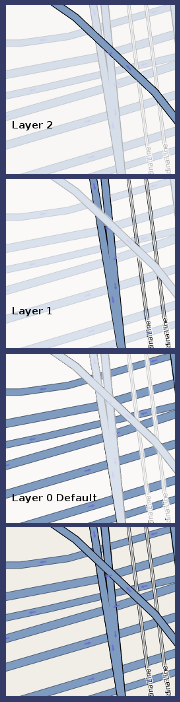
| 18:08, 23 February 2011 | Layers.png (file) |  |
121 KB | As OSM tile showing overlapping bridges. | 1 |
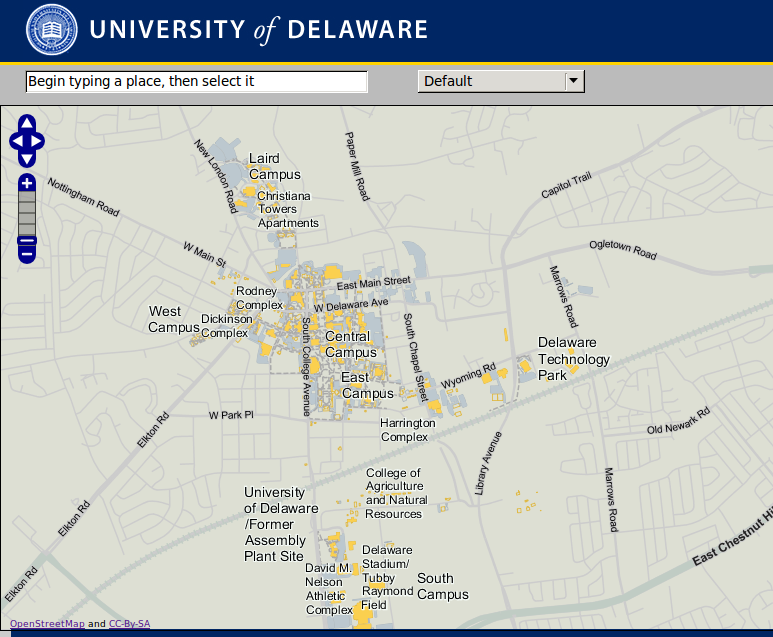
| 17:14, 31 January 2011 | UniDela.png (file) |  |
268 KB | University of Delaware has rolled out a campus map that is based on OpenStreetMap. CC-By-SA | 1 |
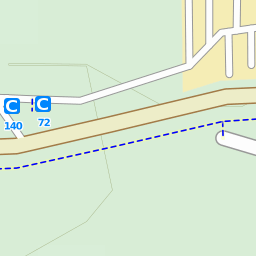
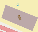
| 19:04, 9 December 2010 | Bike-park-node.png (file) |  |
7 KB | Two {{tag|amenity|bicycle_parking}} nodes with capacity tags of 140 and 72, as rendered in OpenCycleMap | 1 |
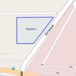
| 18:08, 9 December 2010 | Bikepark-way.png (file) |  |
15 KB | {{tag|amenity|bicycle_parking}} way as shown on the OpenStreetMap "Mapnik" layer. As of 09 December 2010, this was the largest bike park in OSM with a capacity tag of 2000 bicycles. | 1 |
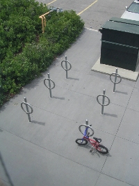
| 14:00, 9 December 2010 | Amenity-bicycle parking.png (file) |  |
94 KB | Six post and ring bicycle parking points with a capacity of 12 bikes. | 1 |
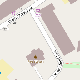
| 18:52, 8 December 2010 | Fire-station-poly.png (file) |  |
9 KB | Fire station polygon rendered in mapnik. | 1 |
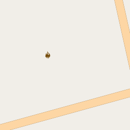
| 18:51, 8 December 2010 | Fire-station-node.png (file) |  |
2 KB | A fire station node rendered in mapnik. | 1 |
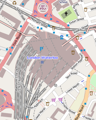
| 23:26, 1 December 2010 | Waterloo.png (file) |  |
107 KB | Waterloo railway station connects to other transportation networks with footways, access roads and subway stations. Amenities within the station and nearby are mapped. cc-by-sa | 1 |
| 14:12, 24 November 2010 | Umd-steps.png (file) |  |
25 KB | This portion of the University of Maryland campus show footways and steps mapped in addition to roadways. CC-By-SA | 1 |
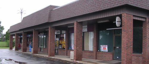
| 13:21, 20 October 2010 | Shops.png (file) |  |
171 KB | Retail shopping mall in Canada. Typical businesses might include, convenience stores, fast food, restaurant, photography studio, paint shop, clothing store, dentists, lawyer, etc. cc-by rweait | 1 |
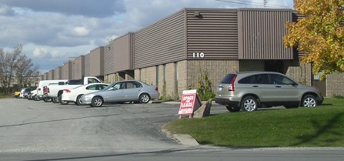
| 13:17, 20 October 2010 | Industrial-mall.jpg (file) |  |
42 KB | commercial / light-industrial mall in Canada. Typical businesses include industrial supply (fasteners, hydraulic pipe and fittings, electrical wire and fittings) light-industrial (machine shops, injection molding, industrial painting and coating) re-pack | 1 |
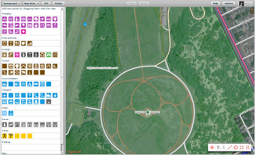
| 00:08, 13 October 2010 | P2-screen.png (file) |  |
275 KB | Potlatch 2 editing screen | 1 |
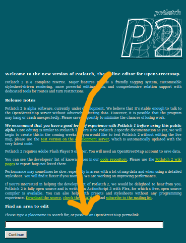
| 23:41, 12 October 2010 | P2-locate.png (file) |  |
59 KB | Start with Potlatch 2 by entering a location or landmark in the search box. | 1 |
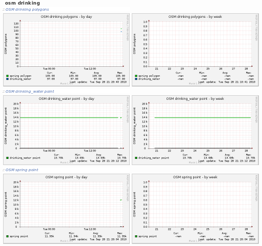
| 01:39, 29 September 2010 | Drinking-before-potm.png (file) |  |
45 KB | Thumbnail graphs of drinking water related tags in OSM, before the start of the October 2010 Project of the Month. Image CC-By-SA | 1 |
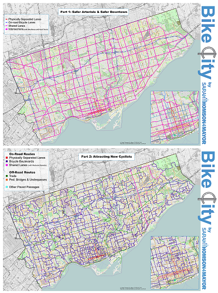
| 20:07, 28 September 2010 | St4m.png (file) |  |
508 KB | Toronto, Canada, mayoral candidate, Sarah Thomson has a cycling plan for Toronto as part of her platform. She used OSM as base map to illustrate her plans. And then attributed OSM and CC-By-SA correctly. Image CC-By-SA. Map data (c) OpenStreetMap an | 1 |
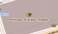
| 11:21, 19 September 2010 | Theatre-mapnik-poly.png (file) |  |
9 KB | Mapnik rendnering of a theatre polygon. cc-by-sa, OpenStreetMap and contributors | 1 |
| 11:13, 19 September 2010 | Cinema-mapnik-poly.png (file) |  |
4 KB | Cinema icon in Mapnik from a cinema polygon. Image cc-by-ca OpenStreetMap and contributors. | 1 |
| 13:35, 13 September 2010 | VictoriaPark.jpg (file) |  |
39 KB | Same Victoria Park image, but with jpg compression. ccby User Rw | 1 |
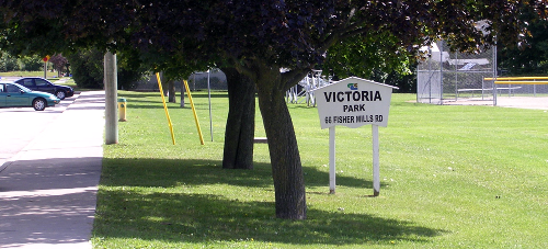
| 14:18, 12 September 2010 | VictoriaPark.png (file) |  |
237 KB | Park, sign and baseball diamond. Photo by User:Rw. Licensed cc-by. | 1 |
| 18:54, 22 August 2010 | OSM-6-bday-toronto.jpg (file) |  |
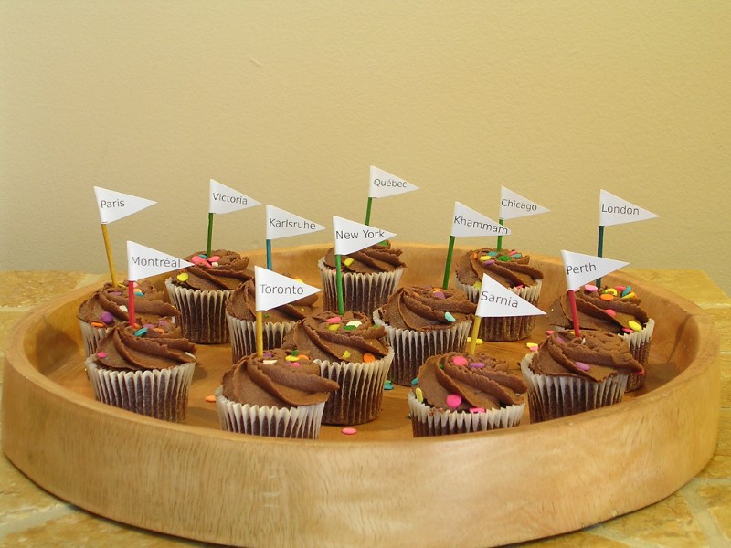
109 KB | Cupcakes with city flags from the OSM 6th Anniversary party in Toronto on 20 August 2010. Photo cc-by rweait | 1 |
| 10:19, 25 July 2010 | Curling-borderless.svg (file) |  |
4 KB | 1 | |
| 20:00, 20 July 2010 | ODbL-Supporter.png (file) |  |
8 KB | 1 | |
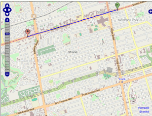
| 11:31, 18 July 2010 | Routing.gif (file) |  |
202 KB | animation of testing routes with gosmore on dev | 1 |