Uploads by U715371
Jump to navigation
Jump to search
This special page shows all uploaded files.
| Date | Name | Thumbnail | Size | Description | Versions |
|---|---|---|---|---|---|
| 17:05, 21 January 2015 | Special motorroad situation.jpg (file) |  |
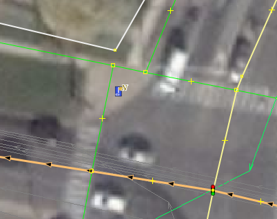
794 KB | A road with two lanes which seems to have one lane as motorroad (left) an one not (right). lat=53.08557 lon=8.80294 | 1 |
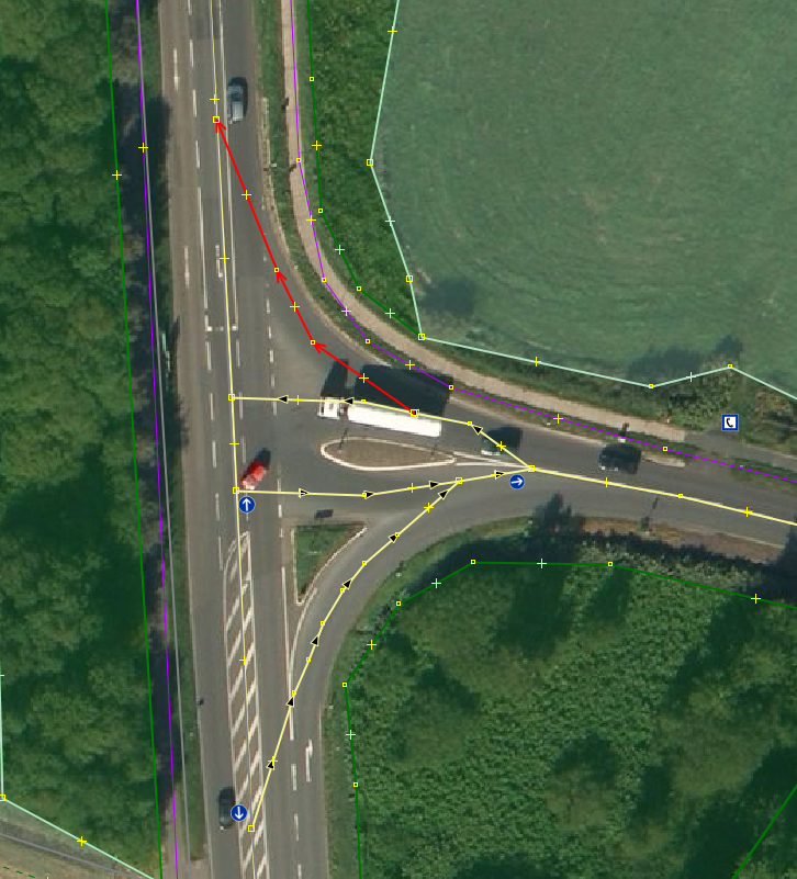
| 07:39, 22 August 2014 | Routing error 1 crossraods solved.png (file) |  |
575 KB | 1 | |
| 07:38, 22 August 2014 | Routing error 1 crossraods coding.png (file) |  |
573 KB | 1 | |
| 21:44, 10 August 2014 | Routing error 3 no-island.png (file) |  |
546 KB | 1 | |
| 23:37, 6 August 2014 | Radweg probleme no7.gif (file) |  |
59 KB | 1 | |
| 21:09, 31 July 2014 | Neverdo-6 routing.gif (file) |  |
590 KB | 1 | |
| 19:57, 31 July 2014 | Mapnik opencyclemap animation.gif (file) |  |
123 KB | 2 | |
| 19:18, 31 July 2014 | Fein vs grob 1.png (file) |  |
133 KB | 2 | |
| 15:58, 31 July 2014 | Neverdo mapping as separate ways and plus double tagging.png (file) |  |
374 KB | 1 | |
| 15:44, 31 July 2014 | Neverdo mapping separate and without connection 2.png (file) |  |
108 KB | 1 | |
| 15:30, 31 July 2014 | Neverdo mapping separate and without connection.png (file) |  |
312 KB | 1 | |
| 15:04, 31 July 2014 | Neverdo sidewalks with cycleways as separate.png (file) |  |
97 KB | 1 | |
| 14:50, 31 July 2014 | Neverdo mapping cycleway tracks this way.png (file) |  |
379 KB | Never do: Mapping cycleway=track with direct connection to the street this way. | 1 |
| 14:39, 31 July 2014 | Neverdo sidewalks mapped as way.png (file) |  |
237 KB | 1 | |
| 23:51, 29 July 2014 | Footway artefakte.png (file) |  |
60 KB | Leading to bad routing. | 1 |
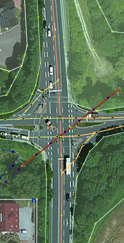
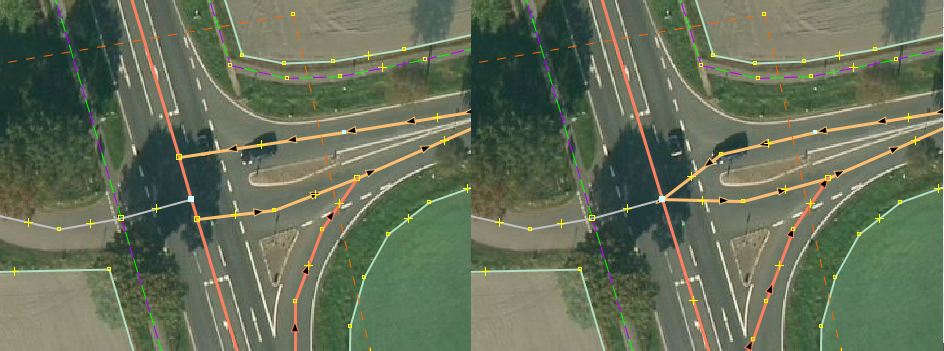
| 11:35, 20 July 2014 | Routing error 2 doppel.png (file) |  |
224 KB | Showing crossroads with an implicid routing error (left) and the solution to the error. | 1 |
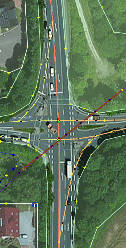
| 00:12, 19 July 2014 | Routing error 1 solved.png (file) |  |
27 KB | 1 | |
| 00:09, 19 July 2014 | Routing error 1 solution.png (file) |  |
132 KB | 1 | |
| 00:04, 19 July 2014 | Routing error 1 coding.png (file) |  |
311 KB | 1 | |
| 00:00, 19 July 2014 | Routing error 1.png (file) |  |
44 KB | 1 | |
| 13:12, 9 July 2014 | Bremen street with cycleway lane between car lanes.jpg (file) |  |
949 KB | The cycleway-lane for going straight is in the middle of the road in between of the straight ahead lane for cars and the right turn lane for cars. The turn right cycleway is the track on the right hand side. | 1 |
| 12:57, 9 July 2014 | Bremen street with cycleway seperate way .jpg (file) |  |
1.22 MB | This picture shows a cycleway which is along a bigger road and could be mapped as separate way. | 1 |
| 23:18, 3 July 2014 | Bremen street with cycleway and sidewalk 3.jpg (file) |  |
4.12 MB | Street with sidewalk, parking lane and currently not usable cycleway. | 1 |
| 22:48, 3 July 2014 | Bremen street with cycleway and sidewalk 2.jpg (file) |  |
3.23 MB | Street with cycleway and sidewalk, but without any signs - possibly. The bicycle sign on the street surface may indicate that cycling is only permitted on street. | 1 |
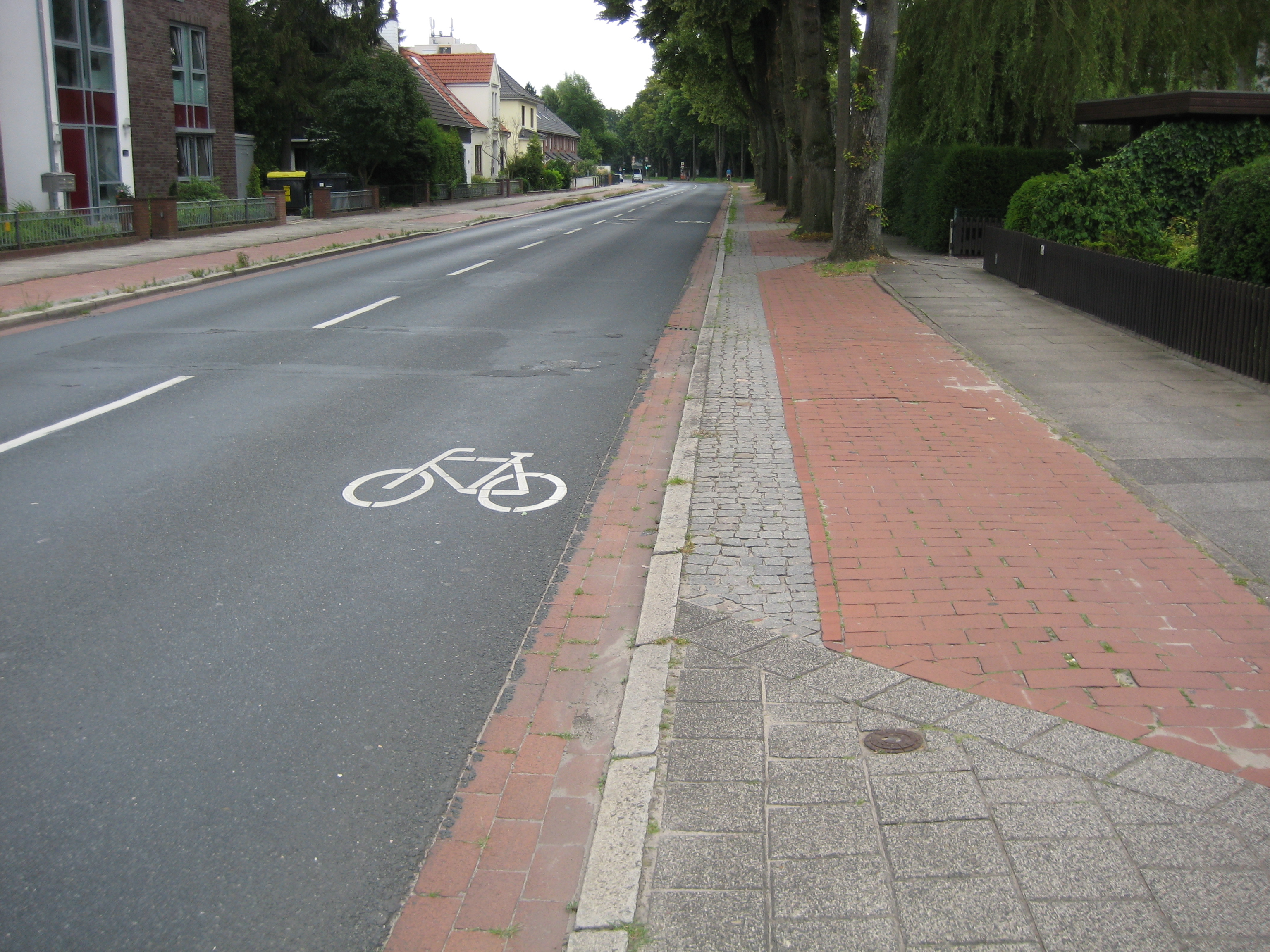
| 22:17, 3 July 2014 | Bremen street with sidewalk 1.jpg (file) |  |
3.07 MB | Street at Bremen with sidewalk where it is allowed to cycle in both directions, too. | 1 |
| 22:13, 3 July 2014 | Bremen street with cycleway and sidewalk 1.jpg (file) |  |
2.94 MB | Street with cycleway and sidewalk somewhere at Bremen. | 1 |
| 20:57, 3 July 2014 | Continues-line-prohibits-to-turn pedestrians solution.png (file) |  |
68 KB | Same picture as File:Continues-line-prohibits-to-turn_pedestrians.png with marked knotes, which are tagged with crossing=no. | 1 |
| 20:53, 3 July 2014 | Continues-line-prohibits-to-turn pedestrians.png (file) |  |
76 KB | This shows a four laned street with a continous line in the middle which prohibits to turn into a street on the wrong side of the road. Usually it is very hard to cross such kind of road as a pedestrian securely. To use many turn restriction relations... | 1 |
| 20:49, 3 July 2014 | Continues-line-prohibits-to-turn.png (file) |  |
165 KB | This shows a four laned street with a continous line in the middle which prohibits to turn into a street on the wrong side of the road. The solution is to use many turn restriction relations as shown. | 1 |
| 20:43, 3 July 2014 | What the barrier-details.png (file) |  |
908 KB | Shows up a road below a train bridge with cycleways, retaining walls and steps to another road. This example shows one detailed and more complicated solution to this problem: File:Errors-by-using-the-on-street-tag-cycleway_problem.png | 1 |
| 20:40, 3 July 2014 | Errors-by-using-the-on-street-tag-cycleway problem.png (file) |  |
989 KB | This picture illustrates a classical routing error by using a usual tagging proposed at the wiki. In reality the red arrow is not a possible routing option due to retaining walls deviding the street, cycleway and steps from each other. The same pictu... | 1 |
| 20:33, 3 July 2014 | Errors-by-using-the-on-street-tag-cycleway blank.png (file) | 980 KB | Shows up an a road below a train bridge with cycleways, retaining walls and steps to another road. This example shows how to map it via wiki propositions. | 1 | |
| 20:27, 3 July 2014 | Workaround-cycleway-on-street-tagging.png (file) |  |
254 KB | This picture shows an example for a workaround, since you are mapping as the wiki mostly requires the cycleways as tags on the streets. | 1 |