Proposal:Refugee Site Location 2
| Refugee site location | |
|---|---|
| Proposal status: | Approved (active) |
| Proposed by: | Manonv |
| Tagging: | amenity=refugee_site |
| Applies to: | |
| Definition: | Refugee site location |
| Statistics: |
|
| Draft started: | 2020-03-19 |
| RFC start: | 2020-03-25 |
| Vote start: | 2020-04-23 |
| Vote end: | 2020-05-07 |
We have modified this proposed features wiki page according to discussions regarding how to best tag places sheltering refugee and/or internally displace persons. Thank you to the contributors who help finding a solution to have a consistent tagging in place for refugee location.
Proposal
This proposal aims to provide a way for mapping refugee sites:
Use amenity=refugee_site for human settlements sheltering refugees and/or internally displaced persons fleeing the effects of a political crisis or a natural disaster for example. Refugee sites gather not only housing accommodation but also diverse facilities that provide services to refugees.
There is already a tag social_facility=shelter to map a single building or a small group of buildings like a refugee center, an accommodation center or a care and hosting center for refugees which are residential facilities for refugees. But this tag is not suitable to map refugee sites that are human settlements/populated places that gather many different facilities, residential ones but also food distribution center, outreach, NGO or government offices, warehouses, Water, Hygiene and Sanitation facilities, etc., along with regular human settlement related services and infrastructures.
That’s why we propose to create a new refugee_site value for the existing amenity key.
Please have a look at the refugee site definition from Wikipedia to have an enhanced understanding of what a refugee site looks like and what has to be mapped as amenity=refugee_site.
Rationale
There is not yet a real consensus within the OSM community regarding the way to reference refugee camps in OSM. As a result, tagging is applied inconsistently which makes it quite difficult to find and use this data. In the past years there have been several attempts to improve the referencing of refugee camps in OSM but they never succeeded in finalizing a full proposal.
Humanitarian organizations working with refugees and other displaced populations are willing to open some of their data to OpenStreetMap for wider and sustainable dissemination, but a common framework aligned with OpenStreetMap standards is necessary. A sustainable approach to sharing, collecting and keeping data up-to-date needs to be based on a tagging system that considers as many use cases as possible.
Since many individuals and organizations already contribute to OpenStreetMap refugee site mapping efforts, it would benefit everyone to agree on a clear and consistent tagging schema for refugee sites.
Using OpenStreetMap geographic data for refugee sites is very useful for humanitarian organizations, local governments and communities, and for refugees themselves. OpenStreetMap data could be valuable for decision making, to avoid duplication of efforts in data collection, and to enable a more efficient humanitarian response.
Examples
There are many different types of refugee sites (see photos and links below). They can be small or enormous, improvised, spontaneous or planned, formal or informal, within or outside a town.
- Berhale refugee site - Ethiopia.png
Berhale refugee site - Ethiopia
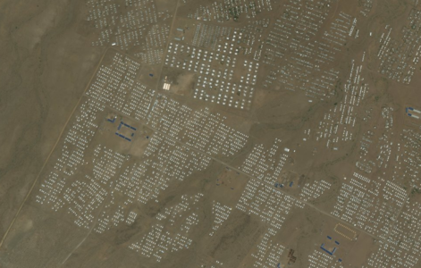
Kakuma refugee site - Kenya
- Moria refugee site - Greece.png
Moria refugee site - Greece

Some examples of camps:
- small camp within a town: https://www.openstreetmap.org/?mlat=5.7656&mlon=20.6886#map=15/5.7656/20.6886
- enormous camp surrounding multiple villages: https://www.openstreetmap.org/?mlat=21.2045&mlon=92.1566#map=15/21.2045/92.1566
- small informal camp within a town: https://www.openstreetmap.org/?mlat=50.9976&mlon=2.2895#map=16/50.9976/2.2895
- large camp outside a town: https://www.openstreetmap.org/?mlat=6.8162&mlon=47.4566#map=14/6.8162/47.4566
- large formal camp outside a town: https://www.openstreetmap.org/?mlat=9.3342&mlon=29.7929#map=14/9.3342/29.7929
Tagging
| key | value | description | required | wiki |
|---|---|---|---|---|
| amenity | refugee_site | human settlement sheltering refugees and/or internally displaced persons | yes |
The tag can be used alternatively on nodes or on areas:
- If the extent of the site is difficult to identify (proximity to other villages, suburban area, etc.) it is recommended to use a node.
- If the extent of the site can be clearly identified from the imagery or field data collection, it is recommended to use an area. Please note this extent does not have to match the official boundary of a camp (which doesn’t necessarily coincide to its physical limitations), as defined by government and specialized agencies, for which a dedicated tag can be used.
Useful tag combination (optional)
Can be added to the main tag amenity=refugee_site to details the typology of the camps and other valuable information
| key | value | description | required | wiki |
|---|---|---|---|---|
| EXISTING TAGS AND VALUE to be reused | ||||
| name | <string> | optional | Names | |
| alt_name | <string> | optional | ||
| population | <number, estimated population> | to indicate a rough number of refugee in the refugee site | optional | |
| operator | <name of operator> | the operator information, if known, will allows you to differentiate between different types of camps, planned, formal or informal for instance | optional | |
| operator:type | <ngo, community, government, intergovernmental_organization> | optional | ||
| start_date | <date, establishment> | to indicate the date the refugee site opened or construction finished | optional | |
Rendering
Features/Pages affected
Proposed_features/Refugee_Camp_Boundaries A link to this new Proposed features wiki page will be added.
Humanitarian_OSM_Tags/Humanitarian_Data_Background The page will be updated, this overall article contain out of date information.
External discussions
No external discussion at the moment.
Comments
Please comment on the discussion page.
Voting
Voting on this proposal has been closed.
It was approved with 31 votes for, 2 votes against and 0 abstentions.
 I approve this proposal. --EneaSuper (talk) 11:20, 26 April 2020 (UTC)
- I approve this proposal. --Anaximandre (talk) 10:50, 30 April 2020 (UTC)
- I approve this proposal. --Lucas Longour (talk) 10:36, 26 April 2020 (UTC)
- I approve this proposal. --Øukasz (talk) 08:27, 24 April 2020 (UTC)
- I approve this proposal. --MarTintamarre (talk) 11:25, 24 April 2020 (UTC)
- I approve this proposal. --Léonie Miège (talk) 11:44, 24 April 2020 (UTC)
- I approve this proposal. --Renecha (talk) 19:26, 24 April 2020 (UTC)
- I approve this proposal. --Severin (talk) 14:03, 25 April 2020 (UTC)
- I approve this proposal. --Waldhans (talk) 06:59, 26 April 2020 (UTC)
- I approve this proposal. --Gendy54 (talk) 11:00, 26 April 2020 (UTC)
- I approve this proposal. --Russdeffner (talk) 11:29, 26 April 2020 (UTC)
- I approve this proposal. --Deuzeffe (talk) 13:26, 26 April 2020 (UTC)
- I approve this proposal. --JacLavi (talk) 13:49, 26 April 2020 (UTC)
- I approve this proposal. --Lukfunk (talk) 17:33, 26 April 2020 (UTC)
- I approve this proposal. --kiggudde (talk) 05:11, 27 April 2020 (UTC)
- I approve this proposal. --Lxsch (talk) 05:33, 27 April 2020 (UTC)
 I oppose this proposal. amenity seems like a bad key for this, place=refugee_site seems much more appropriate. Not everything is an amenity. --Doublah (talk) 07:46, 27 April 2020 (UTC)
- place=* cannot be used because these sites may also be at the same time settlements, and your suggestion would lead to multiple place values, which is undesirable in general. This was also mentioned several times during the discussion.--Dieterdreist (talk) 11:10, 27 April 2020 (UTC)
- I approve this proposal. Although I believe there are still some issues in the proposal, I think it can generally be approved. "Refugee sites gather not only housing accommodation but also diverse facilities that provides services to refugees." does this mean it is a strict requirement that the features must "provide services", or is it optional (...may provide...)? Then there is a reasonable list of different sites: "They can be small or enormous, improvised, spontaneous or planned, formal or informal, within or outside a town.", but there is no suggested tagging to represent any of these properties (well besides "population"). I also do not like the definition of start_date in this context, which you state as "to indicate the date the refugee site opened or construction finished" (neither would be true in case of an informal settlement, maybe it should better be "date when the first refugeed arrived at the site" or something like this). To distinguish between informal and planned sites, I would suggest to combine with the established tag informal=*. For planned sites, I guess mention of the key capacity=* would also be useful (although there may be big differences between actual occupation vs. planned/constructed for capacity). No need to mention "alt_name", there are many name variations, and they are all included in "name" anyway. --Dieterdreist (talk) 11:32, 27 April 2020 (UTC)
- I approve this proposal.--Eraunio (talk) 16:19, 27 April 2020 (UTC)
- I approve this proposal. --Hedaja (talk) 21:58, 27 April 2020 (UTC)
- I approve this proposal. --RebeccaF (talk) 11:12, 28 April 2020 (UTC)
- I oppose this proposal. Still I cannot understand why amenity=* should be used instead of amenity=social_facility + social_facility=refugee_camp or social_facility=camp. This would also help to modify already mapped refugee camps by using a tag not so different from social_facility=shelter. --Michael Montani (talk) 13:09, 28 April 2020 (UTC)
- I approve this proposal. I still think place=refugee_site is the better choice, but I approve because it would be good to have finally one consistent usage of tagging for refugee settlements --Jorieke (talk) 16:59, 28 April 2020 (UTC)
- I approve this proposal. "I still think place=refugee_site is the better choice, but I approve because it would be good to have finally one consistent usage of tagging for refugee settlements": same here --Nospam2005 (talk) 18:27, 29 April 2020 (UTC)
- I approve this proposal. Thanks for improving the proposal rather than getting discouraged! Preemptive comment: amenity key is perfectly fine and there is no good reason to avoid using it. But I want to register my opposition to start_date tag that is tagging historic data, unsuitable for OSM mapping Mateusz Konieczny (talk) 23:25, 29 April 2020 (UTC)
- I approve this proposal. --MMoreno (talk) 09:23, 30 April 2020 (UTC)
- I approve this proposal. --Wille (talk) 15:38, 30 April 2020 (UTC)
- I approve this proposal. --Grosjen (talk) 20:15, 30 April 2020 (UTC)
- I approve this proposal. --PaulU (talk) 10:20, 1 May 2020 (UTC)
- I approve this proposal. --Tasauf1980 (talk) 06:37, 2 May 2020 (UTC)
- I approve this proposal. --AntMadeira (talk) 20:27, 2 May 2020 (UTC)
- I approve this proposal. --Ismaeldiarria (talk) 11:52, 3 May 2020 (UTC)
- I approve this proposal. --Jessbeutler (talk) 18:48, 5 May 2020 (UTC)