Tag:highway=ladder
| Description |
|---|
| Use for a ladder, a vertical or inclined set of steps or rungs intended for climbing or descending of a person with the help of hands. |
| Group: highways |
| Used on these elements |
| Implies |
| Useful combination |
|
| See also |
| Status: approved |
| Tools for this tag |
|
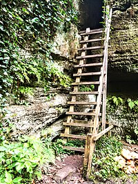
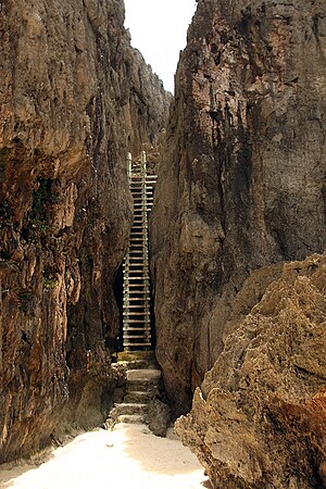
A ladder, a vertical or inclined set of steps or rungs intended for climbing or descending of a person with the help of hands.
Ladders are sometimes important elements for a highway graph, connecting a lower to an upper end, and while they may be unsurmountable for some users (e.g. in a wheelchair or with a bicycle), they can be very useful for hikers to avoid long detours, or even to reach an otherwise not reachable place, or are used in different context to reach places for maintenance as required (e.g. in factories, to get on or from roofs or silos, to climb out of a waterway or waterbody with a steep border, etc.) or in case of emergencies.
For the distinction between highway=steps and highway=ladder, ladder should be preferred if normally abled people are required to use their hands, for example in the following cases:
- a normally abled person has to use their hands because of steepness
- the stair tread is very short (refers to the horizontal dimension of the individual step in the direction of walking), so that many people will want to use their hands. This is to cater for situations of ladders in less inclined positions, where it is still considered a ladder and not just stairs e.g. [1]
How to map
These integrate into the highway network, so connect them to other highways where possible. You can either represent the ladder with a node or with a way, nodes should be used for vertical ladders while a way is preferred for inclined ladders.
On ways
Use incline=* on ways to indicate the direction (up/down).
On nodes
If the ladder is a node on a way, the way should be split and the upper way should get a higher layer=* than the part reaching from below, when several ways are connected to the ladder on different levels, sort the layers as always.
Level
In buildings or when otherwise applicable, you can also add a level=* tag on the ladder to indicate which level(s) it is located on (in case of a range, skip the levels where the ladder does not provide access).
Tags to use in combination
- step_count=* can be added to indicate the number of steps
- height=*
Examples
See also
- highway=steps – stairs
- highway=via_ferrata – a mountain route equipped with fixed cables, stemples, ladders, and bridges
- ladder=* – this tag indicates the presence of a ladder (as a property of something else)
| ||||||||||||||||||||||||||||||


