User:Yopaseopor
Anteriores
Enlaces
Mapas personalizados
-Accessibilitat
-OSM Lit Map
Quests Mapcomplete
Test-Preparació proposta senyals trànsit 2024
Rationale
Traffic signs are one of the most important kind of elements you can find... in the "road world". They are extended over the world and there are so many kinds of it. But was a minor tag in OSM (few elements, few tags related, few values...untill now). It is important to structure a complete scheme which answers all the meanings of a traffic sign, not only the meaning for the road but also the element itself.
Different approaches
by key
Highway.The classics
In 2006 we can find the first traffic sign. Stop. With its principal key. From then there's an approximation with nodes with the tag highway=(give_way,traffic_signals, and stop)
| Value | Element | Sign | Comment | Additional tags on the way |
|---|---|---|---|---|
| highway=stop | 
|
Stop sign. Usually tagged as highway=stop instead. | highway=stop (on a node) | |
| highway=give_way | 
|
Give way sign. Usually tagged as highway=give_way instead. | highway=give_way (on a node) | |
| highway=traffic_signals | Traffic signal. | highway=traffic_signals (on a node) |
Human-readable values
| Tags | Element | Sign | Comment | Tags for affected highways | |
|---|---|---|---|---|---|
| traffic_sign=city_limit +
name=* (name of city/village) |
City/village sign. By default it is assumed there is an end of city/village sign on the back for drivers in the opposite direction; add city_limit=begin if this is not the case. | source:maxspeed=DE:urban if not overridden by other speed limit source (or with other appropriate country code)
zone:traffic=DE:urban | |||
| traffic_sign=city_limit +
name=* (name of city/village) |
End of city/village sign. | source:maxspeed=DE:rural if not overridden by other speed limit source (or with other appropriate country code) | |||
| traffic_sign=maxspeed +
maxspeed=* (the speed limit) |

|

|
Maximum speed sign. Like all traffic signs these should be tagged as a node. Usually not part of the highway, so the direction can be inferred. | maxspeed=* + source:maxspeed=sign | |
| traffic_sign=maxspeed + | 
|

|
End of maximum speed sign. | ||
| traffic_sign=stop | 
|
Stop sign. Usually tagged implicitly on a node of the highway with highway=stop instead. | highway=stop (on a node) | ||
| traffic_sign=give_way | 
|
Give way sign. Equivalent to the United States yield sign. Usually just highway=give_way is tagged instead. | highway=give_way (on a node) | ||
| traffic_sign=variable_message | Electronic Variable Message Sign, also known as Dynamic Message Signs. Remotely programmed to give traffic information such as expected travel times to destinations, temporary speed limits, incident warnings etc. Usually combined with man_made=gantry. (Example photo) | ||||
| traffic_sign=overtaking + | 
|

|
No overtaking sign. | overtaking=no | |
| traffic_sign=overtaking + | 
|

|
End of no overtaking sign. | ||
| traffic_sign=maxwidth | 
|
Maximum width sign. | maxwidth=* | ||
| traffic_sign=maxheight | 
|
Maximum height sign. | maxheight=* | ||
| traffic_sign=maxweight | 
|
Maximum weight sign. | maxweight=* | ||
| traffic_sign=stop_ahead | 
|

|
Stop ahead sign. Can be a standard yield sign plus additional plate containing STOP and distance (as in most of Europe) or a red triangle or yellow diamond with an image of a stop sign elsewhere. | ||
| traffic_sign=yield_ahead | 
|

|
Yield/give way ahead sign. Can be a standard yield sign plus additional plate with distance (as in most of Europe) or a red triangle or yellow diamond with an image of a yield/give way sign elsewhere. | ||
| traffic_sign=signal_ahead | 
|

|
Signal ahead sign. | ||
| traffic_sign=hazard | 
|

|
A hazard to motorists. | Combined with hazard=* to indicate the type of hazard. | |
Traffic signs by national ID
Signs specific to a particular country should be mapped by the country/region prefix followed by a colon and then the traffic sign.
- The country/region prefix should be the
 ISO 3166-1 alpha-2 country code or
  ISO 3166-2 country subdivision code (always uppercase). This prefix is separated by a colon
 :from the sign. Additional colons can be included within the prefix to create a hierarchy of further custom subdivisions. - Traffic signs should be represented by their official ID (if such IDs are assigned).
- Multiple unrelated signs should be separated with a semicolon
;. If traffic signs are related, the additional sign IDs should be separated from the main sign by comma,. - Where the traffic sign requires a numeric or textual value, you can supply it after the ID using brackets
[value]. This can be repeated for signs that require multiple parameters. For numeric parameters, use a dot.as decimal separator and a minus-for negative values (if needed). - In case of multiple signs separated by commas or semicolons, the prefix should appear only once at the beginning (except if signs from different prefixes are combined).
Examples

|
traffic_sign=GB:956 |
 |
traffic_sign=GB:616,954 |

|
traffic_sign=GB:523.1[-10] |

|
traffic_sign=BE:F4a |
 
|
traffic_sign=DE:260,1020-30;265[3.8] |

|
traffic_sign=US:CA:SW-59 |
 
|
traffic_sign=NL:H01d[Merum][Maerem][Roermond];A0150 |
Here it is a table with most of them Key:traffic sign#Lists of IDs per country
by way of map them
Also there are two ways of mapping them: as a separated node or as part of way.
Separated node
Create a separate node beside the road at the position of the actual sign. This allows to map the exact physical position of the sign, but it is impossible to reliably deduce the affected road or travel direction in this case. Software algorithms which operate on ways will thus generally not be able to consider the traffic sign, but only the tags of the way instead.
You can use the direction=* tag to describe the facing orientation of the sign by using an angle or cardinal direction.
Note that the sign is facing against the direction of travel. So if you encounter a traffic sign when traveling north, then the sign is facing south. So you can add direction=180 or direction=S. Likewise, when traveling west, signs are facing east, so you tag them with direction=90 or direction=E.
Node in a way
As a part of the way you can use the direction=* with the values direction=forward, direction=backward, direction=90 direction=270 , to show the facing direction . It is easy for renders to assume being part of the way traffic signs affect that way but it is difficult to assume the exact position of the traffic sign.
On a way or area
When tagged on a way or an area, the traffic_sign=* tag describes the traffic sign(s) that apply to that way or area. The tag is not meant to mark the actual position of the sign in this case, but the affected way or area instead. It should however be assumed that the physical location of the sign is at the beginning and / or the end of the affected section (but note that the affected section may be comprised of multiple ways within OSM).
Problems
There are two different keys and three ways of mapping traffic signs. It is complicated for a newbie mapper to know how to map the possible different values and their order. Every code has its place. And mapping direction is not easier, when you have a node alone you need to put the facing direction When you have the node in a way you have to put forward or backward relative to the way it is. This can be the opposite value.
Aim of this proposal
The aim of this new scheme for traffic_signs is to unite the different approaches for mapping traffic sign as it is. It uses the most complete parts of the existing schemes. It uses the "categories" you can find in traffic signs law from Europe or US, like hazard with a node per traffic sign and with a human readable value,using existing OSM tags to his when possible and marking the position with a numbered subtag :2 or :3...This avoid misinterpretation errors from the tags and also the multivalue problems. Also permits the correspondence between some tags each other. And to be more specific you can use the tag traffic_sign:id=* to specify the code of this traffic sign per country if you know the value. It uses the traffic ID national code you can find in the traffic sign law of each country to mark which traffic sign is and also gives the entire importance as states do in their laws (we know it because when you ask a government e.g. Spanish government, for the database of traffic signs in their roads each traffic sign has a unique ID with its position and code.) There are so convenience to not fit more than three traffic signs at the same pole to make easier the readability for human eye at the reality[1].
How it works. How to map
The mapping method is a node part of the way using the values explaining its direction relative to the way.
Here it is some examples of approximation of readable values and "subkeys" applied to the traffic_sign key.
- First you say the type of the traffic sign: Warning (Hazard in OSM),Regulatory (all the maxspeed,maxwidth,maxheight,maxweight,maxaxleload,overtaking...),Information (includes city_limit traffic_signs) ,Complementary or Others. Stop and give_way uses highway key until community decide to unify all the traffic signs with one key.
- Then you apply the subkey for this type.
- Do you know the id of the traffic sign in its country? Use traffic_sign:id=*
- Finally you say the direction relative to the way: direction=forward, direction=backward, direction=90 direction=270 .
- And don't forget the side of the way the sign is located.
e.g. :
When there is a second traffic sign you use the subtag 2: to traffic_sign tag and so on (e.g. traffic_sign:2=maxspeed and/or traffic_sign:2:id=DE:206).
Here there are main values for mapping a traffic sign.
Traffic signs human readable values examples
| Tag=value | Comment |
|---|---|
| highway=traffic_signals | Traffic signal. |
| highway=stop | Stop sign. Usually tagged implicitly on a node of the highway with highway=stop to unify all the human readable values for this. |
| highway=give_way | Give way sign. Usually tagged as highway=give_way to unify all the human readable values for this. |
| traffic_sign=hazard | A hazard is a potential source of damage to health, life, property, or any other interest of value (see Hazard). Hazards include natural features of the environment as well as those of human origin. |
| traffic_sign=maxspeed | These signs marks the regulation. They can be prohibitive, mainly give a positive (mandatory) instruction ,mainly give a positive advisory instruction, can mark the end of that prohibition. And also here you have all the restrictions of max* or min*. |
| traffic_sign=information | Here you have all the signs you can find about information instructions. |
| traffic_sign=complimentary | These are all the signs that accompany all the other traffic signs to clarify or adjust the meaning or the situation taht applies the main traffic sign. |
| traffic_sign=destination | All the traffic signs about orientation, destination and confirmation. Not only the plate itself. |
| traffic_sign=* | All common values according to taginfo. |
When there is a second traffic sign you use the subtag 2: to traffic_sign tag and so on (e.g. traffic_sign:2=maxspeed and/or traffic_sign:2:id=DE:206).
A good start. Traffic_sign=hazard
Due to the approval of hazard in 2020 there were born the first category for traffic signs as it. Hazard (the initial version of this proposal was talking about warning traffic signs.As you can see in this table all Vienna convention and MUTCD has similar items to specify these situations. It is interesting to use existent tagging in OSM so probably would not have any big change rather than some new proposals of human readable values.
In this other table you will see image of the two main styles of pictures Worldwide accepted: Vienna convention and MUTCD. They can change a little by countries but they are similar.
| Key | Human readable value | Usage count | Element | Description | traffic_sign:id
Vienna |
traffic_sign:id
MUTCD |
|---|---|---|---|---|---|---|
| hazard | damaged_road | A section of damaged road where it is recommended to reduce speed | 
ES:P15 |

US:W8-8 | ||
| hazard | traffic_signals | A section of road approaching near traffic lights where it is recommended to reduce speed | 
ES:P3 |

US:W3-3 | ||
| hazard | animal_crossing | A place where animals are known to appear unexpectedly, presenting a collision hazard to motorists. | 
ES:P24 |

US:W11-3 | ||
| hazard | bump | A bump in the road which may be hazardous to motorists. | 
ES:P15a |

US:W8-1 | ||
| hazard | crossroad | Crossing of two roads. | 
ES:P2 |

US:W2-1 | ||
| hazard | children | A place where children are known to play in the roadway, presenting a collision hazard to children and motorists. | 
ES:P21 |

US:S1-1 | ||
| hazard | cyclist | An area where cyclists share a roadway with motor vehicles | 
ES:P22 |

US:W18-1 | ||
| hazard | dangerous_junction | A junction or intersection that has a high rate of traffic collisions. | 
ES:P50 |

US:W18-1 | ||
| hazard | dip | A dip in the road which may be hazardous to motorists. | 
ES:P15b |

US:W8-2 | ||
| hazard | emergency_vehicles | A section of road approaching near a intersection with road for emergency vehicles where it is recommended to reduce speed. | 
ES:P50 |

US:W11-8 | ||
| hazard | falling_rocks | An area in which rocks, dirt, or other natural materials may fall unexpectedly from cliffs above, or may have fallen, presenting a hazard. | 
ES:P26 |

US:W8-14 | ||
| hazard | fog | An area where fog tends to form more frequently than surrounding areas. | 
ES:P33 |
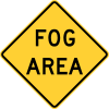
US:W8-22 | ||
| hazard | frail_pedestrians | A place where frail or disabled pedestrians are likely to cross a road | 
ES:P21b |

US:W18-1 | ||
| hazard | frost_heave | An area where the road is known to bulge because of ice underneath the roadway. | 
ES:P50 |

US:W18-1 | ||
| hazard | ground_clearance | A place (usually a hill or incline) where vehicles with long wheelbases risk being grounded. | 
ES:P50 |

US:W10-5 | ||
| hazard | horse_riders | An area where horse riders share a roadway with motor vehicles. | 
ES:P50 |

US:W11-7 | ||
| hazard | ice | An area where ice tends to form more frequently than surrounding areas. | 
ES:P34 |

US:W18-1 | ||
| hazard | landslide | An area where landslides, mudslides or rockslides are known to occur. | 
ES:P26 |

US:W8-14 | ||
| hazard | loose_gravel | An area along the road where rocks and stones may be present, presenting a hazard to motorists. | 
ES:P28 |

US:W8-7 | ||
| hazard | low_flying_aircraft | An area where low flying aircraft are known to appear. | 
ES:P12 |

US:I3-5 | ||
| hazard | pedestrians | An area where pedestrians share a roadway with motor vehicles | 
ES:P20 |
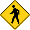
US:W11-2 | ||
| hazard | queues_likely | An area which frequently experiences a queue of cars backed up on the roadway | 
ES:P31 |

US:W18-1 | ||
| hazard | road_narrows | A place where the road narrows immediately following the sign. | 
ES:P17 |

US:W5-1 | ||
| hazard | roundabout | A section of road approaching near a roundabout where it is recommended to reduce speed. | 
ES:P4 |

US:W2-6 | ||
| hazard | school_zone | An area near a school where special traffic laws apply. | 
ES:P21 |

US:S1-1 | ||
| hazard | side_winds | An area which frequently receives high winds that present a danger to people. | 
ES:P29 |

US:W1-5R | ||
| hazard | slippery | An area or stretch of roadway which is slippery, or slippery under certain conditions, presenting a hazard to motorists | 
ES:P19 |

US:W8-5 | ||
| hazard | curve | A section of road which presents a risk to motorists due to a single curve. | 
ES:P13a |

US:W1-2L | ||
| hazard | curves | A section of road which presents a risk to motorists due to multiple curves. | 
ES:P14a |

US:W1-4R | ||
| hazard | turn | A section of road that turns sharply | 
ES:P13a |

US:W1-1R | ||
| hazard | turns | A section of road that turns sharply two times, in opposite directions | 
ES:P14a |

US:W1-3L |
Stop and give_way
| Key | Human readable value | Usage count | Element | Description | traffic_sign:id
Vienna |
traffic_sign:id
MUTCD |
|---|---|---|---|---|---|---|
| highway | stop | A sign of stop | 
ES:R2 |

US:R1-1 | ||
| highway | give_way | A sign of give_way / yield | 
ES:R2 |

US:R1-2 |
traffic_sign=max* ,min or advisory
| Key | Human readable value | Usage count | Element | Description | traffic_sign:id
Vienna |
traffic_sign:id
MUTCD |
|---|---|---|---|---|---|---|
| maxspeed | * | A sign of maxspeed. Specifies the maximum legal speed limit on a road, railway or waterway. | 
ES:R301 |

US:R2-1 | ||
| maxspeed:advisory | * | A sign of advisory maxspeed. Specifies the recomended speed limit on a road, railway or waterway. | 
ES:S7 |

US:W13-1 | ||
| minspeed | * | A sign of minspeed. Specifies the minimum legal speed limit on a road, railway or waterway. | 
ES:R411 |

US:R2-4P | ||
| maxheight | * | The legal maximum height | 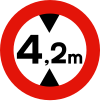
ES:R205 |
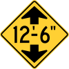
US:W12-2 | ||
| maxwidth | * | The legal maximum width | 
ES:R204 |

US:W5-1 | ||
| maxweight | * | The legal maximum weight | 
ES:R204 |

US:R12-1 | ||
| maxaxleload | * | The legal maximum axleload weight | 
ES:R202 |

US:R12-2 | ||
| maxlength | * | The legal maximum length | 
ES:R203 |

US:W12-2 | ||
| overtaking | no | A sign of no overtaking | 
ES:R305 |

US:W18-1 | ||
| overtaking:hgv | no | A sign of no overtaking for HGV. | 
ES:R305 |

US:W18-1 |
traffic_sign=implicit other regulatory signs
| Key | Human readable value | Usage count | Element | Description | traffic_sign:id
Vienna |
traffic_sign:id
MUTCD |
|---|---|---|---|---|---|---|
| maxspeed | implicit | A sign of end of maxspeed limit. | 
ES:R501 |

US:W18-1 | ||
| maxspeed:advisory | implicit | A sign of end of advisory maxspeed. Specifies the end of recomended speed limit on a road, railway or waterway. | 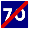
ES:S8 |

US:W18-1 | ||
| minspeed | implicit | A sign of end of minspeed limit. | 
ES:R506 |

US:W18-1 | ||
| overtaking | implicit | A sign of no overtaking | 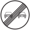
ES:R502 |

US:W18-1 | ||
| overtaking:hgv | implicit | A sign of no overtaking for HGV. | 
ES:R503 |

US:W18-1 |
traffic_sign=access (no) and other regulatory signs
| Key | Human readable value | Usage count | Element | Description | traffic_sign:id
Vienna |
traffic_sign:id
MUTCD |
|---|---|---|---|---|---|---|
| access | no | A sign of no access. Except pedestrians. | 
ES:R100 |

US:R5-1 | ||
| foot | yes | A sign of wrong way. Except pedestrians. | 
ES:R101 |

US:R5-1a | ||
| motor_vehicle | no | A sign of no access for motor vehicles. | 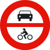
ES:R102 |

US:R5-3 | ||
| motorcycle | no | A sign of no access for motorcycles. | 
ES:R104 |

US:R5-8 | ||
| hgv | no | A sign of no access for hgv. | 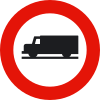
ES:R106 |
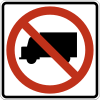
US:R5-2 | ||
| hazmat | no | A sign of no access for hazmat vehicles. | 
ES:R106 |
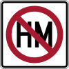
US:R14-3 | ||
| hazmat:explosive | no | A sign of no access for hazmat with explosive material vehicles. | 
ES:R109 |

US:R14-3 | ||
| hazmat:water | no | A sign of no access for hazmat water vehicles. | 
ES:R110 |

US:R14-3 | ||
| agricultural | no | A sign of no access for agricultural vehicles. | 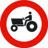
ES:R111 |

US:W18-1 | ||
| bicycle | no | A sign of no access for bicycles. | 
ES:R114 |
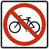
US:R5-6 | ||
| foot | no | A sign of no access for pedestrians. | 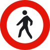
ES:R116 |

US:R9-3 | ||
| horse | no | A sign of no access for equestrians. | 
ES:R117 |

US:R9-14 |
traffic_sign=access (designated) and other regulatory signs
| Key | Human readable value | Usage count | Element | Description | traffic_sign:id
Vienna |
traffic_sign:id
MUTCD |
|---|---|---|---|---|---|---|
| motor_vehicle | designated | A sign of designated access for motor vehicles. | 
ES:R404 |

US:W18-1 | ||
| motorcycle | designated | A sign of designated access for motorcycles. | 
ES:R405 |

US:W18-1 | ||
| hgv | designated | A sign of designated access for hgv. | 
ES:R406 |

US:W18-1 | ||
| hazmat | designated | A sign of designated access for hazmat vehicles. | 
ES:R414 |
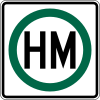
US:R14-2 | ||
| hazmat:explosive | designated | A sign of designated access for hazmat with explosive material vehicles. | 
ES:R416 |

US:R14-2 | ||
| hazmat:water | designated | A sign of designated access for hazmat water vehicles. | 
ES:R415 |

US:R14-2 | ||
| bicycle | designated | A sign of designated access for bicycles. | 
ES:R407 |

US:W18-1 | ||
| foot | designated | A sign of designated access for pedestrians. | 
ES:R410 |

US:W18-1 | ||
| horse | designated | A sign of designated access for equestrians. | 
ES:R409 |

US:W18-1 |
traffic_signs for restriction
| Key | Human readable value | Usage count | Element | Description | traffic_sign:id
Vienna |
traffic_sign:id
MUTCD |
|---|---|---|---|---|---|---|
| restriction | no_stopping | A sign of no stopping | 
ES:R307 |

US:R7-20 | ||
| restriction | no_parking | A sign of no parking | 
ES:R308 |

US:R7-1 | ||
| restriction | no_turn_right | A sign of no turn right | 
ES:R302 |
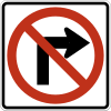
US:R3-1 | ||
| restriction | no_turn_left | A sign of no turn left | 
ES:R303 |
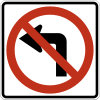
US:R3-2 | ||
| restriction | no_u_turn | A sign of no u-turn | 
ES:R304 |

US:R3-4 |
Mandatory traffic_signs
| Key | Human readable value | Usage count | Element | Description | traffic_sign:id
Vienna |
traffic_sign:id
MUTCD |
|---|---|---|---|---|---|---|
| mandatory | turn_right | A mandatory sign for turn right | 
ES:R400a |

US:R3-5R | ||
| mandatory | turn_left | A mandatory sign for turn left | 
ES:R400b |

US:R3-5L | ||
| mandatory | through | A mandatory sign for straight through | 
ES:R400c |

US:R3-5a | ||
| mandatory | keep_right | A mandatory sign for keep right | 
ES:R401a |

US:R4-7 | ||
| mandatory | keep_left | A mandatory sign for keep left | 
ES:R401b |

US:R4-8 | ||
| mandatory | roundabout | A mandatory sign for roundabout | 
ES:R402 |

US:R6-4 | ||
| mandatory | through_left | A mandatory sign for straight through or turn left | 
ES:R403b |

US:R3-6L | ||
| mandatory | through_right | A mandatory sign for straight through or turn right | 
ES:R403a |

US:R3-6R | ||
| mandatory | no_through | A mandatory sign for turn left or turn right | 
ES:R403c |
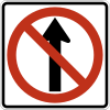
US:R3-27 |
Information traffic_signs
| Key | Human readable value | Usage count | Element | Description | traffic_sign:id
Vienna |
traffic_sign:id
MUTCD |
|---|---|---|---|---|---|---|
| information | motorway | An information sign says you enter in a motorway | 
ES:S1 |

US:W18-1 | ||
| information | end_motorway | An information sign says you exit from a motorway | 
ES:S21 |
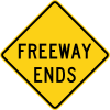
US:W19-3 | ||
| information | expressway | An information sign says you enter in a expressway or motor vehicle way. | 
ES:S3 |

US:W18-1 | ||
| information | end_expressway | An information sign says you exit from a expressway or motor vehicle way. | 
ES:S4 |

US:W19-4 | ||
| information | tunnel | An information sign says you enter in a tunnel | 
ES:S5 |

US:W18-1 | ||
| information | crossing | An information sign says you enter in a crossing | 
ES:S13 |

US:W18-1 | ||
| information | noexit | An information sign says you enter in a way that does not have exit | 
ES:S15a |

US:W18-1 | ||
| information | parking | An information sign says you enter in a parking | 
ES:S17 |

US:W18-1 | ||
| information | taxi_stop | An information sign says here it is a taxi stop | 
ES:S18 |

US:W18-1 | ||
| information | bus_stop | An information sign says here it is a bus stop | 
ES:S19 |

US:W18-1 | ||
| information | tram_stop | An information sign says here it is a tram stop | 
ES:S20 |

US:W18-1 | ||
| information | living_street | An information sign says here you enter in a living_street | 
ES:S28 |

US:W18-1 | ||
| information | end_living_street | An information sign says here you exit from a living_street | 
ES:S29 |

US:W18-1 |
Lanes traffic_signs
| Key | Human readable value | Usage count | Element | Description | traffic_sign:id
Vienna |
traffic_sign:id
MUTCD |
|---|---|---|---|---|---|---|
| lanes | oneway | A sign says you there is only one way lane in that direction. | ES:S12 |
US:R6-1L | ||
| lanes | 1 | A sign says you there is only one way lane. | 
ES:S11 |

US:W18-1 | ||
| lanes | 2 | A sign says you there is two lanes way. | 
ES:S11a |

US:W18-1 | ||
| lanes | 3 | A sign says you there is three lanes way. | 
ES:S11b |

US:W18-1 | ||
| lanes | 3_to_2 | A sign says you a lane of three ends here. | 
ES:S52 |

US:W4-2R | ||
| lanes | 2_to_1 | A sign says you a lane ends here. | 
ES:S52b |

US:W4-2R | ||
| lanes | 1_to_2 | A sign says you a lane starts here. | 
ES:S53 |

US:W18-1 | ||
| lanes | 2_to_3 | A sign says you a lane starts here from two lanes. | 
ES:S53b |

US:W18-1 |
Services traffic_signs
| Key | Human readable value | Usage count | Element | Description | traffic_sign:id
Vienna |
traffic_sign:id
MUTCD |
|---|---|---|---|---|---|---|
| services |
Complimentary traffic_signs
| Key | Human readable value | Usage count | Element | Description | traffic_sign:id
Vienna |
traffic_sign:id
MUTCD |
|---|---|---|---|---|---|---|
| complimentary |
Ref_id traffic_signs
| Key | Human readable value | Usage count | Element | Description | traffic_sign:id
Vienna |
traffic_sign:id
MUTCD |
|---|---|---|---|---|---|---|
| ref_id |
Boundary traffic_signs
| Key | Human readable value | Usage count | Element | Description | traffic_sign:id
Vienna |
traffic_sign:id
MUTCD |
|---|---|---|---|---|---|---|
| boundary |
Position
When there is a second traffic sign you use the subtag 2: to traffic_sign=* tag and/or traffic_sign:id=* so on
(e.g. traffic_sign:2=maxspeed and/or traffic_sign:2:id=DE:206).
Direction
The mapping method is a node , mainly part of the way, using the values explaining its direction relative to the way.
| Tag=value | Comment |
|---|---|
| direction=forward | Forward to the way. It is relative to the orientation you draw a way, as rivers |
| direction=backward | Backward to the way. It is relative to the orientation you draw a way, as rivers |
| direction=90 (clockwise) | 90º to the way. It is relative to the orientation you draw a way, as rivers |
| direction=270 (clockwise) | 270º to the way. It is relative to the orientation you draw a way, as rivers |
| direction=* (clockwise) | other directions relative to the way |
Side
Also it is completed with a tag side that marks the side of the way traffic sign is in.
| Tag=value | Comment |
|---|---|
| side=right | the right side of the way . It is relative to the orientation you draw a way, as rivers |
| side=left | the left side of the way. |
| side=both | the left and right sides at the same time. |
| side=up | all elevated traffic signs or traffic panels. |
| side=down | all traffic road marks. |

