Template:Et:Map Features:natural
Jump to navigation
Jump to search
Loodusobjektid
See silt kirjeldab looduslikke objekte. Neid võib sildistada loodusobjektidena isegi juhul, kui inimesed on neid muutnud.
| võti | väärtus | element | kirjeldus | Tag Usage[1] | renderdus | foto |
|---|---|---|---|---|---|---|
Vegetation | ||||||
| natural | fell | No, see #545. | ||||
| natural | grassland | Areas where the vegetation is dominated by grasses (Poaceae) and other herbaceous (non-woody) plants. For mown/managed grass see landuse=grass, for hay/pasture see landuse=meadow. | ||||
| natural | heath | nõmm | ||||
| natural | moor | Don't use, see wikipage. Upland areas, characterised by low-growing vegetation on acidic soils. | currently not rendered by OSM Carto | |||
| natural | scrub | põõsastik Ülesharimata maa põõsaste või madalate puudega. | ||||
| natural | shrubbery | An area of shrubbery that is actively maintained or pruned by humans. A slightly wilder look is also possible | currently not rendered by OSM Carto | |||
| natural | tree | puu | ||||
| natural | tree_row | A line of trees. | ||||
| natural | tree_stump | A tree stump, the remains of a cut down or broken tree. | ||||
| natural | tundra | Habitat above tree line in alpine and subpolar regions, principally covered with uncultivated grass, low growing shrubs and mosses and sometimes grazed. | ||||
| natural | wood | |||||
|
| ||||||
| natural | bay | laht | ||||
| natural | beach | rand | ||||
| natural | blowhole | An opening to a sea cave which has grown landwards resulting in blasts of water from the opening due to the wave action | ||||
| natural | cape | A piece of elevated land sticking out into the sea or large lake. Includes capes, heads, headlands and (water) promontories. | ||||
| natural | coastline | rannajoon Rannajoon peaks jooksma kellaosuti suunas ümber vee ja kellaosuti vastassuunas ümber maa, st maa jääb joonest vasakule ja vesi paremale. Erandina ei pea rannajoon moodustama suletud joont, vaid olema ühendatud, et tekiks suletud polügon. | ||||
| natural | crevasse | A large crack in a glacier | ||||
| natural | geyser | A spring characterized by intermittent discharge of water ejected turbulently and accompanied by steam. | ||||
| natural | glacier | liustik Aasta läbi jääga kaetud ala. | ||||
| natural | hot_spring | A spring of geothermally heated groundwater | ||||
| natural | isthmus | A narrow strip of land, bordered by water on both sides and connecting two larger land masses. | ||||
| natural | mud | muda | ||||
| natural | peninsula | A piece of land projecting into water from a larger land mass, nearly surrounded by water | ||||
| natural | reef | A feature (rock, sandbar, coral, etc) lying beneath the surface of the water | ||||
| natural | shingle | An accumulation of rounded rock fragments on a beach or riverbed | ||||
| natural | shoal | An area of the sea floor near the sea surface (literally, becomes shallow) and exposed at low tide. See natural=sand as well. | ||||
| natural | spring | allikas | ||||
| natural | strait | A narrow area of water surrounded by land on two sides and by water on two other sides. | ||||
| natural | water | |||||
| natural | wetland | soo või raba | ||||
|
| ||||||
| natural | arch | A rock arch naturally formed by erosion, with an opening underneath. | currently not rendered by OSM Carto | |||
| natural | arete | An arête, a thin, almost knife-like, ridge of rock which is typically formed when two glaciers erode parallel U-shaped valleys. | ||||
| natural | bare_rock | An area with sparse/no soil or vegetation, so that the bedrock becomes visible. | ||||
| natural | natural=blockfield | A surface covered with boulders or block-sized rocks, usually the result of volcanic activity or associated with alpine and subpolar climates and ice ages. | ||||
| natural | cave_entrance | koopasuu | ||||
| natural | cliff | rannakalju/pankrannik Lineaarsena peaks kalju ülemine ots paiknema joone vasakul pool, alumine ots paremal. | ||||
| natural | dune | A hill of sand formed by wind, covered with no or very little vegetation. See also natural=sand and natural=beach | currently not rendered by OSM Carto | |||
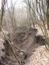
| natural | earth_bank | Large erosion gully or steep earth bank | ||||
| natural | fumarole | A fumarole is an opening in a planet's crust, which emits steam and gases | ||||
| natural | gully | Small scale cut in relief created by water erosion | ||||
| natural | hill | A hill. | currently not rendered by OSM Carto | |||
| natural | peak | mäetipp | ||||
| natural | ridge | A mountain or hill linear landform with a continuous elevated crest | ||||
| natural | rock | A notable rock or group of rocks attached to the underlying bedrock. | currently not rendered by OSM Carto | |||
| natural | saddle | The lowest point along a ridge or between two mountain tops | ||||
| natural | sand | liiv Taimestikku pole või on väga vähe. | ||||
| natural | scree | kiviklibu | ||||
| natural | sinkhole | A natural depression or hole in the surface topography. | currently not rendered by OSM Carto | |||
| natural | stone | kivi Üksik kivi, nt rändrahn | currently not rendered by OSM Carto | |||
| natural | valley | A natural depression flanked by ridges or ranges of mountains or hills | currently not rendered by OSM Carto | |||
| natural | volcano | vulkaan Võib olla nii aktiivne, puhkeseisundis kui | ||||
| natural | user defined | |||||
This table is a wiki template with a default description in English. Editable here.
- ↑ Does not include uses in semi-colon value separated lists


