El:Map Features
Το OpenStreetMap αναπαριστά φυσικά χαρακτηριστικά πάνω στο έδαφος, π.χ. δρόμους ή κτήρια, χρησιμοποιώντας ετικέτες συνδεόμενες με τις βασικές δομές δεδομένων του (κόμβους, διαδρομές και σχέσεις). Κάθε ετικέτα περιγράφει μια ιδιότητα του χαρακτηριστικού που αντιπροσωπεύεται από τον συγκεκριμένο κόμβο, διαδρομή ή σχέση.
Το σύστημα ελεύθερης σήμανσης του OpenStreetMap επιτρέπει τον χάρτη να περιλαμβάνει έναν απεριόριστο αριθμό γνωρισμάτων που περιγράφουν κάθε χαρακτηριστικό. Η κοινότητα συμφωνεί σε συγκεκριμένους συνδυασμούς κλειδιών και τιμών για τις ετικέτες που χρησιμοποιούνται συχνότερα και δρούνε ως ανεπίσημα πρότυπα. Ωστόσο, οι χρήστες μπορούνε να δημιουργήσουνε καινούριες ετικέτες για να βελιώσουνε το ύφος του χάρτη ή για να υποστηριχθούνε αναλύσεις που βασίζονται σε παλαιότερες μη-καταγεγραμμένες ιδιότητες των χαρακτηριστικών. Σύντομες περιγραφές των ετικετών σε σχέση με συγκεκριμένα θέματα ή ενδιαφέροντα μπορούν να βρεθούνε χρησιμοποιώντας τις σελίδες χαρακτηριστικών.
Τα περισσότερα χαρακτηριστικά μπορούν να περιγραφούνε χρησιμοποιώντας μόνο έναν μικρό αριθμό ετικετών, όπως π.χ. ένα μονοπάτι με ετικέτα κατηγοριοποίησης highway=footway, και πιθανόν επίσης μία ονομασία (χρησιμοποιώντας την ετικέτα name=*). Αλλά καθώς το OpenStreetMap είναι ένας παγκόσμιος χάρτης, μπορεί να υπάρχουνε πολλοί διαφορετικοί τύποι χαρακτηριστικών, που σχεδόν όλοι μπορούνε να περιγραφούνε απο ετικέτες.
Για λεπτομέρειες σχετικά με περισσότερες ετικέτες και προτεινόμενες αλλαγές σε ήδη υπάρχουσες ετικέτες δείτε τις σελίδες για τα (προτεινόμενα χαρακτηριστικά) και τα (μη-ισχύοντα χαρακτηριστικά). Εάν δεν εντοπίσετε μια κατάλληλη ετικέτα σε αυτή την λίστα (έχοντας πρώτα ελέγξει τις αντίστοιχες περιγραφές στις σελίδες τους), τότε είστε ελεύθερες/οι να δημιουργήσετε κάτι κατάλληλο, αρκεί οι τιμές της ετικέτας να είναι επαληθεύσιμες. Με το πέρασμα του χρόνου ίσως βρείτε οτι το όνομα της ετικέτας έχει αλλάξει έτσι ώστε να ταιριάζει με την ευρύτερη σύμφωνη γνώμη των χρηστών. Ωστόσο, πολλές καλές ετικέτες πρώτα χρησιμοποιήθηκανε και έπειτα τεκμηριώθηκαν. Πληροφορίες σχετικά με τις ετικέτες OSM είναι διαθέσιμες ως machine readable semantic network.
Κύρια χαρακτηριστικά
Aerialway
This is used to tag different forms of transportation for people or goods by using aerial wires. For example these may include cable-cars, chair-lifts and drag-lifts. See the page Aerialway for more information on the usage of these tags.
This table is a wiki template with a default description in English. Editable here.
Aeroway
These are mainly related to aerodromes, airfields other ground facilities that support the operation of airplanes and helicopters. See the page Aeroways for an introduction on mapping these features.
This table is a wiki template with a default description in English. Editable here.
Υποδομή (amenity)
Χαρτογράφηση υποδομών που χρησιμοποιούνται από επισκέπτες και κατοίκους. Για παράδειγμα: τηλεφωνικοί θάλαμοι, τουαλέτες, φαρμακεία, καφετέριες, τράπεζες, χώροι στάθμευσης και σχολεία. Δείτε τη σελίδα Amenities για μια εισαγωγή στη χρήση της.
| Κατηγορία | Τιμή | Στοιχείο | Σημείωση | Αναπαράσταση | Φωτογραφία | |
|---|---|---|---|---|---|---|
Διαβίωση | ||||||
| amenity | bar | Μπαρ - Επιχείρηση που πωλεί οινοπνευματώδη ποτά τα οποία πρέπει να καταναλώνονται στις εγκαταστάσεις της. Χαρακτηρίζεται συχνά από δυνατή μουσική, θορυβώδη και ζωντανή ατμόσφαιρα παρόμοια με πάρτυ, με πιθανόν όρθιους θαμώνες και συνήθως δεν πωλεί τρόφιμα.
Εάν το μπαρ δεν αποτελεί την κύρια λειτουργία (για παράδειγμα ένα ξενοδοχείο που επίσης έχει μπαρ), τότε μπορεί να καταγραφεί η κύρια λειτουργία και να προστεθεί bar=yes |
||||
| amenity | biergarten | Biergarten - Υπαίθριος χώρος όπου σερβίρονται αλκοολούχα ποτά και φαγητό, συνήθως σε μεγάλα, κοινόχρηστα τραπέζια. Συχνά είναι δίπλα σε μπυραρία, μπαρ, εστιατόριο ή παμπ | ||||
| amenity | cafe | Καφετέρια, καφενείο, τεϊοποτείο, μπιστρό - Συνήθως ανεπίσημο μέρος που προσφέρει ροφήματα ή/και ελαφριά γεύματα, συχνά με επίκεντρο τον καφέ ή το τσάι (ή μπορεί να είναι μπιστρό, το οποίο πουλάει γεύματα με αλκοολούχα ποτά) | ||||
| amenity | fast_food | Ταχυφαγείο - Μέρος που επικεντρώνεται σε γρήγορη εξυπηρέτηση με παραγγελία μόνο στον 'γκισέ' (όχι σε σερβιτόρο) και φαγητό που μπορείς να πάρεις και για κατανάλωση εκτός καταστήματος. Το φαγητό πληρώνεται πριν καταναλωθεί, σερβίρεται σε πιάτα ή άλλα δοχεία μιας χρήσης και προαιρετικά τρώγεται με πλαστικά σκεύη. Τα καταστήματα αυτά συνήθως έχουν και τραπεζάκια (από 2-3 έως πολλά) που είναι εύκολο να καθαριστούν.
Το είδος του φαγητού που προσφέρεται μπορεί να περιγραφεί με τα χαρακτηριστικά cuisine=* και diet:*=*. Π.χ. |
||||
| amenity | food_court | Περιοχή εστίασης με γειτνιάζοντα πολλά μαγαζιά που πουλάνε κυρίως γρήγορο φαγητό. Συνήθως συναντάται σε εμπορικά κέντρα, αεροδρόμια κτλ.. | ||||
| amenity | ice_cream | Παγωτοπωλείο - Μόνιμο μαγαζί το οποίο πουλάει παγωτό ή/και παγωμένο γιαούρτι. Να μην χρησιμοποιείται για κινητές εγκαταστάσεις. | ||||
| amenity | pub | Παμπ - Μαγαζί που πουλάει κυρίως μπύρα και άλλα αλκοολούχα ποτά. Επίσης μπορεί να προσφέρει φαγητό, το οποίο μπορεί να καταναλωθεί στον ίδιο χώρο, ή κατάλυμα (UK). Χαρακτηρίζονται από παραδοσιακή εμφάνιση και χαλαρή ατμόσφαιρα. Συνήθως μπορείς να κάτσεις και δεν υπάρχει δυνατή μουσική που να εμποδίζει τη διεξαγωγή συζητήσεων. Mπορείτε να διαβάσετε περισσότερες λεπτομέρειες στην ιστοσελίδα της Βικιπαίδειας el|Παμπ | ||||
| amenity | restaurant | Εστιατόριο, Ταβέρνα, Μεζεδοπωλείο, Μαγειρείο, Οινομαγειρείο - Μέρος για εστίαση με σερβιτόρους, το οποίο παρέχει πλήρη γεύματα και έχει άδεια πώλησης για αλκοολούχα ποτά | ||||
Εκπαίδευση | ||||||
| amenity | college | |||||
| amenity | dancing_school | A dancing school or dance studio | ||||
| amenity | driving_school | Σχολή οδήγησης - Σχολή που παραδίδει θεωρητικά και πρακτικά μαθήματα οδήγησης σε νέους οδηγούς. | ||||
| amenity | first_aid_school | A place where people can go for first aid courses. | ||||
| amenity | kindergarten | Νηπιαγωγείο, Βρεφονηπιακός σταθμός, Παιδικός σταθμός - Ίδρυμα που παρέχει φροντίδα και ίσως κάποιου είδους εκπαίδευση σε παιδιά προσχολικής ηλικίας | ||||
| amenity | language_school | Φροντιστήριο ξένων γλωσσών - Σχολείο με αποκλειστικό διδακτικό αντικείμενο την εκμάθηση ξένων γλωσσών. | ||||
| amenity | library | Βιβλιοθήκη - Κτήριο ή αίθουσα όπου φυλάσσονται ταξινομημένα βιβλία για ανάγνωση ή/και δανεισμό από το κοινό | ||||
| amenity | surf_school | A surf school is an establishment that teaches surfing. | ||||
| amenity | toy_library | A place to borrow games and toys, or play with them on site. | ||||
| amenity | research_institute | An establishment endowed for doing research. | ||||
| amenity | training | Public place where you can get training. | ||||
| amenity | music_school | Ωδείο - Ένα ίδρυμα στο οποίο διδάσκεται μουσική τέχνη. | ||||
| amenity | school | Σχολείο - Εκπαιδευτικό ίδρυμα στο οποίο μαθητές, συνήθως από 6 έως 18 ετών, παρακολουθούν μαθήματα πρωτοβάθμιας ή δευτεροβάθμιας εκπαίδευσης | ||||
| amenity | traffic_park | Juvenile traffic schools | ||||
| amenity | university | Πανεπιστήμιο - Ανώτατο εκπαιδευτικό ίδρυμα όπου διδάσκονται, κατά τμήματα, διάφορα μαθήματα | ||||
Μετακίνηση | ||||||
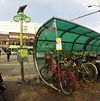
| amenity | bicycle_parking | Χώρος στάθμευσης ποδηλάτων - Xώρος στάθμευσης με κατασκευές προορισμένες για κλείδωμα ποδηλάτων | ||||
| amenity | bicycle_repair_station | General tools for self-service bicycle repairs, usually on the roadside; no service | ||||
| amenity | bicycle_rental | Σταθμός ενοικιαζόμενων ποδηλάτων - Τοποθεσία (όχι κατάστημα) οπου μπορείς να πάρεις ή να αφήσεις ενοικιαζόμενα ποδήλατα | ||||
| amenity | bicycle_wash | Clean a bicycle | ||||
| amenity | boat_rental | Rent a Boat | ||||
| amenity | boat_sharing | |||||
| amenity | bus_station | Σταθμός λεωφορείων - Ένας σταθμός λεωφορείων συμπεριλαμβάνει αρκετές στάσεις, συνήθως αφετηρίες ή τερματικές, επιτρέποντας στους ανθρώπους να ταξιδέψουν προς διάφορες κατευθύνσεις. Ο παρών χαρακτηρισμός έχει αντικατασταθεί από τον public_transport=station, ο οποίος χρησιμοποιείται επίσης για τραμ και τρένα | ||||
| amenity | car_rental | Ενοικίαση αυτοκινήτων | ||||
| amenity | car_sharing | |||||
| amenity | car_wash | Πλυντήριο Αυτοκινήτων | ||||
| amenity | compressed_air | A device to inflate tires/tyres (e.g. motorcar, bicycle) | ||||
| amenity | vehicle_inspection | Government vehicle inspection | ||||
| amenity | charging_station | Σταθμός Φόρτισης | ||||
| amenity | driver_training | A place for driving training on a closed course | ||||
| amenity | ferry_terminal | |||||
| amenity | fuel | Πρατήριο καυσίμων, Σταθμός ανεφοδιασμού καυσίμων, Βενζινάδικο - Εγκατάσταση μεταπώλησης καυσίμων, όπου οχήματα μπορούν να ανεφοδιαστούν. Οι δρόμοι εντός της περιοχής των βενζινάδικων συνήθως περιγράφονται με highway=service | ||||
| amenity | grit_bin | |||||
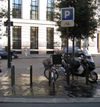
| amenity | motorcycle_parking | Χώρος στάθμευσης μοτοσυκλετών | ||||
| amenity | parking | Χώρος στάθμευσης πολλών αυτοκινήτων - Οι δρόμοι εντός του χώρου στάθμευσης συνήθως περιγράφονται με highway=service και service=parking_aisle | ||||
| amenity | parking_entrance | Είσοδος στάθμευσης αυτοκινήτων - Είσοδος ή έξοδος σε υπόγειο ή πολυώροφο χώρο στάθμευσης. Ομαδοποίησε πολλαπλές εισόδους χώρου στάθμευσης χρησιμοποιώντας τις ετικέτες type=site και site=parking. Μην αναμιγνύετε με amenity=parking. | Underground Multi-storey | |||
| amenity | parking_space | Μονή θέση στάθμευσης αυτοκινήτων- Ομαδοποιήστε πολλές μονές θέσεις στάθμευσης αυτοκινήτων με μια σχέση (relation) χρησιμοποιώντας τις ετικέτες type=site και site=parking. Μην αναμιγνύετε με amenity=parking | ||||
| amenity | taxi | Πιάτσα ταξί | ||||
| amenity | weighbridge | A large weight scale to weigh vehicles and goods | ||||
Οικονομικά | ||||||
| amenity | atm | Μηχάνημα ανάληψης μετρητών - Αν και μηχανήματα ανάληψης που είναι στην εξωτερική πρόσοψη μιας τράπεζας μπορούν να χαρακτηριστούν με συνδυασμό amenity=bank και atm=yes, προτείνεται να προστίθενται ως ξεχωριστά σημεία. | ||||
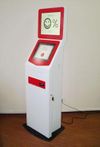
| amenity | payment_terminal | Self-service payment kiosk/terminal | ||||
| amenity | bank | Τράπεζα | ||||
| amenity | bureau_de_change | Ανταλλακτήριο Συναλλάγματος | ||||
| amenity | money_transfer | A place that offers money transfers, especially cash to cash | ||||
| amenity | payment_centre | A non-bank place, where people can pay bills of public and private services and taxes. | ||||
Ιατροφαρμακευτική περίθαλψη | ||||||
| amenity | baby_hatch | Βρεφοδόχος | ||||
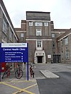
| amenity | clinic | Κλινική | ||||
| amenity | dentist | Οδοντιατρείο | ||||
| amenity | doctors | Ιατρείο | ||||
| amenity | hospital | Νοσοκομείο | ||||
| amenity | nursing_home | Γηροκομείο | ||||
| amenity | pharmacy | Φαρμακείο | ||||
| amenity | social_facility | Κοινωνική μονάδα | ||||
| amenity | veterinary | Κτηνιατρείο | ||||
Ψυχαγωγία | ||||||
| amenity | arts_centre | Κέντρο Τεχνών - Ένας χώρος όπου διάφορες τέχνες εκτελούνται ή διεξάγονται | ||||
| amenity | brothel | Οίκος ανοχής | ||||
| amenity | casino | Καζίνο | ||||
| amenity | cinema | Κινηματογράφος | ||||
| amenity | community_centre | Κοινοτικό κέντρο - Ένας χώρος που χρησιμοποιείται κυρίως για τοπικές εκδηλώσεις και γιορτές. | ||||
| amenity | conference_centre | A large building that is used to hold a convention | ||||
| amenity | events_venue | A building specifically used for organising events | ||||
| amenity | exhibition_centre | An exhibition centre | ||||
| amenity | fountain | Σιντριβάνι | ||||
| amenity | gambling | |||||
| amenity | love_hotel | A love hotel is a type of short-stay hotel operated primarily for the purpose of allowing guests privacy for sexual activities. | ||||
| amenity | music_venue | An indoor place to hear contemporary live music. | ||||
| amenity | nightclub | Νυχτερινό κέντρο, ντισκοτεκ, μπουζούκια - Μέρος για να πιεις και να χορέψεις τη νύχτα | ||||
| amenity | planetarium | Πλανητάριο | ||||
| amenity | public_bookcase | Ανταλλακτική βιβλιοθήκη δρόμου - Έπιπλο στον δρόμο με βιβλία για ανταλλαγή | ||||
| amenity | social_centre | Κοινωνικό κέντρο - Ένας χώρος για δωρεάν και μη κερδοσκοπικές δραστηριότητες. | ||||
| amenity | stage | Κοινωνικό κέντρο - Ένας χώρος για δωρεάν και μη κερδοσκοπικές δραστηριότητες. | ||||
| amenity | stripclub | |||||
| amenity | studio | Στούντιο - Χώρος για τη δημιουργία ραδιοφωνικών ή τηλεοπτικών προγραμμάτων και την εκπομπή τους ή για ηχογράφηση μουσικής. | ||||
| amenity | swingerclub | |||||
| amenity | theatre | Θέατρο - Χρησιμοποιείται για να επισημάνει ένα θέατρο όπου πραγματοποιούνται ζωντανές εμφανίσεις, όπως θεατρικές παραστάσεις, μουσικές εκδηλώσεις και επίσημες συναυλίες.
|
||||
Public Service | ||||||
| amenity | courthouse | Δικαστήριο | ||||
| amenity | fire_station | Πυροσβεστικός σταθμός, Πυροσβεστική | ||||
| amenity | police | Αστυνομία, Αστυνομικό τμήμα | ||||
| amenity | post_box | Γραμματοκιβώτιο,Ταχυδρομικό κουτί | ||||
| amenity | post_depot | Post depot or delivery office, where letters and parcels are collected and sorted prior to delivery. | ||||
| amenity | post_office | Ταχυδρομείο | ||||
| amenity | prison | Φυλακή | ||||
| amenity | ranger_station | |||||
| amenity | townhall | Δημαρχείο | ||||
Facilities | ||||||
| amenity | bbq | Ψησταριά, Γκριλ, Μπάρμπεκιου - Mόνιμη κοινόχρηστη κατασκευή για ψήσιμο φαγητού που συνήθως συναντάται στην ύπαιθρο, κυρίως στο εξωτερικό και μπορεί να τη χρησιμοποιήσει η καθεμία/ένας. Για παράδειγμα μπορεί να βρεθεί σε δημόσια πάρκα ή σε παραλίες. Αν και μπορεί να υπάρχει παροχή καύσιμης ύλης, συνήθως η κατασκευή έχει απλώς τη σχάρα του γκριλ και χρειάζεται να φέρεις εσύ κάρβουνα/ξύλα. Καταγράψτε μόνιμες κατασκευές και όχι προσωρινές | ||||
| amenity | bench | Παγκάκι | ||||
| amenity | dog_toilet | Area designated for dogs to urinate and excrete. | ||||
| amenity | dressing_room | Area designated for changing clothes. | ||||
| amenity | drinking_water | Πόσιμο Νερό, Ψύκτης νερού - Είναι μέρος όπου άνθρωποι μπορούν να πιούνε νερό ή να το πάρουνε σε δοχείο (όχι να το αγοράσουνε). Χρησιμοποιήστε αυτό το χαρακτηριστικό μόνο αν είστε σίγουρες/σίγουροι οτι το νερό είναι κατάλληλο για ανθρώπινη κατανάλωση.
|
||||
| amenity | give_box | A small facility where people drop off and pick up various types of items in the sense of free sharing and reuse. | ||||
| amenity | mailroom | A mailroom for receiving packages or letters. | ||||
| amenity | parcel_locker | Machine for picking up and sending parcels | ||||
| amenity | shelter | Καταφύγιο | ||||
| amenity | shower | Λουτρό | ||||
| amenity | telephone | Τηλέφωνο, Τηλεφωνικός θάλαμος | ||||
| amenity | toilets | Τουαλέτες | ||||
| amenity | water_point | |||||
| amenity | watering_place | Ποτίστρα | ||||
Waste Management | ||||||
| amenity | sanitary_dump_station | A place for depositing human waste from a toilet holding tank. | ||||
| amenity | recycling | Ανακύκλωση | ||||
| amenity | waste_basket | Καλάθι Απορριμμάτων | ||||
| amenity | waste_disposal | Κάδος Απορριμμάτων | ||||
| amenity | waste_transfer_station | A waste transfer station is a location that accepts, consolidates and transfers waste in bulk. | ||||
Άλλα | ||||||
| amenity | animal_boarding | Ξενοδοχείο ζώων - Μια εγκατάσταση όπου μπορείς, πληρώνοντας, να αφήσεις το κατοικίδιό σου για περιορισμένο χρονικό διάστημα (π.χ. για διακοπές). Διαφέρει από τα καταφύγια ζώων στο ότι το κάθε κατοικίδιο έχει μια ιδιοκτήτρια/ιδιοκτήτη, που το παίρνει πίσω. Εάν η εγκατάσταση έχει άλλο κύριο αντικείμενο (π.χ. ένα κτηνιατρείο, ένα καταφύγιο ζώων, ένα ξενοδοχείο, ή οτιδήποτε άλλο) και παρέχει φιλοξενία ως δευτερεύουσα υπηρεσία, η εγκατάσταση θα πρέπει να επισημανθεί σύμφωνα με το κύριο αντικείμενό της (π.χ. amenity=veterinary, amenity=animal_shelter, tourism=hotel) και στη συνέχεια προσθέστε μια δευτερεύουσα ετικέτα που είναι: animal_boarding=yes/no/<animal>[;<animal>...] | ||||
| amenity | animal_breeding | A facility where animals are bred, usually to sell them | ||||
| amenity | animal_shelter | Καταφύγιο ζώων - Μια εγκατάσταση για τη θεραπεία και αποκατάσταση συνήθως εγκαταλελειμμένων, αδέσποτων ή άγριων ζώων | ||||
| amenity | animal_training | A facility used for non-competitive animal training | ||||
| amenity | baking_oven | An oven used for baking bread and similar, for example inside a building=bakehouse. | ||||
| amenity | clock | Ρολόι - ένα δημόσιο, ορατό ρολόι | ||||
| amenity | crematorium | Κρεματόριο - Χώρος αποτέφρωσης νεκρών | ||||
| amenity | dive_centre | A dive center is the base location where sports divers usually start scuba diving or make dive guided trips at new locations. | ||||
| amenity | funeral_hall | A place for holding a funeral ceremony, other than a place of worship. | ||||
| amenity | grave_yard | Νεκροταφείο, κοιμητήριο | ||||
| amenity | hunting_stand | |||||
| amenity | internet_cafe | A place whose principal role is providing internet services to the public. | ||||
| amenity | kitchen | A public kitchen in a facility to use by everyone or customers | ||||
| amenity | kneipp_water_cure | |||||
| amenity | lounger | An object for people to lie down. | ||||
| amenity | marketplace | Αγορά | ||||
| amenity | monastery | Monastery is the location of a monastery or a building in which monks and nuns live. | ||||
| amenity | mortuary | A morgue or funeral home, used for the storage of human corpses. | ||||
| amenity | photo_booth | Θάλαμος στιγμιαίων φωτογραφιών - Θάλαμος αυτόματης λήψης στιγμιαίων φωτογραφιών, συνήθως με εισαγωγή κερμάτων | ||||
| amenity | place_of_mourning | A room or building where families and friends can come, before the funeral, and view the body of the person who has died. | ||||
| amenity | place_of_worship | Τόπος λατρείας, Χώρος Λατρείας, Ναός | ||||
| amenity | public_bath | A location where the public may bathe in common, etc. japanese onsen, turkish bath, hot spring | ||||
| Δημόσιο κτήριο | ||||||
| amenity | refugee_site | A human settlement sheltering refugees or internally displaced persons | ||||
| amenity | vending_machine | Μηχάνημα Αυτόματης Πώλησης, Αυτόματος Πωλητής (π.χ. τροφίμων, ποτών, εισιτηρίων) | ||||
| amenity | ||||||
This table is a wiki template with a default description in English. Editable here.
Εμπόδιο (barrier)
Η ετικέτα εμπόδιο χρησιμοποιείται για να περιγράψει εμπόδια που συνήθως συναντώνται σε ταξίδια. Δείτε τη σελίδα με τίτλο Barriers για μια εισαγωγή στη χρήση της ετικέτας.
| Κατηγορία | Τιμή | Στοιχείο | Σημείωση | Αναπαράσταση | Φωτογραφία | |
|---|---|---|---|---|---|---|
Γραμμικό εμπόδιο | ||||||
| barrier | cable_barrier | Καλωδιακό στηθαίο ασφαλείας. Είναι στηθαίο παραπλεύρως του δρόμου ή διαχωριστικό στηθαίο φτιαγμένο από συρματόσχοινα στερεωμένα σε στύλους. Δείτε επίσης την πιο εκτενή περιγραφή της Βικιπαίδειας. | ||||
| barrier | city_wall | Μια οχύρωση που χρησιμοποιείται για να προστατεύσει μια πόλη ή οικισμό από πιθανούς επιτιθέμενους. Η δεξιά πλευρά είναι το κάτω μέρος, η αριστερή πλευρά το πάνω. Αν κι οι δύο πλευρές είναι στο ίδιο ύψος, προσθέστε "two_sided=yes" | ||||
| barrier | ditch | Χαντάκι, Αυλάκι, Τάφρος | ||||
| barrier | fence | Φράκτης | ||||
| barrier | guard_rail | Προστατευτικό Κιγκλίδωμα | ||||
| barrier | handrail | Κουπαστή | ||||
| barrier | hedge | Περίφραξη, Φράκτης από θάμνους | ||||
| barrier | retaining_wall | Τοίχος Αντιστήριξης | ||||
| barrier | wall | Τοίχος | ||||
Περιορισμός πρόσβασης στους δρόμους | ||||||
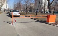
| barrier | block | Εμπόδιο-μπλοκ | ||||
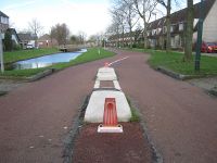
| barrier | bollard | Στύλος/κολωνάκι | ||||
| barrier | border_control | Συνοριακός σταθμός ελέγχου - Σημείο ελέγχου σε διεθνή σύνορα μεταξύ δύο χωρών. Ελέγχονται διαβατήρια ή άλλο είδος ταυτότητας. | ||||
| barrier | bump_gate | |||||
| barrier | bus_trap | |||||
| barrier | cattle_grid | |||||
| barrier | coupure | A cut through a flood protection feature (e.g., (flood)wall, levee, or dyke) for a road or railway, that is readily made flood tight if required. | ||||
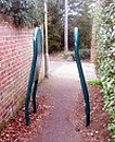
| barrier | cycle_barrier | Εμπόδιο ποδηλάτων - Εμπόδια στην κυκλοφορία ποδηλάτων, συνήθως ένα ζευγάρι μεταλλικών σωλήνων κάθετα στη διαδρομή, τα κενά των οποίων επιτρέπουν στους πεζούς να περνάνε. | ||||
| barrier | debris | Χαλάσματα - Ένας δρόμος εμποδίζεται από χαλάσματα, με ή χωρίς χώμα. Για πολύ ή λίγο χρόνο. Συνήθως χρησιμοποιείται σαν πρώτο βήμα στο κλείσιμο ενός εγκατελειμένου δρόμου. | ||||
| barrier | entrance | Είσοδος - Ένα κενό σε ένα γραμμικό εμπόδιο, όπου τίποτα δεν εμποδίζει τη διέλευση. Εννοείται access=yes. Οι περιορισμοί είναι οι ίδιοι με τη διαδρομή που το διασχίζει, εάν υπάρχει τέτοια. | ||||
| barrier | full-height_turnstile | Περιστροφική πόρτα - Πλήρους ύψους περιστροφική πόρτα (τουρνικέ), γνωστή και ως HEET-turnstile (High Entrance/Exit Turnstile), όπως αυτές για πρόσβαση σε περιοχές ασφαλείας. Προσέξτε τη μίξη παύλας και κάτω πάυλας | ||||
| barrier | gate | Πύλη - Μια είσοδος που μπορεί να ανοίξει ή να κλείσει | ||||
| barrier | hampshire_gate | |||||
| barrier | height_restrictor | Περιοριστής ύψους - Συνδυάστε με maxheight=* | ||||
| barrier | horse_stile | |||||
| barrier | kent_carriage_gap | [1] | ||||
| barrier | kissing_gate | |||||
| barrier | lift_gate | Ανυψούμενη Πύλη | ||||
| barrier | motorcycle_barrier | Eμπόδιο μοτοσυκλετών - Εμπόδια στη διαδρομή που εμποδίζουν την πρόσβαση σε μοτοσυκλέτες. | ||||
| barrier | planter | A plant box, or simply a planter, is a structure containing plants for decoration, which (in this context) has the primary purpose of preventing large vehicles from passing. | ||||
| barrier | sally_port | |||||
| barrier | sliding_beam | Something between barrier=sliding_gate and barrier=lift_gate: it has a quite thin bar like in lift gate, but the bar slides aside to allow through. | ||||
| barrier | sliding_gate | Gates open sideways; usually automatic.
Combine with access=* where appropriate. |
||||
| barrier | spikes | Καρφιά - Καρφιά στο έδαφος που εμποδίζουν τη μη εξουσιοδοτημένη πρόσβαση. Μπορούν να είναι και αφαιρούμενα π.χ. μετά την πληρωμή σε ένα γκαράζ | ||||
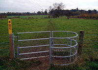
| barrier | stile | Σκάλα φράχτη - Μια σκάλα φράχτη επιτρέπει στους πεζούς να διασχίσουν έναν τοίχο ή φράχτη, αλλά ποτέ δεν "ανοίγει" πραγματικά το εμπόδιο (σε αντίθεση με μια πύλη, μια σκάλα φράχτη έχει λίγα ή καθόλου κινούμενα μέρη) | ||||
| barrier | sump_buster | |||||
| barrier | swing_gate | |||||
| barrier | toll_booth | Διόδια - Εδώ συλλέγονται διόδια (ή εισιτήρια εισόδου) για τη χρήση του δρόμου. Χρησιμοποιείται με toll=* και charge=* | ||||
| barrier | turnstile | Περιστροφική πύλη - Μια περιστροφική πύλη (τουρνικέ) χρησιμοποιείται για να επιτρέψει σε ένα άτομο κάθε φορά να περάσει. Χρησιμοποιείστε το για μικρές πύλες, όπως αυτές σε σούπερ μάρκετ (ή μερικά τρένα/μετρό). | ||||
| barrier | wedge | A wedge-shaped barrier that rises out of the ground to block traffic. | ||||
| barrier | wicket_gate | A wicket gate, or simply a wicket, is a pedestrian door or gate, particularly one built into a larger door or into a wall or fence. | ||||
| barrier | yes | |||||
Linear barriers or access control on highways (e.g., along or for blocking a path or road) | ||||||
| Κατηγορία | Τιμή | Στοιχείο | Σημείωση | Photo for along | Αναπαράσταση | Φωτογραφία |
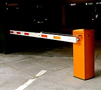
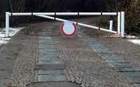
| barrier | bar | A fixed horizontal bar which blocks motor vehicles but can usually be bypassed on foot or bike. Often placed at trailheads. | ||||
| barrier | barrier_board | A barrier board to restrict the passage of a way or to block off an area. | ||||
| barrier | bollard | Στύλος/κολωνάκι | ||||
| barrier | chain | Αλυσίδα - Μια αλυσίδα που χρησιμοποιείται για να εμποδίσει μηχανοκίνητα οχήματα. | ||||
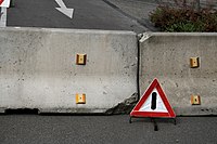
| barrier | jersey_barrier | Αποτελείται από βαρυά προκατασκευασμένα κομμάτια/μπλοκ, για τη δημιουργία εμποδίου. Χρησιμοποιείστε material=plastic ή material=concrete για να περιγράψετε το υλικό κατασκευής. | ||||
| barrier | kerb | Κράσπεδο | ||||
| barrier | log | Κορμός - Χρησιμοποιείστε το όταν το πέρασμα είναι κλειστό από ξυλεία (κορμός δέντρου). Αυτό το είδος εμποδίου είναι συχνά χρήσιμο για να κάτσεις. Αυτό το εμπόδιο επιβαρύνει τους ποδηλάτες, αλλά μπορεί να περαστεί σηκώνοντας το ποδήλατο από πάνω. | ||||
| barrier | rope | Σκοινί - Ένα εύκαμπτο εμπόδιο φτιαγμένο από ίνες, συστρεμένες και πλεγμένες μαζί για βελτιωμένη αντοχή. Σαν εμπόδιο, είναι συχνά περισσότερο συμβολικό παρά εμποδίζει πραγματικά την πρόσβαση πεζών. | ||||
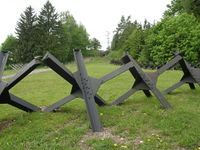
| barrier | tank_trap | Static anti-tank obstacles that can take various forms, such as Czech hedgehog (barrier=tank_trap; tank_trap=czech_hedgehog). | ||||
| barrier | tyres | A crash barrier made from tyres stacked on top of each other, commonly found at motor racing circuits. | ||||
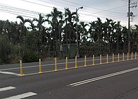
| barrier | delineators | A barrier made of plastic/rubber posts, common on one-way two-lane roads where overtaking is prohibited, or on busy roads to prevent forbidden turns or parking along the curb. | ||||
| barrier | user defined | All commonly used values according to Taginfo | ||||
This table is a wiki template with a default description in English. Editable here.
Όριο
Η ετικέτα όριο χρησιμοποιείται για να περιγράψει διοικητικά και άλλα όρια. Δείτε τη σελίδα με τίτλο boundary για μια εισαγωγή στη χρήση της ετικέτας.
| Κατηγορία | Τιμή | Στοιχείο | Σημείωση | Αναπαράσταση | Φωτογραφία | |
|---|---|---|---|---|---|---|
Boundary types | ||||||
| boundary | aboriginal_lands | A boundary representing official reservation boundaries of recognized aboriginal / indigenous / native peoples. | ||||
| boundary | administrative | Διοικητικό Όριο | ||||
| boundary | border_zone | A border zone is an area near the border where special restrictions on movement apply. Usually a permit is required for visiting. | ||||
| boundary | forest | A delimited forest is a land which is predominantly wooded and which is, for this reason, given defined boundaries. It may cover different tree stands, non-wooded areas, highways… but all the area within the boundaries are considered and managed as a single forest. | ||||
| boundary | forest_compartment | A forest compartment is a numbered sub-division within a delimited forest, physically materialized with visible, typically cleared, boundaries. | ||||
| boundary | hazard | A designated hazardous area, with a potential source of damage to health, life, property, or any other interest of value. | ||||
| boundary | health | Health division boundaries. Some mappers use health_level=* instead of admin_level=* to specify level in the health system hierarchy. | ||||
| boundary | maritime | Θαλάσσιο όριο | ||||
| boundary | marker | A boundary marker, border marker, boundary stone, or border stone is a robust physical marker that identifies the start of a land boundary or the change in a boundary, especially a change in direction of a boundary. See also historic=boundary_stone | ||||
| boundary | national_park | Εθνικό πάρκο | ||||
| boundary | place | boundary=place is commonly used to map the boundaries of a place=*, when these boundaries can be defined but these are not administrative boundaries. | ||||
| boundary | political | |||||
| boundary | postal_code | Ταχυδρομικός κώδικας | ||||
| boundary | protected_area | |||||
| boundary | religious_administration | |||||
| boundary | special_economic_zone | A government-defined area in which business and trade laws are different. | ||||
| boundary | disputed | An area of landed claimed by two or more parties (use with caution). See also Disputed territories. | ||||
| boundary | ||||||
Attributes | ||||||
| admin_level | ||||||
| health_level | (number) | Used by some mappers instead of admin_level=* in conjunction with boundary=health and is usually in the range 1 to 10. | ||||
| postal_code_level | (number) | Used by some mappers instead of admin_level=* in conjunction with boundary=postal_code and is usually in the range 1 to 10. | ||||
| [[ Data item not found. Check your spelling. | religious_level ]] | (number) | Used by some mappers instead of admin_level=* in conjunction with boundary=religious_administration and is usually in the range 1 to 10. | ||||
| border_type | * | |||||
| start_date | (date) | Useful if the boundary is very recent (or if it will become effective in a near future). | ||||
This table is a wiki template with a default description in English. Editable here.
Τύποι κτηρίων
Η ετικέτα κτήριο χρησιμοποιείται για να προσδιορίσει μεμονωμένα κτίρια ή ομάδες συνδεδεμένων κτηρίων. Δείτε τη σελίδα με τίτλο building για μια εισαγωγή στη χρήση της ετικέτας και man_made=* για προσθήκη ετικετών διαφόρων άλλων κατασκευών.
| Κατηγορία | Τιμή | Σημείωση | Φωτογραφία | |||
|---|---|---|---|---|---|---|
Στέγαση | ||||||
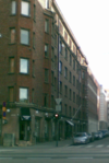
| building | apartments | Διαμερίσματα | ||||
| building | barracks | Buildings built to house military personnel or laborers. | ||||
| building | bungalow | |||||
| building | cabin | Καλύβα | ||||
| building | detached | |||||
| building | dormitory | Φοιτητική Εστία, Κοιτώνας | ||||
| building | farm | Φάρμα | ||||
| building | ger | A permanent or seasonal round yurt or ger. | ||||
| building | hotel | Ξενοδοχείο | ||||
| building | house | Σπίτι | ||||
| building | houseboat | |||||
| building | residential | Κτίριο Κατοικιών | ||||
| building | semidetached_house | A residential house that shares a common wall with another on one side. Typically called a "duplex" in American English. | ||||
| building | static_caravan | |||||
| building | stilt_house | A building raised on piles over the surface of the soil or a body of water | ||||
| building | terrace | Ενωμένα Ομοιόμορφα Σπίτια | ||||
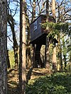
| building | tree_house | An accommodation, often designed as a small hut, sometimes also as a room or small apartment. Built on tree posts or on a natural tree. A tree house has no contact with the ground. Access via ladders, stairs or bridgeways. | ||||
| building | trullo | A stone hut with a conical roof. | ||||
Εμπορικό | ||||||
| building | commercial | Εμπορικό | ||||
| building | industrial | Βιομηχανικό | ||||
| building | kiosk | Κιόσκι | ||||
| building | office | Γραφείων | ||||
| building | retail | Λιανικού εμπορίου | ||||
| building | supermarket | A building constructed to house a self-service large-area store. | ||||
| building | warehouse | Αποθήκη | ||||
Religious | ||||||
| building | religious | Unspecific building related to religion. Prefer more specific values if possible. | ||||
| building | cathedral | Καθεδρικός ναός | ||||
| building | chapel | Εκκλησάκι, παρεκκλήσι | ||||
| building | church | Εκκλησία | ||||
| building | kingdom_hall | A building that was built as a |
||||
| building | monastery | A building constructed as |
||||
| building | mosque | Τέμενος, τζαμί | ||||
| building | presbytery | A building where priests live and work. | ||||
| building | shrine | |||||
| building | synagogue | Συναγωγή | ||||
| building | temple | |||||
Αστικό | ||||||
| building | bakehouse | A building that was built as a bakehouse (i.e. for baking bread). Often used in conjunction with another node amenity=baking_oven and oven=wood_fired. | ||||
| building | bridge | Γέφυρα | ||||
| building | civic | |||||
| building | college | A college building. Use amenity=college on the whole college area to represent the college as an institution. | ||||
| building | fire_station | A building constructed as fire station, i.e. to house fire fighting equipment and officers, regardless of current use. Add amenity=fire_station on the grounds for an active fire station. | ||||
| building | government | For government buildings in general, including municipal, provincial and divisional secretaries, government agencies and departments, town halls, (regional) parliaments and court houses. | ||||
| building | gatehouse | An entry control point building, spanning over a highway that enters a city or compound. | ||||
| building | hospital | Νοσοκομείο | ||||
| building | kindergarten | For any generic kindergarten buildings. Buildings for specific uses (sports halls etc.) should be tagged for their purpose. If there is currently a kindergarten in the building, use amenity=kindergarten on the perimeter of the kindergarten grounds. | ||||
| building | museum | A building which was designed as a museum. | ||||
| building | public | Δημόσιο | ||||
| building | school | Σχολείο | ||||
| building | toilets | A toilet block. | ||||
| building | train_station | Σταθμός τρένου | ||||
| building | transportation | Μεταφορά | ||||
| building | university | Πανεπιστήμιο | ||||
Agricultural/plant production | ||||||
| building | barn | Αποθήκη αγροκτήματος, Σιταποθήκη, Αχυρώνας | ||||
| building | conservatory | A building or room having glass or tarpaulin roofing and walls used as an indoor garden or a sunroom (winter garden). | ||||
| building | cowshed | Βουστάσιο | ||||
| building | farm_auxiliary | |||||
| building | greenhouse | Θερμοκήπιο | ||||
| building | slurry_tank | A circular building built to hold a liquid mix of primarily animal excreta (also known as slurry). | ||||
| building | [[ Too many Data Items entities accessed. | stable ]] | Στάβλος | ||||
| building | sty | Χοιροστάσιο | ||||
| building | livestock | A building for housing/rising other livestock (apart from cows, horses or pigs covered above), or when the livestock changes. | ||||
Sports | ||||||
| building | grandstand | The main stand, usually roofed, commanding the best view for spectators at racecourses or sports grounds. | ||||
| building | pavilion | A sports pavilion usually with changing rooms, storage areas and possibly an space for functions & events. Avoid using this term for other structures called pavilions by architects (see |
||||
| building | riding_hall | A building that was built as a riding hall. | ||||
| building | sports_hall | A building that was built as a sports hall. | ||||
| building | sports_centre | A building that was built as a sports centre. | ||||
| building | stadium | Στάδιο | ||||
Storage | ||||||
| building | allotment_house | A small outbuilding for short visits in a allotment garden. | ||||
| building | boathouse | A boathouse is a building used for the storage of boats. | ||||
| building | hangar | Υπόστεγο Αεροσκαφών | ||||
| building | hut | Παράγκα | ||||
| building | shed | Αποθήκη κήπου | ||||
Cars | ||||||
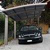
| building | carport | A carport is a covered structure used to offer limited protection to vehicles, primarily cars, from the elements. Unlike most structures a carport does not have four walls, and usually has one or two. | ||||
| building | garage | Γκαράζ, σταθμός αυτοκινήτων | ||||
| building | garages | |||||
| building | parking | Structure purpose-built for parking cars. | ||||
Power/technical buildings | ||||||
| building | digester | A digester is a bioreactor for the production of biogas from biomass. | ||||
| building | service | |||||
| building | tech_cab | Small prefabricated cabin structures for the air-conditioned accommodation of different technology. | ||||
| building | transformer_tower | Πύργος μετασχηματιστή | ||||
| building | water_tower | A water tower. | ||||
| building | storage_tank | Storage tanks are containers that hold liquids | ||||
| building | silo | A silo is a building for storing bulk materials | ||||
Άλλο | ||||||
| building | beach_hut | A small, usually wooden, and often brightly coloured cabin or shelter above the high tide mark on popular bathing beaches. | ||||
| building | bunker | (Υπόγειο) Καταφύγιο | ||||
| building | castle | A building constructed as a castle. Can be further specified with historic=castle + castle_type=*. | ||||
| building | construction | Κατασκευή | ||||
| building | container | For a container used as a permanent building. Do not map containers placed temporarily, for example used in shipping or construction. | ||||
| building | guardhouse | A small building constructed to house guard(s). | ||||
| building | military | A military building. Also use military=*. | ||||
| building | outbuilding | A less important building near to and on the same piece of land as a larger building. | ||||
| building | pagoda | A building constructed as a pagoda. | ||||
| building | quonset_hut | A lightweight prefabricated structure in the shape of a semicircle. | ||||
| building | roof | Υπόστεγο | ||||
| building | ruins | Ερείπια, Χαλάσματα | ||||
| building | tent | For a permanently placed tent. Do not map tents placed temporarily. | ||||
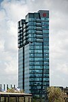
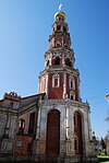
| building | tower | A tower-building. | ||||
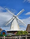
| building | windmill | A building constructed as a traditional windmill, historically used to mill grain with wind power. | ||||
| building | yes | |||||
| building | ||||||
Επιπρόσθετες ιδιότητες
| Κατηγορία | Τιμή | Στοιχείο | Σημείωση | Φωτογραφία |
|---|---|---|---|---|
| building:architecture | <architectural style> | Architectural style of a building | ||
| building:colour | <RGB hex triplet> | <W3C colour name> | Indicates colour of the building | ||
| building:fireproof | yes | no | Fire-resistance information. | ||
| building:flats | <number> | The number of residential units (flats, apartments) in an apartment building (building=apartments), residential building (building=residential), house (building=house), detached house (building=detached) or similar building. | ||
| building:levels | <number> | The number of visible levels (floors) in the building as used in the Simple 3D buildings scheme | ||
| building:material | <material type> | Outer material for the building façade | ||
| building:min_level | <number> | For describing number of values, "filling" space between ground level and bottom level of building or part of building | ||
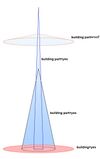
| building:part | As building | To mark a part of a building, which has attributes, different from such ones at other parts | ||
| building:soft_storey | yes | no | reinforced | A building where any one level is significantly more flexible (less stiff) than those above and below it | ||
| construction_date | <date> | The (approximated) date when the building was finished. | ||
| entrance | yes | main | exit | service | emergency | An entrance in a building. Replaces the deprecated tag building=entrance. | ||
| height | <number> | The height of the building in meters. | ||
| max_level | <number> | Maximum indoor level (floor) in the building as used in the Simple Indoor Tagging scheme | ||
| min_level | <number> | Minimum indoor level (floor) in the building as used in the Simple Indoor Tagging scheme | ||
| non_existent_levels | <number> | List of indoor levels (floors) that do not exists in the building as used in the Simple Indoor Tagging scheme | ||
| start_date | <date> | The (approximated) date when the building was finished. |
This table is a wiki template with a default description in English. Editable here.
Δεξιοτεχνία
Η ετικέτα δεξιοτεχνία χρησιμοποιείται για μέρος που παράγει ή επεξεργάζεται εξατομικευμένα προϊόντα ή το μέρος εργασίας κάποιου μάστορα. Δείτε τη σελίδα με τίτλο craft για μια εισαγωγή στη χρήση της ετικέτας.
| Κατηγορία | Τιμή | Σημείωση | Αναπαράσταση | Φωτογραφία |
|---|---|---|---|---|
| craft | agricultural_engines | Γεωργικές μηχανές | ||
| craft | atelier | A place where visual artists work | ||
| craft | bag_repair | A place where bags/luggage are repaired. | ||
| craft | bakery | A workplace for fresh bakery goods. No shop. | ||
| craft | basket_maker | Πλέξιμο καλαθιών | ||
| craft | beekeeper | Μελισσοκόμος | ||
| craft | blacksmith | Σιδηρουργείο | ||
| craft | boatbuilder | Ναυπηγείο | ||
| craft | bookbinder | Βιβλιοδεσία | ||
| craft | brewery | Ζυθοποιείο | ||
| craft | builder | Constructs buildings, streets and other objects. | ||
| craft | cabinet_maker | A person who makes fine wooden furniture. | ||
| craft | carpenter | Ξυλουργείο | ||
| craft | carpet_layer | Τοποθέτηση μοκετών | ||
| craft | caterer | Τροφοδοσία | ||
| craft | chimney_sweeper | καθαριστής καμινάδων | ||
| craft | clockmaker | Ωρολογοποιός | ||
| craft | confectionery | Ζαχαροπλαστική | ||
| craft | distillery | Αποστακτήριο | ||
| craft | door_construction | A workplace of someone constructing doors. | ||
| craft | dressmaker | Μοδίστρα, Ράφτης | ||
| craft | electrician | Ηλεκτρολόγος | ||
| craft | floorer | Πατωματζής | ||
| craft | gardener | Κηπουρός | ||
| craft | glaziery | Τζαμιών τοποθέτηση | ||
| craft | handicraft | Χειροτεχνία | ||
| craft | hvac | |||
| craft | insulation | Μόνωσης τοποθέτηση | ||
| craft | jeweller | Αργυροχρυσοχοείο | ||
| craft | joiner | An artisan who builds things by joining pieces of wood, particularly furniture or ornamental work. | ||
| craft | key_cutter | Κλειδαράδικο | ||
| craft | locksmith | Κλειδαράς | ||
| craft | metal_construction | Μεταλλικές κατασκευές | ||
| craft | optician | Οπτικός | ||
| craft | painter | Ζωγράφος | ||
| craft | parquet_layer | |||
| craft | photographer | Φωτογραφικό στούντιο | ||
| craft | photographic_laboratory | Φωτογραφικό εργαστήριο | ||
| craft | piano_tuner | A piano tuner or technician. A professional that tunes, regulates and makes the maintenance of pianos. Most of them repair simple problems and some restore a whole piano. | ||
| craft | plasterer | Σοβατζής | ||
| craft | plumber | Υδραυλικός | ||
| craft | pottery | Κεραμοποιείο | ||
| craft | rigger | |||
| craft | roofer | Στέγες – κατασκευή | ||
| craft | saddler | Σαμαράς | ||
| craft | sailmaker | Ιστιοραφείο | ||
| craft | sawmill | Πριονιστήριο | ||
| craft | scaffolder | Κατασκευαστής σκαλωσιών | ||
| craft | sculptor | Γλύπτης | ||
| craft | shoemaker | Τσαγκαράδικο | ||
| craft | stand_builder | |||
| craft | stonemason | Λιθοξόος | ||
| craft | stove_fitter | A workplace/office of a person/company who designs and builds stoves/tiled stoves. | ||
| craft | sun_protection | Τέντες και παντζούρια | ||
| craft | tailor | Ράφτης | ||
| craft | tiler | Πλακάκια – τοποθέτηση - Τεχνίτης που στρώνει δάπεδα με πλάκες | ||
| craft | tinsmith | Λευκοσιδηρουργός | ||
| craft | turner | A turner or wood turner. | ||
| craft | upholsterer | Ταπετσαρίες | ||
| craft | watchmaker | Ωρολογοποιός | ||
| craft | window_construction | Κατασκευή κουφωμάτων | ||
| craft | winery | Οινοποιείο | ||
| craft |
This table is a wiki template with a default description in English. Editable here.
Έκτακτη ανάγκη (emergency)
Η ετικέτα έκτακτη ανάγκη χρησιμοποιείται για να περιγράψει τη θέση εγκαταστάσεων και εξοπλισμού έκτακτης ανάγκης. Δείτε τη σελίδα με τίτλο emergency για μια εισαγωγή στη χρήση της ετικέτας.
| Κατηγορία | Τιμή | Στοιχείο | Σημείωση | Αναπαράσταση | Φωτογραφία | |
|---|---|---|---|---|---|---|
Ιατρική διάσωση | ||||||
| emergency | ambulance_station | Σταθμός ασθενοφόρων | ||||
| emergency | defibrillator | Απινιδωτής | ||||
Πυροσβέστες | ||||||
| emergency | fire_extinguisher | Πυροσβεστήρας | ||||
| emergency | fire_flapper | |||||
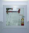
| emergency | fire_hose | Πυροσβεστική φωλιά | ||||
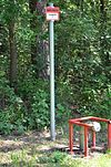
| emergency | fire_hydrant | Πυροσβεστικός κρουνός | ||||
| emergency | water_tank | Δεξαμενή νερού για πυρόσβεση | ||||
| emergency | fire_water_pond | A man made or natural pond with water for a fire department. | ||||
| emergency | suction_point | A preferred point to pump water off a river or other waters for a fire department. | ||||
Ναυαγοσώστες | ||||||
| emergency | lifeguard_base | Βάση ναυαγοσώστη | ||||
| emergency | lifeguard_tower | Πύργος ναυαγοσώστη | ||||
| emergency | lifeguard_platform | Εξέδρα ναυαγοσώστη | ||||
| emergency | lifeguard_place | Τοποθεσία ναυαγοσώστη | ||||
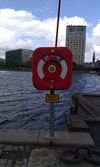
| emergency | life_ring | Κυκλικό σωσίβιο, κουλούρα, δαχτυλίδι ζωής, δαχτυλίδι kisby, πλωτήρας perry | ||||
Άλλα | ||||||
| emergency | assembly_point | Σημείο συγκέντρωσης | ||||
| emergency | access_point | Σημείο πρόσβασης | ||||
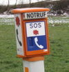
| emergency | phone | Τηλέφωνο | ||||
| emergency | ses_station | |||||
| emergency | siren | Σειρήνα | ||||
| emergency | ||||||
Γεωλογικό
H ετικέτα γεωλογικό χρησιμοποιείται για να περιγράψει το γεωλογικό προφίλ μιας περιοχής. Δείτε τη σελίδα με τίτλο geological για μια εισαγωγή στη χρήση της ετικέτας.
| Κατηγορία | Τιμή | Στοιχείο | Σημείωση | Αναπαράσταση | Φωτογραφία |
|---|---|---|---|---|---|
| geological | moraine | ||||
| geological | outcrop | Εκτεθειμένο γεωλογικό υπέδαφος | |||
| geological | palaeontological_site | Παλαιοντολογική περιοχή | |||
| geological |
This table is a wiki template with a default description in English. Editable here.
Αυτοκινητόδρομος
H ετικέτα αυτοκινητόδρομος χρησιμοποιείται για να περιγράψει δρόμους και πεζοδρόμια. Δείτε τη σελίδα με τίτλο highway για μια εισαγωγή στη χρήση της ετικέτας. Δείτε τη σελίδα με τίτλο restrictions για μια εισαγωγή σχετικά με τον περιορισμό της πρόσβασης των οχημάτων ανάλογα με τον τύπο, την ώρα, την ημέρα, το φορτίο, τον σκοπό, κ.λ.π.
| Κατηγορία | Τιμή | Στοιχείο | Σημείωση | Αναπαράσταση | Φωτογραφία | |
|---|---|---|---|---|---|---|
Roads | ||||||
|
These are the principal tags for the road network. They range from the most to least important. | ||||||
| highway | motorway | Αυτοκινητόδρομος | ||||
| highway | trunk | Λεωφόρος | ||||
| highway | primary | Πρωτεύων Δρόμος, Κύρια Οδός | ||||
| highway | secondary | Δευτερεύων Δρόμος, Δευτερεύουσα Οδός | ||||
| highway | tertiary | Τριτεύων Δρόμος | ||||
| highway | unclassified | Μη κατηγοριοποιημένος Δρόμος | ||||
| highway | residential | Οικιστική Οδός, Αστική οδός, Τοπική οδός | ||||
Link roads | ||||||
| highway | motorway_link | Σύνδεση Αυτοκινητόδρομου | ||||
| highway | trunk_link | Σύνδεση λεωφόρου | ||||
| highway | primary_link | Σύνδεση Πρωτεύοντος | ||||
| highway | secondary_link | Σύνδεση Δευτερεύοντος | ||||
| highway | tertiary_link | Σύνδεση τριτεύοντος | ||||
Special road types | ||||||
| highway | living_street | For living streets, which are residential streets where pedestrians have legal priority over cars, speeds are kept very low and this is can use for narrow roads that usually using for motorcycle roads. | ||||
| highway | service | Δρόμος εξυπηρέτησης, Βοηθητικός δρόμος | ||||
| highway | pedestrian | Πεζόδρομος | ||||
| highway | track | Χωματόδρομος, Καρόδρομος | ||||
| highway | bus_guideway | A busway where the vehicle guided by the way (though not a railway) and is not suitable for other traffic. Please note: this is not a normal bus lane, use access=no, psv=yes instead! | ||||
| highway | escape | Λωρίδα έκτακτης ανάγκης | ||||
| highway | raceway | A course or track for (motor) racing | ||||
| highway | road | Άγνωστος Δρόμος | ||||
| highway | busway | A dedicated roadway for bus rapid transit systems | ||||
Paths | ||||||
| highway | footway | For designated footpaths; i.e., mainly/exclusively for pedestrians. This includes walking tracks and gravel paths. If bicycles are allowed as well, you can indicate this by adding a bicycle=yes tag. Should not be used for paths where the primary or intended usage is unknown. Use highway=pedestrian for pedestrianised roads in shopping or residential areas and highway=track if it is usable by agricultural or similar vehicles. For ramps (sloped paths without steps), combine this tag with incline=*. | ||||
| highway | bridleway | For horse riders. Pedestrians are usually also permitted, cyclists may be permitted depending on local rules/laws. Motor vehicles are forbidden. | ||||
| highway | steps | For flights of steps (stairs) on footways. Use with step_count=* to indicate the number of steps | ||||
| highway | corridor | For a hallway inside of a building. | ||||
| highway | path | A non-specific path. Use highway=footway for paths mainly for walkers, highway=cycleway for one also usable by cyclists, highway=bridleway for ones available to horse riders as well as walkers and highway=track for ones which is passable by agriculture or similar vehicles. | ||||
| highway | via_ferrata | A via ferrata is a route equipped with fixed cables, stemples, ladders, and bridges in order to increase ease and security for climbers. These via ferrata require equipment : climbing harness, shock absorber and two short lengths of rope, but do not require a long rope as for climbing. | ||||
When sidewalk/crosswalk is tagged as a separate way | ||||||
| footway | sidewalk | Sidewalk that runs typically along residential road. Use in combination with highway=footway or highway=path | ||||
| footway | crossing | Διάβαση | ||||
When sidewalk (or pavement) is tagged on the main roadway (see Sidewalks) | ||||||
| sidewalk | both | left | right | no | Specifies that the highways has sidewalks on both sides, on one side or no sidewalk at all | ||||
When cycleway is drawn as its own way (see Bicycle) | ||||||
| highway | cycleway | For designated cycleways. Add foot=*, though it may be avoided if default-access-restrictions do apply. | ||||
Cycleway tagged on the main roadway or lane (see Bicycle) | ||||||
| cycleway | lane | A lane is a route that lies within the roadway | ||||
| cycleway | opposite | Used on ways with oneway=yes where it is legally permitted to cycle in both directions. Used together with oneway:bicycle=no. | ||||
| cycleway | opposite_lane | Used on ways with oneway=yes that have a cycling lane going the opposite direction of normal traffic flow (a "contraflow" lane). Used together with oneway:bicycle=no. | ||||
| cycleway | track | A track provides a route that is separated from traffic. In the United States, this term is often used to refer to bike lanes that are separated from lanes for cars by pavement buffers, bollards, parking lanes, and curbs. Note that a cycle track may alternatively be drawn as a separate way next to the road which is tagged as highway=cycleway. | ||||
| cycleway | opposite_track | Used on ways with oneway=yes that have a cycling track going the opposite direction of normal traffic flow. Used together with oneway:bicycle=no. | ||||
| cycleway | share_busway | There is a bus lane that cyclists are permitted to use. | ||||
| cycleway | opposite_share_busway | Used on ways with oneway=yes that have a bus lane that cyclists are also permitted to use, and which go in the opposite direction to normal traffic flow (a "contraflow" bus lane). Used together with oneway:bicycle=no. | ||||
| cycleway | shared_lane | Cyclists share a lane with motor vehicles, there are markings reminding about this. In some places these markings are known as "sharrows" ('sharing arrows') and this is the tag to use for those. | ||||
| busway | lane | Bus lane on both sides of the road. (See also: Parallel scheme for bus/psv lane tagging lanes:bus=* / lanes:psv=*) | ||||
Street parking tagged on the main roadway (see Street parking) | ||||||
| parking:left / :right / :both (hereafter: parking:side) |
lane | street_side | on_kerb | half_on_kerb | shoulder | no | separate | yes | Primary key to record parking along the street. Desribes the parking position of parked vehicles in the street. | ||||
| parking:sideorientation=* | parallel | diagonal | perpendicular | To specify the orientation of parked vehicles if there is street parking. | ||||
Lifecycle (see also lifecycle prefixes) | ||||||
| highway | proposed | For planned roads, use with proposed=* and a value of the proposed highway value. | ||||
| highway | construction | For roads under construction. Use construction=* to hold the value for the completed road. | different colours | |||
Attributes | ||||||
| abutters | commercial | industrial | mixed | residential | retail etc. | See Key:abutters for more details. | ||||
| bicycle_road | yes | A bicycle road is a road designated for bicycles. If residential streets get the status of bicycle roads, normally, by special signs, motor traffic is admitted with limited speed, often only for residents. | ||||
| bus_bay | both | left | right | A bus bay outside the main carriageway for boarding/alighting | ||||
| change | yes | no | not_right | not_left | only_right | only_left | Specify the allowed/forbidden lane changes | ||||
| destination | <place name of destination> | Destination when following a linear feature | ||||
| embankment | yes | dyke | A dyke or a raised bank to carry a road, railway, or canal across a low-lying or wet area. | ||||
| embedded_rails | yes | <type of railway> | A highway on which non-railway traffic is also allowed has railway tracks embedded in it but the rails are mapped as separate ways. | ||||
| ford | yes | The road crosses through stream or river, vehicles must enter any water. | ||||
| ice_road | yes | A highway is laid upon frozen water basin, definitely doesn't exist in summer. | ||||
| incline | Number % | ° | up | down | Incline steepness as percents ("5%") or degrees ("20°"). Positive/negative values indicate movement upward/downwards in the direction of the way. | ||||
| junction | roundabout | This automatically implies oneway=yes, the oneway direction is defined by the sequential ordering of nodes within the Way. This applies on a way, tagged with highway=* already. | ||||
| lanes | <number> | The number of traffic lanes for general purpose traffic, also for buses and other specific classes of vehicle. | ||||
| lane_markings | yes | no | Specifies if a highway has painted markings to indicate the position of the lanes. | ||||
| lit | yes | no | Street lighting | ||||
| maxspeed | <number> | Specifies the maximum legal speed limit on a road, railway or waterway. | ||||
| motorroad | yes | no | The motorroad tag is used to describe highways that have motorway-like access restrictions but that are not a motorway. | ||||
| mountain_pass | yes | The highest point of a mountain pass. | ||||
| mtb:scale | 0-6 | Applies to highway=path and highway=track. A classification scheme for mtb trails (few inclination and downhill). | ||||
| mtb:scale:uphill | 0-5 | A classification scheme for mtb trails for going uphill if there is significant inclination. | ||||
| mtb:scale:imba | 0-4 | The IMBA Trail Difficulty Rating System shall be used for bikeparks. It is adapted to mtb trails with artificial obstacles. | ||||
| mtb:description | Text | Applies to highway=path and highway=track. A key to input variable infos related to mtbiking on a way with human words | ||||
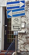
| oneway | yes | no | reversible | Oneway streets are streets where you are only allowed to drive in one direction. | ||||
| oneway:bicycle | yes | no | | Used on ways with oneway=yes where it is legally permitted to cycle in both directions. | ||||
| overtaking | yes | no | caution | both | forward | backward | Specifying sections of roads where overtaking is legally forbidden. Use overtaking:forward=yes/no/caution and overtaking:backward=yes/no/caution when it depends on driving direction. | ||||
| parallel | diagonal | perpendicular | marked | no_parking | no_stopping | fire_lane. | Deprecated variant to map parking along streets. See section on street parking above or the street parking page for more details. | |||||
| free | ticket | disc | residents | customers | private | Deprecated variant to map parking conditions along streets. See section on street parking above or the street parking page for more details. | |||||
| passing_places | yes | A way which has frequent passing places (See also: highway=passing_place) | ||||
| priority | forward | backward | Traffic priority for narrow parts of roads, e.g. narrow bridges. | ||||
| priority_road | designated | yes_unposted | end | Specifying roads signposted as priority roads. | ||||
| sac_scale | hiking | mountain_hiking | demanding_mountain_hiking | alpine_hiking | demanding_alpine_hiking | difficult_alpine_hiking | Applies to highway=path and highway=footway. A classification scheme for hiking trails. | ||||
| service | alley | driveway | parking_aisle etc. | See Key:service for more details. | ||||
| shoulder | no | yes | right | both | left | Presence of shoulder in highway | ||||
| smoothness | excellent | good | intermediate | bad | very_bad | horrible | very_horrible | impassable | Specifies the physical usability of a way for wheeled vehicles due to surface regularity/flatness. See Key:smoothness for more details. | ||||
| surface | paved | unpaved | asphalt | concrete | paving_stones | sett | cobblestone | metal | wood | compacted | fine_gravel | gravel | pebblestone | plastic | grass_paver | grass | dirt | earth | mud | sand | ground | See Key:surface for more details. | ||||
| tactile_paving | yes | no | A paving in the ground to be followed with a blindman's stick. | ||||
| tracktype | grade1 | grade2 | grade3 | grade4 | grade5 | To describe the quality of the surface. See Key:tracktype for more information. | ||||
| traffic_calming | bump | hump | table | island | cushion | yes | etc. | Features used to slow down traffic. See Key:traffic calming for more details. | ||||
| trail_visibility | excellent | good | intermediate | bad | horrible | no | Applies to highway=path, highway=footway, highway=cycleway and highway=bridleway. A classification for hiking trails visibility | ||||
| trailblazed | yes | no | poles | cairns | symbols | Applies to highway=*. Describing trail blazing and marking. See Key:trailblazed for more information. | ||||
| trailblazed:visibility | excellent | good | intermediate | bad | horrible | no | Applies to trailblazed=*. A classification for visibility of trailblazing. See Key:trailblazed:visibility for more information. | ||||
| turn | left | slight_left | through | right | slight_right | merge_to_left | merge_to_right | reverse | The key turn can be used to specify the direction in which a way or a lane will lead. | ||||
| width | <number> | The width of a feature. | ||||
| winter_road | yes | A highway functions during winter, probably can't be driven in summer. | ||||
Other highway features | ||||||
| highway | bus_stop | Στάση λεωφορείου | ||||
| highway | crossing | A.k.a. crosswalk. Pedestrians can cross a street here; e.g., zebra crossing | ||||
| highway | cyclist_waiting_aid | Street furniture for cyclists that are intended to make waiting at esp. traffic lights more comfortable. | ||||
| highway | elevator | Ανελκυστήρας | ||||
| highway | emergency_bay | An area beside a highway where you can safely stop your car in case of breakdown or emergency. | ||||
| highway | emergency_access_point | Σημείο πρόσβασης έκτακτης ανάγκης | ||||
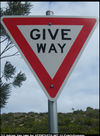
| highway | give_way | Δώσε προτεραιότητα | ||||
| emergency | phone | Τηλεφωνική συσκευή έκτακτης ανάγκης | ||||
| highway | ladder | A vertical or inclined set of steps or rungs intended for climbing or descending of a person with the help of hands. | ||||
| highway | milestone | Highway location marker | ||||
| highway | mini_roundabout | Μικρός κυκλικός κόμβος | ||||
| highway | motorway_junction | Διασταύρωση αυτοκινητόδρομου | ||||
| highway | passing_place | The location of a passing space | ||||
| highway | platform | A platform at a bus stop or station. | ||||
| highway | rest_area | Χώρος ανάπαυσης | ||||
| highway | services | A service station to get food and eat something, often found at motorways | ||||
| highway | speed_camera | Κάμερα ταχύτητας | ||||
| highway | stop | Σήμα στάσης | ||||
| highway | street_lamp | Φανοστάτης | ||||
| highway | toll_gantry | A toll gantry is a gantry suspended over a way, usually a motorway, as part of a system of electronic toll collection. For a toll booth with any kind of barrier or booth see: barrier=toll_booth | ||||
| highway | traffic_mirror | Mirror that reflects the traffic on one road when direct view is blocked. | ||||
| highway | traffic_signals | Φωτεινοί σηματοδότες | ||||
| highway | trailhead | Designated place to start on a trail or route | ||||
| highway | turning_circle | A turning circle is a rounded, widened area usually, but not necessarily, at the end of a road to facilitate easier turning of a vehicle. Also known as a cul de sac. | ||||
| highway | turning_loop | A widened area of a highway with a non-traversable island for turning around, often circular and at the end of a road. | ||||
| highway | User Defined | All commonly used values according to Taginfo | ||||
=== Ιστορικό (historic) ===Χρησιμοποιείται για να περιγράψει διάφορα ιστορικά μέρη. Για παράδειγμα: αρχαιολογικούς χώρους, ναυάγια, ερείπια, κάστρα και αρχαία κτήρια. Δείτε την σελίδα historic για μια εισαγωγή στην χρήση της.
This table is a wiki template with a default description in English. Editable here.
Χρήση γης (landuse)
Χρησιμοποιείται για να περιγράψει την χρήση μιας περιοχής γης. Δείτε την σελίδα landuse για μια εισαγωγή στην χρήση της.
| Κατηγορία | Τιμή | Στοιχείο | Σημείωση | Αναπαράσταση | Φωτογραφία | |
|---|---|---|---|---|---|---|
Common landuse key values - developed land | ||||||
| landuse | commercial | Εμπορική - Κυρίως για περιοχή με κτήρια με γραφεία καθως και την σχετική υποδομή. | ||||
| landuse | construction | Εργοτάξιο - Η ετικέτα πρέπει να αλλάξει όταν η κατασκευή ολοκληρωθεί. | ||||
| landuse | education | An area predominately used for educational purposes/facilities. | ||||
| landuse | fairground | A site where a fair takes place | ||||
| landuse | industrial | Βιομηχανική - Κυρίως εργοστάσια, εργαστήρια ή αποθήκες. | ||||
| landuse | residential | Οικιστική - Κυρίως κατοικίες ή πολυκατοικίες. | ||||
| landuse | retail | Λιανεμποριο - Κυρίως καταστήματα. | ||||
| landuse | institutional | Land used for institutional purposes, see The meaning of this tag is ambiguous and unclear. Consider using another tag that better describes the object. For instance landuse=commercial. See talk page for discussion. |
||||
| Κατηγορία | Τιμή | Στοιχείο | Σημείωση | Αναπαράσταση | Φωτογραφία | |
Common landuse key values - rural and agricultural land | ||||||
| landuse | aquaculture | Warning: currently, there is no convention on the exact meaning of this tag. Therefore, it makes sense to treat it like "boundary of aquaculture" (without implication of water body), which means, water body should be tagged by its own, using natural=water etc. |
||||
| landuse | allotments | Ένα κομμάτι γης που παραχωρείται στους κατοίκους της περιοχής για την καλλιέργεια λαχανικών και λουλουδιών. | ||||
| landuse | farmland | Χωράφια - Μια έκταση που χρησιμοποιείται για καλλιέργειες και βοσκοτόπια (βοσκή ζώων, καλλιέργεια φυτών, λαχανικών, λουλουδιών, φρούτων). | ||||
| landuse | farmyard | Αγρόκτημα, φάρμα - Μια έκταση γης με αγροτικά κτίρια, όπως αγροικίες, κατοικίες, υπόστεγα, στάβλους, αχυρώνες, υπόστεγα εξοπλισμού, αποθήκες ζωοτροφών, κ.λ.π. καθώς και τον ανοιχτό χώρο ανάμεσα τους και τους θάμνους/δέντρα γύρω τους. | ||||
| landuse | paddy | An area of land where the surface and shape of the land is made suitable for growing rice. | ||||
| landuse | animal_keeping | An area of land that is used to keep animals, particularly horses and livestock. | ||||
| landuse | flowerbed | An area designated for flowers | ||||
| landuse | forest | Δάσος | ||||
| landuse | greenhouse_horticulture | Κηπουρική θερμοκηπίων | ||||
| landuse | meadow | Λιβάδι - Μια έκταση γης με βλάστηση κυρίως από γρασίδι και άλλα μη ξυλώδη φυτά,που συνήθως θερίζονται για την παραγωγή σανού. | ||||
| landuse | orchard | Δενδρόκηπος - Σκόπιμη φύτευση δένδρων ή θάμνων που διατηρούνται για την παραγωγή τροφίμων. | ||||
| landuse | plant_nursery | Φυτώριο | ||||
| landuse | vineyard | Αμπελώνας | ||||
| Κατηγορία | Τιμή | Στοιχείο | Σημείωση | Αναπαράσταση | Φωτογραφία | |
Common landuse key values - waterbody | ||||||
| landuse | basin | Λεκανοπέδιο - Μια περιοχή του νερού που στραγγίζει σε ένα ποτάμι. Μαζί με basin=* για τις λεκάνες απορροής ομβρίων / ομβρίων διείσδυσης / κράτησης / κατακράτησης. | ||||
| Δεξαμενή - Αποθηκεύει νερό, μπορεί να είναι στεγασμένη ή υπαίθρια. Για μια σκεπαστή δεξαμενή βλέπε επίσης man_made=reservoir_covered. Δείτε επίσης water=reservoir για εναλλακτικούς χαρακτηρισμούς. | ||||||
| landuse | salt_pond | Αλυκή - Ένα μέρος όπου το θαλασσινό νερό εξατμίζεται για την εξαγωγή του άλατος. | ||||
| Κατηγορία | Τιμή | Στοιχείο | Σημείωση | Αναπαράσταση | Φωτογραφία | |
Other landuse key values | ||||||
| landuse | brownfield | Περιγράφει τη γη που θα χρησιμοποιηθεί για νέα ανάπτυξη, όπου παλιά κτίρια έχουν κατεδαφιστεί και εκκαθαρίζονται. | ||||
| landuse | cemetery | Κοιμητήριο, Νεκροταφείο - Χώρος ενταφιασμού. Μπορείτε να προσθέσετε religion=* (οι τιμές που μπορείτε να καταχωρήσετε είναι στην σελίδα 'place of worship'). Για μικρότερους χώρους(π.χ. με μια εκκλησία κοντά) αντι για landuse=cemetery μπορείτε να χρησιμοποιείσετε amenity=grave_yard. | ||||
| Προστατευόμενη περιοχή (Μη αποδεκτή ετικέτα)- Προτιμήστε να χρησιμοποιήσετε boundary=protected_area, protected_area=*. | ||||||
| landuse | depot | An area used as a depot for e.g. vehicles (trains, buses or trams). Consider using rather standard landuse tags like landuse=railway, landuse=commercial, landuse=industrial, with subtag like industrial=depot. | ||||
| landuse | garages | Για περιοχή με πολλά γκαραζ, ιδιωτικούς χώρους στάθμευσης, συνήθως κοντά στα διαμερίσματα τα οποία εξυπηρετούν. | ||||
| landuse | grass | Γρασίδι. Επίσης δείτε την ετικέτα landuse=meadow. Προσέξτε οτι η συγκεκριμένη ετικέτα δεν αφορά χρήση γης άλλα κάλυψη γης (landcover) και υπάρχει πρόταση να εγκαταλειφθεί. | ||||
| landuse | greenfield | Περιγράφει γη που έχει προγραμματιστεί για νέα ανάπτυξη, όπου δεν υπάρχουν προηγούμενα κτήρια. Μια περιοχή με τέτοια ετικέτα θα μετατραπεί σε ένα εργοτάξιο. |
| |||
| landuse | landfill | Υγειονομικής ταφής | ||||
| landuse | military | Στρατιωτική - Για γη που ανήκει/χρησιμοποιείται από το στρατό για οποιονδήποτε σκοπό. | ||||
| landuse | port | Λιμάνι - Παράκτια βιομηχανική περιοχή, όπου γίνεται χειρισμός εμπορικής κυκλοφορίας. | ||||
| landuse | quarry | Λατομείο | ||||
| landuse | railway | Σιδηροδρομική - Περιοχή για σιδηροδρομική χρήση, γενικά εκτός ορίων για το ευρύ κοινό. | ||||
| landuse | recreation_ground | Χώρος αναψυχής - Ανοικτός χώρος πρασίνου για γενική αναψυχής, ο οποίος μπορεί να περιλαμβάνει γήπεδα, δίχτυα και ούτω καθεξής, συνήθως δημοτικός αλλά ενδεχομένως και σε ιδιωτικά κολέγια ή σε εταιρείες. | ||||
| landuse | religious | An area used for religious purposes | ||||
| landuse | village_green | Ένας χώρος κοινής γης, συνήθως με γρασίδι, στο κέντρο ενός χωριού | ||||
| landuse | winter_sports | An area dedicated to winter sports (e.g. skiing) | ||||
| landuse | user defined | All commonly used values according to Taginfo | ||||
This table is a wiki template with a default description in English. Editable here.
Αναψυχή (leisure)
Χρησιμοποιείται για να επισημάνει εγκαταστάσεις αναψυχής και αθλητικές. Δείτε την σελίδα leisure για μια εισαγωγή στην χρήση της.
| Κατηγορία | Τιμή | Στοιχείο | Σημείωση | Αναπαράσταση | Φωτογραφία |
|---|---|---|---|---|---|
| leisure | adult_gaming_centre | Ένας χώρος με παιχνίδια όπου πληρώνεις για να παίξεις, όπως βιντεοπαιχνίδια, προσομοιωτές οδήγησης, φλιπεράκια, κ.λπ. Με όριο ηλικίας. Σε αντίθεση με το leisure=amusement_arcade. | |||
| leisure | amusement_arcade | Ένας χώρος με παιχνίδια όπου πληρώνεις για να παίξεις, όπως βιντεοπαιχνίδια, προσομοιωτές οδήγησης, φλιπεράκια, κ.λπ. Χωρίς ένα καθορισμένο όριο ηλικίας. Σε αντίθεση με το leisure=adult_gaming_centre. | |||
| leisure | bandstand | Μια ανοιχτή εγκατάσταση όπου μουσικά συγκροτήματα μπορόυν να εκτελέσουν συναυλίες. | |||
| leisure | bathing_place | Public place where you can freely bath in nature. | |||
| leisure | beach_resort | Oργανωμένη παραλία | |||
| leisure | bird_hide | Παρατηρητήριο πουλιών | |||
| leisure | bleachers | Raised, tiered rows of benches found at spectator events | |||
| leisure | bowling_alley | A facility that is equipped to play the game of bowling. | |||
| leisure | common | A common land (deprecated). | |||
| leisure | dance | Χορός - Ένα μέρος για να πας για χορό. | |||
| leisure | disc_golf_course | Disc golf course | |||
| leisure | dog_park | Πάρκο σκύλων - Χώρος, με ή χωρίς περίφραξη, όπου οι ιδιοκτήτες σκύλων επιτρέπεται να ασκούν τα κατοικίδιά τους χωρίς να τα περιορίζουν με λουρί. | |||
| leisure | escape_game | A physical adventure game in which players solve a series of puzzles using clues, hints and strategy to complete the objectives at hand. | |||
| leisure | firepit | ||||
| leisure | fishing | Ψάρεμα | |||
| leisure | fitness_centre | A place with exercise machines and/or fitness/dance classes. | |||
| leisure | fitness_station | A place with exercise machines, single or collection of, outdoor. | |||
| leisure | garden | Κήπος - Τόπος με λουλούδια και άλλα φυτά που καλλιεργούνται σε ένα διακοσμητικό και δομημένο τρόπο ή για επιστημονικούς σκοπούς. | |||
| leisure | golf_course | Γήπεδο γκολφ | |||
| leisure | hackerspace | Χάκερσπεις - Ένας τόπος όπου άνθρωποι με κοινά ενδιαφέροντα, συχνά για τους ηλεκτρονικούς υπολογιστές, την τεχνολογία, την επιστήμη, την ψηφιακή τέχνη ή την ηλεκτρονική τέχνη, μπορούν να συναντηθούν, να κοινωνικοποιηθούν και/ή να συνεργαστούν. | |||
| leisure | horse_riding | A facility where people practise horse riding, usually in their spare time, e.g. a riding centre. For a riding arena use leisure=pitch + sport=equestrian. | |||
| leisure | ice_rink | Παγοδρόμιο - Ένα μέρος όπου μπορείτε να κάνετε πατινάζ ή να παίξετε χόκεϊ επί πάγου. | |||
| leisure | marina | Μαρίνα - Για ελλιμενισμό σκαφών αναψυχής και σκαφών αναψυχής με κινητήρα. | |||
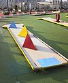
| leisure | miniature_golf | Μίνι γκολφ | |||
| leisure | nature_reserve | Προστατευόμενος βιότοπος - Προστατευόμενη φυσική περιοχή μεγάλης σημασίας για την ενδημική χλωρίδα και την πανίδα ή με ιδιαίτερο γεωλογικό ή άλλο ενδιαφέρον. | |||
| leisure | outdoor_seating | Areas for outdoor gastronomy. | |||
| leisure | park | Πάρκο - Ανοιχτός χώρος πρασίνου για αναψυχή, συνήθως δημοτικός. | |||
| leisure | picnic_table | A picnic table | |||
| leisure | pitch | Γήπεδο - Ειδικός χώρος για αθλήματα όπως ποδόσφαιρο, μπάσκετ, βόλεϋ, τένις και πατινάζ. Για να περιγραφεί το είδος του αθλήματος χρησιμοποιήστε sport=*. | |||
| leisure | playground | Παιδική χαρά - Χώρος για να παίζουν τα μικρά παιδιά. | |||
| leisure | resort | A place used for relaxation or recreation, attracting visitors for vacations, tourism and/or going swimming in a pool and/or a nearby body of water. | |||
| leisure | sauna | A small room or house designed to experience dry or wet heat sessions, or an establishment with one or more of these and auxiliary facilities. | |||
| leisure | slipway | Γλίστρα, Νεωλκείο | |||
| leisure | sports_centre | Αθλητικό κέντρο - Μια ξεχωριστή εγκατάσταση όπου μια σειρά από αθλήματα λαμβάνουν χώρα μέσα σε ένα κλειστό χώρο. Για να περιγραφεί το είδος του αθλήματος χρησιμοποιήστε sport=*. | |||
| leisure | sports_hall | A sufficiently large single room that is suitable for practising sports indoors and does not have a "centre" character. | |||
| leisure | stadium | Στάδιο - Ένας μεγάλος αθλητικός στίβος με πολλαπλά κλιμακωτά καθίσματα. | |||
| leisure | summer_camp | Θερινή παιδική κατασκήνωση - Η καλοκαιρινή κατασκήνωση είναι ένα πρόγραμμα υπό επίβλεψη για παιδιά ή εφήβους που πραγματοποιείται κατά τους θερινούς μήνες σε ορισμένες χώρες. | |||
| leisure | swimming_area | Περιοχή κολύμβησης - περιοχή σε ποτάμι, λίμνη ή άλλη δεξαμενή νερού όπου το κολύμπι επιτρέπεται. | |||
| leisure | swimming_pool | Πισίνα κολύμβησης | |||
| leisure | tanning_salon | Place where customers can use UV lamps to tan their skin. | |||
| leisure | track | Ειδική διαδρομή π.χ. για τρέξιμο, για αγωνιστικά ποδήλατα, για λαγωνικά ή για άλογα. | |||
| leisure | trampoline_park | An leisure facility consisting of many interlinked trampolines | |||
| leisure | water_park | Περιοχή ψυχαγωγίας με νεροτσουλήθρες, πισίνες αναψυχής και αποδυτήρια. | |||
| leisure | wildlife_hide | Παρατηρητήριο άγριας ζωής. Δείτε επίσης την ετικέτα leisure=bird_hide. | |||
| leisure | user defined | All commonly used values according to Taginfo |
This table is a wiki template with a default description in English. Editable here.
Ανθρώπινη κατασκευή (man_made)
Μια ετικέτα για τον χαρακτηρισμό τεχνητών κατασκευών που προστίθενται στο τοπίο. Δείτε τη σελίδα με τίτλο man_made για μια εισαγωγή στη χρήση της ετικέτας.
| Κατηγορία | Τιμή | Στοιχείο | Σημείωση | Αναπαράσταση | Φωτογραφία |
|---|---|---|---|---|---|
| man_made | adit | Είσοδος ορυχείου - Ένας τύπος εισόδου σε ένα υπόγειο ορυχείο που είναι οριζόντια ή σχεδόν οριζόντια. | |||
| man_made | advertising | A generic advertising device. | |||
| man_made | antenna | An antenna to transmit and/or receive wireless signals. | |||
| man_made | avalanche_protection | A feature to protect from avalanches or to keep them from going off. | |||
| man_made | beacon | Φρυκτωρία - Συνήθως ιστορική κατασκευή για την αποστολή σινιάλων με φωτιά. Για φάρους χρησιμοποιήστε το man_made=lighthouse. | |||
| man_made | beehive | Beehive | |||
| man_made | borehole | A bore used for a purpose not covered by man_made=petroleum_well or man_made=water_well. | |||
| man_made | breakwater | Κυματοθραύστης - Προστατεύει μια ακτή ή λιμάνι από τη θάλασσα ή τα κύματα. | |||
| man_made | bridge | Γέφυρα - Δηλώνει το περίγραμμα μιας γέφυρας και συγκεντρώνει όλα τα χαρακτηριστικά της. Συνδυάστε το με layer=*. Επίσης προσθέστε man_made=bridge και layer=* σε όλους τους δρόμους που περνάνε πάνω απο την γέφυρα. | |||
| man_made | bunker_silo | Κατασκευή ανοιχτής όψης για την αποθήκευση πραγμάτων. Μπορεί να χρησιμοποιηθεί με οχήματα για να γεμίσει και να αδειάσει. | |||
| man_made | cairn | A mound of stones, usually conical or pyramidal, raised as a landmark or to designate a point of importance in surveying. | |||
| man_made | carpet_hanger | A construction to hang carpets for cleaning with the help of carpet beaters. | |||
| man_made | cellar_entrance | An entrance into artificially created vault. | |||
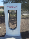
| man_made | charge_point | A device for charging electric vehicles. | |||
| man_made | chiller | industrial cooling construction with large diameter fans | |||
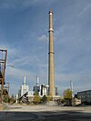
| man_made | chimney | Καμινάδα | |||
| man_made | clarifier | A clarifier of a wastewater treatment plant. | |||
| man_made | clearcut | Αποψιλωμένη περιοχή - Περιοχή όπου τα περισσότερα ή όλα τα δέντρα είναι κομμένα ομοιόμορφα. Χρησιμοποιείται σε συνδυασμό με natural=shrub. | |||
| man_made | column | A column used to support a structure or for decoration. | |||
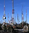
| man_made | communications_tower | Πύργος τηλεπικοινωνιών, πύργος κεραιών | |||
| man_made | [[ Too many Data Items entities accessed. | compass_rose ]] | A compass rose or wind rose. | |||
| man_made | compressor | Industrial equipment used to compress a gas by reducing its volume. | |||
| man_made | cooling | Industrial cooling facility. | |||
| man_made | cooling_tower | A cooling tower | |||
| man_made | courtyard | An area that is usually enclosed by walls or buildings. | |||
| man_made | crane | Γερανός - Ένας στάσιμος, μόνιμος γερανός, όπως εκείνοι σε αποβάθρες. | |||
| man_made | cross | Σταυρός - Σταυρός με μικρή ιστορική ή θρησκευτική αξία, π.χ. σταυρός σε κορυφή. | |||
| man_made | cutline | Αντιπυρική ζώνη - Χρησιμοποιείται για να σηματοδοτήσει γραμμή περικοπής σε δάση. | |||
| man_made | dolphin | A marine structure for berthing and mooring of vessels. | |||
| man_made | dovecote | A place where doves are farmed or stored. | |||
| man_made | dyke | Ανάχωμα - Αντιπλημμυρικό ανάχωμα που χτίστηκε για να περιορίσει τη ροή του νερού ή άλλων υγρών. | |||
| man_made | embankment | Επίχωμα - Μια υπερυψωμένη όχθη που φέρει έναν δρόμο, σιδηρόδρομο, ή ένα κανάλι πάνω απο μια χαμηλού υψομέτρου ή υγρή περιοχή. | |||
| man_made | flagpole | Ιστός σημαίας - Ένα μακρύ κοντάρι που έχει κατασκευαστεί για να κρατήσει τη σημαία. | |||
| man_made | flare | A tower constructed to burn off excess gas. | |||
| man_made | footwear_decontamination | A facility to decontaminate footwear for hikers. | |||
| man_made | frost_fan | A device to stop frosts from damaging crops. | |||
| man_made | fuel_pump | A fuel pump (petrol pump, gas pump) | |||
| man_made | gantry | An overhead structure across a major road usually for holding signs, often variable-message signs. | |||
| man_made | gas_well | A natural gas well | |||
| man_made | gasometer | Αεριοφυλάκιο - Μεγάλο δοχείο αποθήκευσης αερίων. | |||
| man_made | geoglyph | A large design or motif (generally longer than 4 metres) produced on the ground | |||
| man_made | goods_conveyor | A conveyor system for transporting materials | |||
| man_made | groyne | Κυματοθραύστης, λιμενοβραχίονας, πρόβολος | |||
| man_made | guard_stone | A guard stone: a stone built onto or into the corner of a building or wall to prevent carriages from damaging the structure, often found on either side of an entrance to a laneway, or alongside a wall to protect it. | |||
| man_made | guy_wire | Guy wire designed to add stability to a freestanding structure. | |||
| man_made | heap | A large pile of material | |||
| man_made | hongsalmun | A gate for entering a sacred place in Korea. The gate indicates entry to a sacred realm. | |||
| man_made | iljumun | The first gate at the entrance to many Korean Buddhist temples | |||
| man_made | insect_hotel | A structure intended to provide shelter for insects. | |||
| man_made | kiln | Καμίνι, φούρνος, κλίβανος | |||
| man_made | lighthouse | Φάρος | |||
| man_made | manhole | Hole with a cover that allows access to an underground service location, just large enough for a human to climb through. | |||
| man_made | mast | Ιστός κεραίας - Mια κάθετη κατασκευή που χτίστηκε για να κρατήσει για παράδειγμα κεραίες. | |||
| man_made | maypole | A tall wooden pole erected as a part of various European folk traditions to celebrate the beginning of summer. | |||
| man_made | milk_churn_stand | A current or former collection point for milk churns. | |||
| man_made | mineshaft | Σήραγγα/φρεάτιο ορυχείου - Μια κάθετη σήραγγα. | |||
| man_made | monitoring_station | Σταθμός καταγραφής | |||
| man_made | nesting_site | A man made nesting aid that is mounted on a support device. | |||
| man_made | obelisk | Tall, narrow, four-sided, tapered monument which usually ends in a pyramid-like shape at the top. | |||
| man_made | observatory | Παρατηρητήριο | |||
| man_made | offshore_platform | Υπεράκτια Εξέδρα | |||
| man_made | oil_gas_separator | Industrial equipment used to separate liquid and gaseous components (oil and gas) produced from a petroleum well. | |||
| man_made | oxidation_ditch | An oxidation ditch of a wastewater treatment plant. | |||
| man_made | paifang | A traditional style of Chinese architectural arch or gateway structure. | |||
| man_made | petroleum_well | Πετρελαιοπηγή | |||
| man_made | pier | Αποβάθρα, προβλήτα, μόλος - Μια προεξοχή στη θάλασσα, συνήθως για αναψυχή. | |||
| man_made | pipeline | Αγωγός, Σωλήνωση για τη μεταφορά διαφόρων υγρών, όπως νερό, φυσικό αέριο, αποχέτευση. | |||
| man_made | planter | A structure for planting flowers or other ornamental plants. | |||
| man_made | pump | A device in charge of moving or raising the level of liquids. | |||
| A pumping rig for producing oil. Use of this tag is discouraged. See man_made=petroleum_well instead. | |||||
| man_made | pumping_station | Pumping station: a facility including pumps and equipment for pumping fluids from one place to another | |||
| man_made | quay | A man-made structure alongside navigable water used for loading and unloading vessels. | |||
| man_made | reservoir_covered | Καλυμμένη Δεξαμενή, Καλυμμένος Ταμιευτήρας | |||
| man_made | satellite_dish | A dish-shaped parabolic antenna designed to receive or transmit radio waves to or from a satellite | |||
| man_made | silo | Σιλό - Εμπορευματοκιβώτιο για την αποθήκευση χύμα υλικών, συχνά δημητριακών όπως σιτάρι ή καλαμπόκι. | |||
| man_made | snow_fence | ||||
| man_made | spoil_heap | Spoil heap, piles of waste rock removed during mining. | |||
| man_made | spring_box | A structure designed for protecting and catching groundwater from a natural spring. | |||
| man_made | storage_tank | Δεξαμενή Αποθήκευσης, Ταμιευτήρας | |||
| man_made | street_cabinet | Εξωτερικό ερμάριο - Π.χ. Υπαίθριος Κατανεμητής (ΚΑΦΑΟ). Όλα τα είδη ντουλαπιών που φιλοξενούν εξοπλισμό για τη λειτουργία διαφορετικών ειδών εγκαταστάσεων. Μπορεί να τα βρείτε όχι μόνο στο δρόμο, αλλά παντού. | |||
| man_made | stupa | A Buddhist dome-shaped structure with a spire on top | |||
| man_made | surveillance | Παρακολούθηση - Για να σηματοδοτήσει χώρους και κτήρια που ελέγχονται από δημόσιες ή ιδιωτικές κάμερες. | |||
| man_made | survey_point | Σημείο επισκόπησης - Tριγωνομετρικό σημείο, γεωδαιτικό σημείο. | |||
| man_made | tailings_pond | Tailings pond: A body of liquid or slurry used to store byproducts of mining operations | |||
| man_made | telescope | Τηλεσκόπιο | |||
| man_made | torii | The gate structure found at the entrance of Shinto shrines and (rarely) Japanese Buddhist temples. | |||
| man_made | tower | Πύργος - Μια ψηλή και συχνά λεπτή κατασκευή, π.χ. πύργος τηλεπικοινωνιών. Παρακαλούμε προσθέστε και το είδος με tower:type=* εαν είναι δυνατόν. | |||
| man_made | threshing_floor | An open air paved area created to thresh the grain harvest and then winnow it. | |||
| man_made | utility_pole | A single pole supporting elevation of any of various and unspecified public utilities, such as power transmission, lighting or telephony. | |||
| man_made | ventilation_shaft | A vertical space in mines, tunnels, or buildings allowing stale air to leave the space underneath and/or fresh air to enter it. | |||
| man_made | video_wall | A digital screen, typically constructed out of smaller LED panels. | |||
| man_made | wastewater_plant | Εγκατάσταση Επεξεργασίας Λυμάτων | |||
| man_made | water_tap | Βρύση νερού - Μια τεχνητή κατασκευή που παρέχει πρόσβαση σε νερό και (συνήθως) είναι εξοπλισμένη με βαλβίδα. | |||
| man_made | water_tower | Πύργος Υδατοδεξαμενής - Ένας πύργος για την αποθήκευση νερού, βρίσκεται συνήθως σε λόφους ή δίπλα σε μια πόλη. | |||
| man_made | water_well | Πηγάδι νερού - Μια ανασκαφή ή δομή που δημιουργήθηκε στο έδαφος σκάβοντας, τη διάνοιξη οπών ή γεώτρησης για την πρόσβαση στον υπόγειο υδροφόρο ορίζοντα. | |||
| man_made | water_works | ||||
| man_made | watermill | Μύλος/υδρόμυλος | |||
| man_made | wildlife_crossing | Structure that allow animals to cross human barriers safely. | |||
| man_made | windmill | Ανεμόμυλος - Ανεμόμυλος, ως επί το πλείστον αρχαίος και εκτός λειτουργίας. Δείτε το power=generator σε συνδυασμό με generator:source=wind για τις σύγχρονες ανεμογεννήτριες. | |||
| man_made | windpump | A device that pumps natural gas or water using the wind, typically mass produced. | |||
| man_made | works | Εργοστάσιο | |||
| man_made | yes | General tag for man-made (artificial) structures. | |||
| man_made | user defined | All commonly used values according to Taginfo |
This table is a wiki template with a default description in English. Editable here.
Military
This is used for facilities and on land used by the military. These may include the Navy, Army, Air Force and Marines. See the page titled Military for an introduction on its usage.
This table is a wiki template with a default description in English. Editable here.
Φυσικό (natural)
Xρησιμοποιείται για να περιγράψει τα φυσικά χαρακτηριστικά της γης. Αυτά περιλαμβάνουν επίσης τα χαρακτηριστικά που έχουν τροποποιηθεί από τον άνθρωπο. Δείτε την σελίδα natural για μια εισαγωγή στην χρήση της.
| Κατηγορία | Τιμή | Στοιχείο | Σημείωση | Tag Usage[1] | Αναπαράσταση | Φωτογραφία |
|---|---|---|---|---|---|---|
Βλάστηση ή σχετικό με επιφάνεια | ||||||
| natural | fell | Βιότοπος πάνω από τη γραμμή δέντρων σε αλπικές και υποπολικές περιοχές, που καλύπτεται κυρίως με ακαλλιέργητο γρασίδι, χαμηλούς θάμνους και βρύα και μερικές φορές χρησιμοποιείται για βοσκή. | No, see #545. | |||
| natural | grassland | Λιβάδι - Όπου η βλάστηση κυριαρχείται από χόρτα (Poaceae) και άλλα ποώδη (μη ξυλώδη) φυτά, εκτός από διακοσμητικό γρασίδι (δείτε landuse=grass), κούρεμα για σανό (δείτε landuse=meadow). | ||||
| natural | heath | Θαμνότοπος χαμηλός - Γυμνή, ακαλλιέργητη έκταση με χαμηλούς θάμνους και μικρή ή καθόλου κάλυψη απο δέντρα. | ||||
| natural | moor | Μην το χρησιμοποιείτε. Τύπος οικοτόπου, σε εύκρατα λιβάδια, σαβάνες, και θαμνώδεις εκτάσεις σε ορεινές περιοχές, που χαρακτηρίζεται από χαμηλή ανάπτυξη της βλάστησης σε όξινο έδαφος. Επειδή ο όρος είναι γενικός, χρησιμοποιείστε κάποιον άλλον. | currently not rendered by OSM Carto | |||
| natural | scrub | Θαμνότοπος - Ακαλλιέργητη γη που καλύπτεται από μεγάλους θάμνους ή υπανάπτυκτα δέντρα. | ||||
| natural | shrubbery | An area of shrubbery that is actively maintained or pruned by humans. A slightly wilder look is also possible | currently not rendered by OSM Carto | |||
| natural | tree | Δέντρο - Μόνα ή δέντρα που ξεχωρίζουν. | ||||
| natural | tree_row | Δεντροστοιχία - Σειρά δέντρων. | ||||
| natural | tree_stump | A tree stump, the remains of a cut down or broken tree. | ||||
| natural | tundra | Habitat above tree line in alpine and subpolar regions, principally covered with uncultivated grass, low growing shrubs and mosses and sometimes grazed. | ||||
| natural | wood | Δάσος - Δασική έκταση όπου η παραγωγή ξυλείας δεν είναι η κυρίαρχη χρήση (εάν είναι, χρησιμοποιείστε landuse=forest). Υπάρχουν πάντως και εναλλακτικοί τρόποι για προσθήκη ετικετών σε δάση, δείτε την σελίδα https://wiki.openstreetmap.org/wiki/Forest. | ||||
Σχετικό με νερό | ||||||
| natural | bay | Κόλπος, Όρμος - Ένα μεγάλο σώμα νερού που περικλείεται εν μέρει από γη, αλλά με ένα ευρύ στόμιο. | ||||
| natural | beach | Παραλία - Μια επίπεδη περιοχή άμμου, χαλικιού ή βότσαλου δίπλα στο νερό. | ||||
| natural | blowhole | An opening to a sea cave which has grown landwards resulting in blasts of water from the opening due to the wave action | ||||
| natural | cape | A piece of elevated land sticking out into the sea or large lake. Includes capes, heads, headlands and (water) promontories. | ||||
| natural | coastline | Ακτογραμμή | ||||
| natural | crevasse | A large crack in a glacier | ||||
| natural | geyser | A spring characterized by intermittent discharge of water ejected turbulently and accompanied by steam. | ||||
| natural | glacier | Παγετώνας - Περιοχές (ή κορυφές) που καλύπτονται με πάγο όλον τον χρόνο. | ||||
| natural | hot_spring | A spring of geothermally heated groundwater | ||||
| natural | isthmus | A narrow strip of land, bordered by water on both sides and connecting two larger land masses. | ||||
| natural | mud | Λάσπη - Ετικέτα χωρίς τεκμηρίωση - Δείτε το natural=wetland και την υπο-ετικέτα wetland=*. | ||||
| natural | peninsula | A piece of land projecting into water from a larger land mass, nearly surrounded by water | ||||
| natural | reef | A feature (rock, sandbar, coral, etc) lying beneath the surface of the water | ||||
| natural | shingle | Βότσαλα - Μια συσσώρευση αποσαθρωμένων απο το νερό βράχων, συνήθως βότσαλα και χαλίκια, αλλά μερικές φορές μεγαλύτερα. | ||||
| natural | shoal | An area of the sea floor near the sea surface (literally, becomes shallow) and exposed at low tide. See natural=sand as well. | ||||
| natural | spring | Πηγή - Ένα μέρος όπου το νερό ρέει με φυσικό τρόπο από το έδαφος. | ||||
| natural | strait | A narrow area of water surrounded by land on two sides and by water on two other sides. | ||||
| natural | water | Νερό - Λίμνες κ.λπ. | ||||
| natural | wetland | Υγρότοπος, Έλος | ||||
Σχετικό με μορφή γης | ||||||
| natural | arch | A rock arch naturally formed by erosion, with an opening underneath. | currently not rendered by OSM Carto | |||
| natural | arete | |||||
| natural | bare_rock | Βράχος γυμνός - Μια περιοχή με αραιή ή καθόλου βλάστηση, έτσι ώστε ο βράχος να είναι ορατός. | ||||
| natural | natural=blockfield | A surface covered with boulders or block-sized rocks, usually the result of volcanic activity or associated with alpine and subpolar climates and ice ages. | ||||
| natural | cave_entrance | Είσοδος σπηλαίου | ||||
| natural | cliff | Γκρεμός | ||||
| natural | dune | A hill of sand formed by wind, covered with no or very little vegetation. See also natural=sand and natural=beach | currently not rendered by OSM Carto | |||
| natural | earth_bank | Large erosion gully or steep earth bank | ||||
| natural | fumarole | A fumarole is an opening in a planet's crust, which emits steam and gases | ||||
| natural | gully | Small scale cut in relief created by water erosion | ||||
| natural | hill | A hill. | currently not rendered by OSM Carto | |||
| natural | peak | Κορυφή - Κορυφή ενός λόφου ή βουνού. | ||||
| natural | ridge | Κορυφογραμμή, ύβωμα | ||||
| natural | rock | Βράχος | currently not rendered by OSM Carto | |||
| natural | saddle | |||||
| natural | sand | Άμμος - Κάλυψη του εδάφους ως επί το πλείστον με σωματίδια πυριτίου, χωρίς καθόλου ή με πολύ αραιή βλάστηση. Δείτε επίσης natural=beach. | ||||
| natural | scree | Σάρα, Πλευρικά κορήματα, Κολλούβιο - Μη ενοποιημένα πετρώματα με γωνίες, τα οποία σχηματίζονται από πτώση βράχων και αποσάθρωση γειτονικών βράχων. | ||||
| natural | sinkhole | Καταβόθρα | currently not rendered by OSM Carto | |||
| natural | stone | Ογκόλιθος | currently not rendered by OSM Carto | |||
| natural | valley | Κοιλάδα | currently not rendered by OSM Carto | |||
| natural | volcano | Ηφαίστειο | ||||
| natural | user defined | All commonly used values according to Taginfo | ||||
This table is a wiki template with a default description in English. Editable here.
Γραφείο (office)
Ένα γραφείο είναι ένας τόπος όπου εκτελείται διοικητική ή επαγγελματική εργασία. Δείτε τη σελίδα με τίτλο office για μια εισαγωγή στη χρήση της ετικέτας.
| Κατηγορία | Τιμή | Στοιχείο | Σημείωση | Αναπαράσταση | Φωτογραφία |
|---|---|---|---|---|---|
| office | accountant | Λογιστικό | |||
| office | advertising_agency | Διαφημιστικό | |||
| office | architect | Αρχιτεκτονικό | |||
| office | association | Ένα γραφείο ενός μη κερδοσκοπικού οργανισμού ή ομάδας, π.χ. μαθητική, αθλητική, καταναλωτική, αυτοκινητιστική, ποδηλατική, συνεταιριστική κ.λπ. | |||
| office | charity | An office of a charitable organization. | |||
| office | company | Εταιρείας | |||
| office | consulting | An office for a consulting firm, providing expert professional advice to other companies or organisations. | |||
| office | cooperative | An office of a cooperative (an autonomous association of persons or organizations). | |||
| office | coworking | Coworking is a style of work that involves a shared working environment, often an office, and independent activity. | |||
| office | diplomatic | An embassy, diplomatic mission, consulate or liaison office of a foreign government or parastatal entity in a host country. | |||
| office | educational_institution | Εκπαιδευτικό ίδρυμα | |||
| office | employment_agency | Εύρεσης εργασίας | |||
| office | engineer | An office of an engineer. | |||
| office | energy_supplier | An office of a energy supplier. | |||
| office | estate_agent | Κτηματομεσιτικό | |||
| office | financial | An office of a company in the financial sector. | |||
| office | forestry | Δασοκομίας | |||
| office | foundation | Ιδρύματος | |||
| office | geodesist | An office of a person who does land surveys. | |||
| office | government | Κυβερνητικό | |||
| office | graphic_design | An office for a graphic designer. | |||
| office | guide | Ένα γραφείο για ξεναγούς, οδηγούς βουνού, οδηγοί κατάδυσης, κ.λπ. | |||
| See healthcare=* for healthcare facilities, office=insurance or office=company for a healthcare company. | |||||
| office | insurance | Ασφαλιστικό | |||
| office | it | ' | |||
| office | lawyer | Δικηγορικό | |||
| office | logistics | An office of a forwarder or hauler. | |||
| office | moving_company | An office of a moving service or relocation company. | |||
| office | newspaper | Εφημερίδας | |||
| office | ngo | ΜΚΟ - Μη Κυβερνητική Οργάνωση | |||
| office | notary | Συμβολαιογραφείο. Δείτε office=lawyer παραπάνω. | |||
| See office=religion below. | |||||
| office | political_party | Πολιτικού κόμματος | |||
| office | private_investigator | Ιδιωτικού ερευνητή | |||
| office | property_management | Office of a company which manages a real estate property. | |||
| office | publisher | An office of a company which publishes books or music. | |||
| office | quango | Ημι-αυτόνομης μη-κυβερνητικής οργάνωσης | |||
real_estate_agent |
Use office=estate_agent instead. | ||||
| office | religion | Θρησκευτικό, για παράδειγμα γραφείο ενορίας. Χρησιμοποιείστε επίσης religion=* και denomination=*. | |||
| office | research | Ερευνητικό | |||
| office | security | An office for private security guards. | |||
| office | surveyor | An office of a person who does surveys. The surveys can be for land, for risk and damage evaluations of properties and equipment, or opinion surveys or statistics. | |||
| Εφορίας. Φορολογικές αρχές και εφορία. Πιθανό αντίγραφο του office=government. | |||||
| office | tax_advisor | Φοροτεχνικό | |||
| office | telecommunication | Τηλεπικοινωνιών | |||
| office | translator | An office of a translator | |||
| office | travel_agent | Ταξιδιωτικό πρακτορείο | |||
| office | union | An office of a trade union, an association of workers forming a bargaining unit. | |||
| office | visa | An office of an organisation offering visa assistance | |||
| office | water_utility | Υπηρεσίας ύδρευσης | |||
| office | yes | Generic tag for unspecified office type. | |||
| office | user defined | All commonly used values according to Taginfo |
This table is a wiki template with a default description in English. Editable here.
Place
This is used mainly to give details about settlements. See the page titled Places for an introduction on its usage.
Administratively declared places
This table is a wiki template with a default description in English. Editable here.
Populated settlements, urban
This table is a wiki template with a default description in English. Editable here.
Populated settlements, urban and rural
This table is a wiki template with a default description in English. Editable here.
Other places
This table is a wiki template with a default description in English. Editable here.
Additional attributes
This table is a wiki template with a default description in English. Editable here.
Power
These are used to map electrical power generation and distributions systems. See Power for an introduction on its usage.
This table is a wiki template with a default description in English. Editable here.
Public transport
This is used for features related to public transport. For example: railway stations, bus stops and services. See the page titled Public transport for an introduction on its usage.
This table is a wiki template with a default description in English. Editable here.
Railway
- Main article: Railways
This tag includes all kinds of railways ranging from heavily used mainline railways to an abandoned rail line.
| Key | Value | Element | Comment | Rendering carto | Photo | |
|---|---|---|---|---|---|---|
Tracks | ||||||
| railway | abandoned | The course of a former railway which has been abandoned and the track removed. The course is still recognized through embankments, cuttings, tree rows, bridges, tunnels, remaining track ties, building shapes and rolling or straight ways. For demolished rails that are no longer identifiable, e.g. that have been built over, some use the highly questionable railway=razed. | ||||
| railway | construction | Railway under construction. | ||||
| railway | disused | A section of railway which is no longer used but where the track and infrastructure remains in place. The track is likely overgrown with endemic vegetation, but could be brought back into useful service with only minor effort. | ||||
| railway | funicular | Cable driven inclined railways on a steep slope, with a pair of cars connected by one cable | ||||
| railway | light_rail | A higher-standard tram system, normally in its own right-of-way. Often it connects towns and thus reaches a considerable length (tens of kilometres). | ||||
| railway | miniature | Miniature railways are narrower than narrow gauge and carry passengers, frequently at an exact scale of "standard-sized" rail (for example "1/4 scale"). They can often be found in parks. | ||||
| railway | monorail | A railway with only a single rail. A monorail can run above the rail like in Las Vegas and Disneyland or can suspend below the rail like the Wuppertal Schwebebahn (Germany). | ||||
| railway | narrow_gauge | Narrow-gauge passenger or freight train tracks. Narrow gauge railways can have mainline railway service like the Rhaetian Railway in Switzerland or can be a small light industrial railway. Use gauge=* to specify the actual width of rails in mm. | ||||
| This is the old tag for historic trains. Use railway:preserved=yes for historical railway instead. | ||||||
| railway | rail | Full sized passenger or freight train tracks in the standard gauge for the country or state. | ||||
| railway | subway | A city passenger rail service running mostly grade separated (see Wikipedia:rapid transit). Often a significant portion of the line or its system/network is underground. | ||||
| railway | tram | One or two carriage rail vehicle tracks, usually sharing motor road, sometimes called "street running" (Other languages). | ||||
Additional track features or attributes | ||||||
| bridge | yes | If the railway goes over a street, waterway or other railway on an elevated structure. | ||||
| cutting | yes | A section where the railway is significantly lower than ground level, but not underground. | ||||
| electrified | contact_line rail yes no |
contact_line: a power line over the train head rail: a third rail near the track supplying the train with power yes: electrified track, but no details available no: track with no power supply. |
||||
| embankment | yes | A section where the railway is raised significantly higher than ground level. | ||||
| embedded_rails | yes/<type of railway> | Specifies that a highway on which non-railway traffic is also allowed has railway tracks embedded in it but the rails are mapped as separate ways. | ||||
| frequency | number [Hz] | The frequency with which a line is electrified. Use 0 for DC. Also see the voltage tag. | ||||
| railway:track_ref | number | Track number | ||||
| service | crossover | Relatively short lengths of track which switch traffic from one parallel line to another | ||||
| service | siding | Relatively short lengths of track, running parallel to (and connected to) a main route | ||||
| service | spur | Relatively short lengths of track, built to give one company or entity access to a main or branch line. | ||||
| service | yard | Tracks within railway company operated marshalling or maintenance yards. | ||||
| tunnel | yes | If the railway goes below ground. Most subways have this tag. | ||||
| tracks | number | Number of parallel tracks in close proximity when mapped as one single way representing all tracks. If not given means unknown and defaults to 1. In many parts of the world the tracks are being drawn out separately so that there is more detail, in which case this tag isn't used. | ||||
| usage | main branch industrial military tourism scientific test |
main line: heavy traffic branch line: connecting places with a mainline industrial: servicing large plants (iron, chemical etc.), surface mining, … military: servicing military area tourism: most mountain rails (rack-rails, funicular) and preserved railways scientific: rail transport at spaceports, large array telescopes, etc. test: track for testing new wheels, rails, tracks and rail technologies. |
||||
| voltage | number | The voltage with which a line is electrified. Also see the frequency tag. | ||||
Stations and stops | ||||||
| railway | halt | A small station without switches | ||||
| public_transport | stop_position | The position on the railway track where the train (its centre) stops at a platform. This is useful for routing on long platforms where also short trains stop and on long platforms where multiple trains stop behind each other. See also public_transport=stop_area. | ||||
| public_transport | platform | This is parallel to the rail line for showing where the actual platforms are. It is also to know where you can change platform and enter the station, so use footpaths to connect them. This is really useful for routing too. Use only if the platform is served by public transport. | ||||
| railway | platform | This is parallel to the rail line for showing where the actual platforms are. It is also to know where you can change platform and enter the station, so use footpaths to connect them. This is really useful for routing too. Use in addition to public_transport=platform. | ||||
| public_transport | station | Railway passenger-only station. | ||||
| railway | station | Railway passenger and/or cargo station. Use in addition to public_transport=station. | ||||
| railway | subway_entrance | The entrance to a subway station, usually going from surface to underground. | ||||
| railway | tram_stop | A tram stop is a place where a passenger can embark / disembark a tram. | ||||
Other railways | ||||||
| railway | buffer_stop | Stops the train at the end of a track. See buffer stop. | ||||
| railway | derail | A device used to prevent fouling of a rail track by unauthorized movements of trains or unattended rolling stock. See Derail (railroad). | ||||
| railway | crossing | A point where pedestrians may cross. | ||||
| railway | level_crossing | A point where rails and roads cross. | ||||
| railway | tram_level_crossing | A point where trams and roads cross. | ||||
| railway | signal | Any kind of railway signal. | ||||
| railway | switch | Full connections between railways (aka 'points'). | ||||
| railway | railway_crossing | Crossing rails with no interconnection. | ||||
| landuse | railway | Ground used around railways and railway-stations. | 
|
|||
| railway | turntable | These are used for changing the direction that part of a train is pointing in. | ||||
| railway | roundhouse | A semicircular building with many stalls for servicing engines. | ||||
| railway | traverser | These are used for changing trains between railways. Also known as transfer table. | ||||
| railway | wash | A railroad carriage/car wash | ||||
| railway | water_crane | A structure to deliver water to steam locomotives | ||||
| railway | ventilation_shaft | A structure that allows ventilation in underground tunnels | ||||
| railway | user defined | All commonly used values according to Taginfo | ||||
This table is a wiki template with a default description in English. Editable here.
Route
- Main article: relation:route
This is used to describe routes of all different kinds.
| Key | Value | Element | Comment | Rendering | Photo |
|---|---|---|---|---|---|
| route | bicycle | Cycle routes or bicycles route are named, numbered or otherwise signed. May go along roads, trails or dedicated cycle paths | |||
| route | bus | The route a public bus service takes. See Buses. | |||
| route | canoe | Signed route for canoeing through a waterway. | |||
| route | detour | Route for fixed detour routes. Examples are Bedarfsumleitung in Germany and uitwijkroute in the Netherlands | 
| ||
| route | ferry | The route a ferry takes from terminal to terminal Please make sure to add at least one node per tile (zoom level 12), better at least one every few km, so offline editors catch it with bbox requests. | |||
| route | foot | Walking Route - is used for routes which are walkable without any limitations regarding fitness, equipment or weather conditions. | |||
| route | hiking | Hiking explains how to tag hiking routes. | |||
| route | horse | Riding routes | |||
| route | inline_skates | Inline has more information on the subject. | |||
| route | light_rail | Route of a light rail line. | |||
| route | mtb | Mountain biking explains how to tag mtb routes. | |||
| route | [[ Too many Data Items entities accessed. | piste ]] | Route of a piste (e.g., snowshoe or XC-Ski trails) in a winter sport area. | |||
| route | railway | A sequence of railway ways, often named (e.g., Channel Tunnel). See Railways. | |||
| route | road | Can be used to map various road routes/long roads. | |||
| route | running | For running (jogging) routes. | |||
| route | ski | For ski tracks (e.g., XC-Ski Trails User:Langläufer/Loipemap). | |||
| route | subway | Route of a metro service | |||
| route | train | Train services (e.g., London-Paris Eurostar) See Railways. | |||
| route | tracks | Railroad track as rail infrastructure. | |||
| route | tram | See Trams for more information on tagging tram services. | |||
| route | trolleybus | The route of a trolleybus service. | |||
| route | User defined | All commonly used values according to Taginfo. |
This table is a wiki template with a default description in English. Editable here.
|
This page represents the status as of 2015 and is out of date. To add missing translations, go to Template:Map Features:shop/doc, copy missing parameters, paste into your language template and complete translations (the link to edit is at the bottom of the table). |
Κατάστημα
Η ετικέτα κατάστημα χρησιμοποιείται για τόπο επιχείρησης που είναι εφοδιασμένος με αγαθά προς πώληση. Δείτε τη σελίδα με τίτλο Shop για μια εισαγωγή στη χρήση της ετικέτας.
| Κατηγορία | Τιμή | Σημείωση | Αναπαράσταση | Φωτογραφία | ||
|---|---|---|---|---|---|---|
Τρόφιμα, Ροφήματα | ||||||
| shop | alcohol | Κάβα ποτών | ||||
| shop | bakery | Φούρνος | ||||
| shop | beverages | Παλιά ετικέτα για κατάστημα πώλησης (όχι για κατανάλωση στο κατάστημα) κυρίως αλκοολούχων και μη ροφήματων.
Παραπλήσιες ετικέτεςː
Δείτε και τις συζητήσεις στις σελίδες για τις αντίστοιχες αγγλικές ετικέτες. |
||||
| shop | brewing_supplies | Shop focused on selling supplies for home brewing of beer, wine and spirits (where permitted). | ||||
| shop | butcher | Κρεοπωλείο | ||||
| shop | cheese | Τυροπωλείο - Μαγαζί που πουλάει κυρίως τυριά | ||||
| shop | chocolate | Σοκολάτα - Μαγαζί που πουλάει κυριώς σοκολάτες και είδη φτιαγμένα απο σοκολάτα (*όχι* γενικό ζαχαροπλαστείο) | ||||
| shop | coffee | Καφεκοπτείο - Μαγαζί που πουλάει κυριώς καφέ αλεσμένο ή σε σπόρους (και ίσως να έχει και μερικά τραπεζάκια και να τον πουλάει ως ρόφημα). | ||||
| shop | confectionery | Ζαχαροπλαστείο, αρτοζαχαροπλαστείο | ||||
| shop | convenience | Παντοπωλείο, Ψιλικατζίδικο - Μαγαζί που πουλάει πράγματα που θα έβρισκες σε ένα σούπερ-μάρκετ άλλα έχει μικρή ποικιλία και λιγότερα προϊόντα | ||||
| shop | dairy | Γαλακτοπωλείο - Μαγαζί που πουλάει κυρίως γαλακτοκομικά προϊόντα (τυριά, γιαούρτια, γάλα, κτλ) | ||||
| shop | deli | Ντελικατέσεν/Εκλεκτά τρόφιμα - Μαγαζί που πουλάει κυρίως εκλεκτά τρόφιμα και πιθανώς επίσης εκλεκτό κρασί. | ||||
| shop | farm | Αγρόκτημα - Μαγαζί ή καντίνα στον δρόμο με φρέσκα αγροτικά προϊόντα *αποκλειστικά ενός* αγρού/παραγωγού ~ *όχι* μανάβικο που πουλάει προϊόντα απο πολλούς παραγωγούς | ||||
| shop | food | Shop focused on selling food, more specific value should be used if possible.
shop=food + food=prepared_meals was also proposed/used for type of shop selling prepared meals, not ready for eating immediately (and requiring for example heating/boiling or other simple preparation). |
||||
| shop | frozen_food | Shop focused on selling frozen food. | ||||
| shop | greengrocer | Μανάβικο/Οπωροπωλείο/Οπωρολαχανοπωλείο - Μαγαζί που πουλάει κυρίως λαχανικά και φρούτα | ||||
| shop | health_food | A health food shop; selling wholefoods, vitamins, nutrition supplements and meat and dairy alternatives. | ||||
| shop | ice_cream | Shop selling ice cream. See also amenity=ice_cream. | ||||
| shop | nuts | Shop selling dried nuts/fruits, edible seeds, etc. Not to be confused with shop=spices. | ||||
| shop | pasta | Ζυμαρικών | ||||
| shop | pastry | Γλυκά ψημένα - Γλυκά ψημένα, όπως μπισκότα, κέικ και πίτες. Δες επίσης το ζαχαροπλαστείο/αρτοζαχαροπλαστείο shop=confectionery, το οποίο θεωρείται πιο γενική περιγραφή | ||||
| shop | seafood | Ψαράδικο/Ιχθυοπωλείο | ||||
| shop | spices | Shop focused on selling spices. | ||||
| shop | tea | Τεϊοπωλείο - Μαγαζί που πουλάει κυρίως τσάι | ||||
| shop | water | Shop focused on selling drinking water. | ||||
| shop | wine | H ετικέτα αυτή προτείνεται να μην χρησιμοποιείται πια. Για κάβα κρασιών χρησιμοποιείστε μαζί τις ετικέτες shop=alcohol και alcohol=wine. Δείτε και τις συζητήσεις στις σελίδες για τις αντίστοιχες αγγλικές ετικέτες. | ||||
Πολυκατάστημα, Εμπορικό κέντρο | ||||||
| shop | department_store | Πολυκατάστημα | ||||
| shop | general | A store that carries a general line of merchandise. (see also shop=convenience if it sells food). | ||||
| shop | kiosk | Περίπτερο | ||||
| shop | mall | Εμπορικό Κέντρο | ||||
| shop | supermarket | Υπεραγορά Τροφίμων, Σούπερ μάρκετ | ||||
| shop | wholesale | Wholesale/warehouse club or cash and carry – a store that sells items in bulk to retailers. The branch of industry can be defined with wholesale=*. | ||||
Ένδυση | ||||||
| shop | baby_goods | Βρεφικά είδη - Κατάστημα που πουλάει κυρίως βρεφικά είδη | ||||
| shop | bag | Τσάντες και βαλίτσες - Κατάστημα που πουλάει κυρίως τσάντες και βαλίτσες | ||||
| shop | boutique | Μπουτίκ | ||||
| shop | clothes | Ρούχα, Ένδυση - Κατάστημα που πουλάει κυρίως ρούχα | ||||
| shop | fabric | Υφάσματα - Κατάστημα που πουλάει κυρίως υφάσματα | ||||
| shop | fashion_accessories | Shop focused on selling fashion accessories. | ||||
| shop | jewelry | Κοσμηματοπωλείο - Κατάστημα που πουλάει κυρίως κοσμήματα | ||||
| shop | leather | Δερμάτινα είδη - Κατάστημα που πουλάει κυρίως δερμάτινα είδη | ||||
| shop | sewing | A shop that sells sewing supplies (fabric, thread, yarn, knitting needles, sewing machines, etc.) | ||||
| shop | shoes | Παπούτσια - Κατάστημα που πουλάει κυρίως παπούτσια | ||||
| shop | shoe_repair | Shop focused on repairing shoes. | ||||
| shop | tailor | Ράφτης | ||||
| shop | watches | Ρολόγια - Κατάστημα που πουλάει κυρίως ρολόγια | ||||
| shop | wool | Shop selling wool for making of clothes or other products. | ||||
Εκπτωτικά | ||||||
| shop | charity | Φιλανθρωπικό κατάστημα | ||||
| shop | second_hand | Μεταχειρισμένα είδη | ||||
| shop | variety_store | Κατάστημα του 1 ευρώ | ||||
Ομορφιά | ||||||
| shop | beauty | Βάψιμο νυχιών ή σαλόνι μαυρίσματος ή σπα | ||||
| shop | chemist | |||||
| shop | cosmetics | Καλλυντικά - Κατάστημα που πουλάει κυρίως καλλυντικά | ||||
| shop | erotic | Ερωτικά είδη | ||||
| shop | hairdresser | Κομμωτήριο | ||||
| shop | hairdresser_supply | A shop, where you can buy hairdressing supplies. | ||||
| shop | hearing_aids | Βοηθήματα ακοής - Κατάστημα που πουλάει κυρίως βοηθήματα ακοής | ||||
| shop | herbalist | Μπαχαροπωλείο, βότανα - Κατάστημα που πουλάει κυρίως μπαχαρικά και βότανα | ||||
| shop | massage | Μασάζ | ||||
| shop | medical_supply | Ορθοπεδικά - Κατάστημα που πουλάει κυρίως ορθοπεδικά είδη | ||||
| shop | nutrition_supplements | Συμπληρώματα διατροφής - Κατάστημα που πουλάει κυρίως συμπληρώματα διατροφής | ||||
| shop | optician | Οπτικά - Κατάστημα που πουλάει κυρίως οπτικά | ||||
| shop | perfumery | Αρωματοπωλείο - Κατάστημα που πουλάει κυρίως αρώματα | ||||
| shop | tattoo | Τατουάζ | ||||
Ιδιοκατασκευές | ||||||
| shop | agrarian | Shop focused on selling agrarian products, like seeds, agricultural machinery, animal feed, etc. | ||||
| shop | appliance | Shop focused on selling large electrical items (aka white goods) washing machines, fridges, cookers, ovens, fans, etc. | ||||
| shop | bathroom_furnishing | Είδη υγιεινής & έπιπλα μπάνιου | ||||
| shop | country_store | Shop focused on selling rural supplies – a range of goods specifically aimed at country dwellers | ||||
| shop | doityourself | Κατάστημα ιδιοκατασκευών, Φτιάξτο μόνος σου | ||||
| shop | electrical | Ηλεκτρολογικά είδη και συσκευές | ||||
| shop | energy | |||||
| shop | fireplace | Shop focused on selling electric fireplaces, stoves or masonry heaters and required fuels | ||||
| shop | florist | Ανθοπωλείο - Κατάστημα πώλησης μπουκέτων, λουλουδιών και γλαστρών. Δείτε και την σελίδα της παραπλήσιας ετικέτας shop=garden_centre | ||||
| shop | garden_centre | Είδη κήπου - Κατάστημα πώλησης ειδών κήπου | ||||
| shop | garden_furniture | Έπιπλα κήπου | ||||
| shop | gas | Αέριο | ||||
| shop | glaziery | Τζάμια | ||||
| shop | groundskeeping | Shop focused on selling outdoor groundskeeping equipment (lawnmowers, chainsaws, small tractors, ... | ||||
| shop | hardware | Κατάστημα τεχνικού εξοπλισμου, Σιδηροπωλείο | ||||
| shop | houseware | Είδη σπιτιού, οικιακά είδη | ||||
| shop | locksmith | Κλειδαράς | ||||
| shop | paint | Χρωματοπωλείο | ||||
| shop | pottery | Shop focused on selling earthenware, stoneware and porcelain and other ceramic ware. | ||||
| shop | security | Shop focused on selling security items like burglar alarms, vaults, locking systems, video surveillance cameras, firefighting equipment, alarm systems, warning systems, etc. | ||||
| shop | tool_hire | Shop hiring out tools | ||||
| shop | trade | Εμπόριο | ||||
Εσωτερική διακόσμηση | ||||||
| shop | antiques | Αντίκες, παλαιοπωλείο | ||||
| shop | bed | Κρεβάτια | ||||
| shop | candles | Κεριά | ||||
| shop | carpet | Χαλιά | ||||
| shop | curtain | Κουρτίνες | ||||
| shop | doors | Shop focused on selling doors | ||||
| shop | flooring | Shop focused on selling floorings | ||||
| shop | furniture | Έπιπλα | ||||
| shop | household_linen | Shop focused on selling household linen. | ||||
| shop | interior_decoration | Εσωτερική διακόσμηση | ||||
| shop | kitchen | Κουζίνα | ||||
| shop | lighting | A shop selling lighting fixtures and lamps. | ||||
| shop | tiles | Shop focused on selling tiles. | ||||
| shop | window_blind | |||||
Ηλεκτρονικές συσκευές | ||||||
| shop | computer | Υπολογιστές | ||||
| shop | electronics | |||||
| shop | hifi | |||||
| shop | mobile_phone | Κινητά τηλέφωνα | ||||
| shop | printer_ink | A shop that sells or refills printer ink cartridges. | ||||
| shop | radiotechnics | Ηλεκτρονικά εξαρτήματα | ||||
| shop | telecommunication | Shop selling internet, television or similar services, and related hardware. | ||||
| shop | vacuum_cleaner | Ηλεκτρικές σκούπες | ||||
Ύπαιθρος | ||||||
| shop | atv | Shop focused on selling |
||||
| shop | bicycle | Ποδηλατάδικο - Μαγαζί πώλησης/επιδιόρθωσης ποδηλάτων | ||||
| shop | boat | Shop focused on selling boats, boat equipment and may rent or repair them | ||||
| shop | car | Εμπορία Αυτοκινήτων | ||||
| shop | car_parts | Ανταλλακτικά αυτοκινήτων - Μαγαζί πώλησης ανταλλακτικών αυτοκινήτων | ||||
| shop | car_repair | Επισκευή αυτοκινήτων | ||||
| shop | caravan | A shop for caravans, motorhomes & similar recreational vehicles. | ||||
| shop | fishing | Ψάρεμα | ||||
| shop | fuel | Shop selling fuels (motor fuel, wood, coal, gas) that can't be considered a amenity=fuel (fuel station). Use fuel:*=yes/no to indicate which fuels are available. | ||||
| shop | golf | Shop focused on selling golf equipment. | ||||
| shop | hunting | Κυνήγι | ||||
| shop | military_surplus | Shop selling used military equipment | ||||
| shop | motorcycle | Εμπόριο Μοτοσυκλετών/Αντιπροσωπεία Μοτοσυκλετών Μαγαζί πώλησης μοτοσυκλετών | ||||
| shop | motorcycle_repair | Μαγαζί επιδιόρθωσης μοτοσυκλετών | ||||
| shop | outdoor | Υπαίθριος εξοπλισμός | ||||
| shop | scuba_diving | Κατάδυση | ||||
| shop | ski | Shop focused on selling skis, ski equipment and may rent or repair them | ||||
| shop | snowmobile | Shop focused on selling snowmobiles, snowmobile equipment and may rent or repair them | ||||
| shop | sports | Άθληση | ||||
| shop | surf | Shop selling surfboards, sailboards, wakeboards, and other types of surf style boards. and/or related accessories, clothes, parts, repair and rental services. | ||||
| shop | swimming_pool | Πισίνας εξοπλισμός | ||||
| shop | trailer | Shop focused on selling trailers and parts and/or repairing / renting them | ||||
| shop | truck | Shop focused on selling trucks and other commercial vehicles | ||||
| shop | tyres | Ελαστικά | ||||
Τέχνη | ||||||
| shop | art | Έργα τέχνης | ||||
| shop | camera | A shop mainly selling cameras and lenses | ||||
| shop | collector | A shop for different collector's items like stamps, coins, action figures, etc. | ||||
| shop | craft | |||||
| shop | frame | Κορνίζες | ||||
| shop | games | Επιτραπέζια παιχνίδια | ||||
| shop | model | Μοντέλα κλίμακας και υλικά | ||||
| shop | music | Μουσική | ||||
| shop | musical_instrument | Μουσικά όργανα | ||||
| shop | photo | Φωτογραφείο | ||||
| shop | trophy | Τρόπαια | ||||
| shop | video | Βιντεο κλαμπ | ||||
| shop | video_games | Βιντεοπαιχνίδια | ||||
Χαρτικά | ||||||
| shop | anime | |||||
| shop | books | Βιβλιοπωλείο | ||||
| shop | gift | Δώρα | ||||
| shop | lottery | A shop of which the main or only purpose is the sale of lottery tickets. | ||||
| shop | newsagent | Πρατήριο Τύπου | ||||
| shop | stationery | Χαρτοπωλείο | ||||
| shop | ticket | Πώληση εισιτηρίων | ||||
Άλλα | ||||||
| shop | bookmaker | A shop that takes bets on sporting and other events at agreed upon odds. | ||||
| shop | cannabis | a shop primarily and legally selling non-medical cannabis products | ||||
| shop | copyshop | Φωτοτυπίες | ||||
| shop | dry_cleaning | Στεγνοκαθαριστήριο | ||||
| shop | e-cigarette | Ηλεκτρονικό τσιγάρο | ||||
| shop | funeral_directors | Γραφείο Τελετών | ||||
| shop | laundry | Πλυντήριο | ||||
| shop | money_lender | |||||
| shop | outpost | Shop primarily used to pick-up items ordered online. | ||||
| shop | party | A shop for party and festival supplies, like costumes, etc. | ||||
| shop | pawnbroker | |||||
| shop | pest_control | Shop selling pest control goods to exterminate rats, insects etc. | ||||
| shop | pet | Κατάστημα Κατοικίδιων | ||||
| shop | pet_grooming | A shop offering grooming services for pets (most frequently dogs) | ||||
| shop | pyrotechnics | Πυροτεχνήματα | ||||
| shop | religion | Θρησκευτικά είδη | ||||
| shop | rental | Shop that rents different kinds of vehicles or (sport) equipment | ||||
| shop | storage_rental | Ενοικίαση αποθηκευτικού χώρου | ||||
| shop | tobacco | Καπνός | ||||
| shop | toys | Παιχνίδια | ||||
| shop | travel_agency | Ταξιδιωτικό γραφείο | ||||
| shop | vacant | Κλειστό κατάστημα | ||||
| shop | weapons | |||||
| shop | A shop of unspecified type – it is always better to use another value that gives info about shop type, if possible. Used also as indicator that feature such as fuel station has a shop. | |||||
| shop | ||||||
This table is a wiki template with a default description in English. Editable here.
Sport
This is used to provide information about which sports are placed on a facility such as a pitch or stadium. It is intended to be used in conjunction with tags landuse=* or leisure=*. See the page titled Sport for an introduction on its usage.
This table is a wiki template with a default description in English. Editable here.
Τουρισμός (tourism)
Χρησιμοποιείται για να χαρτογραφήσει τοποθεσίες και πράγματα που παρουσιάζουν ειδικό ενδιαφέρον για τους τουρίστες. Για παράδειγμα, αυτά μπορεί να είναι αξιοθέατα, μέρη για διαμονή και τόποι και πράγματα που παρέχουν υποστήριξη. Δείτε τη σελίδα με τίτλο tourism για μια εισαγωγή στη χρήση της ετικέτας.
| Τιμή | Στοιχείο | Σημείωση | Αναπαράσταση | Φωτογραφία |
|---|---|---|---|---|
| alpine_hut | Αλπική καλύβα, Kαταφύγιο βουνού - Είναι ένα απομακρυσμένο κτήριο στα βουνά σχεδιασμένο για να παρέχει διευκολύνσεις για διαμονή σε ορειβάτες και πεζοπόρους. Η πρόσβαση συνήθως είναι δυνατή με τα πόδια, με ποδήλατο βουνού ή σκι. Συνήθως, λειτουργούν από έναν Ορειβατικό Σύλλογο ή μια παρόμοια οργάνωση. | |||
| apartment | Διαμέρισμα - Αναφέρεται σε διαμέρισμα διακοπών το οποίο είναι ένας χώρος που μπορεί να ενοικιαστεί για σκοπούς διακοπών. Δεν προσφέρει υπηρεσίες, όπως δεξιώσεις, μπαρ ή πρωινό όπως ένα ξενοδοχείο ή ξενώνας, αν και, κατά κανόνα το διαμέρισμα περιλαμβάνει εγκαταστάσεις μαγειρέματος. Αυτή η ετικέτα μπορεί να χρησιμοποιηθεί για κτήριο που περιλαμβάνει ένα ή περισσότερα διαμερίσματα διακοπών. Έχει ομοιότητες με την ετικέτα tourism=chalet, τα οποία συνήθως συναντώνται ως μονά σπίτια σε βουνά, ενώ τα τουριστικά διαμερίσματα συνήθως βρίσκονται σε χωριά και σε κτήρια με πολλά διαμερίσματα. | |||
| aquarium | An aquarium, meant as |
|||
| artwork | Έργο τέχνης - Xρησιμοποιείται για να επισημάνει δημόσια έργα τέχνης. Συνήθως, αυτά είναι σε εξωτερικούς χώρους. | |||
| attraction | Αξιοθέατο - Συνήθως χρησιμοποιείται για αξιοθέατα φυσικής ή ιστορικής σημασίας. Αυτή η ετικέτα χρησιμοποιείται συχνά σε συνδυασμό με άλλες ετικέτες όπως historic=*, building=*, amenity=*. | |||
| camp_pitch | camp pitch is the free space used to place a tent or or caravan within a tourism=camp_site or tourism=caravan_site area. | |||
| camp_site | Χώρος κατασκήνωσης, Κάμπινγκ - Περιοχή όπου οι άνθρωποι μπορούν να χρησιμοποιήσουν προσωρινά καταφύγια, όπως σκηνές ή ένα τροχόσπιτα. | |||
| caravan_site | Πάρκο τροχόσπιτων - Περιοχή όπου άνθρωποι με τροχόσπιτα μπορούν να μείνουν για μια νύχτα ή και περισσότερο. Συνήθως παρέχουν εγκαταστάσεις, όπως τουαλέτες, απόρριψη αποβλήτων, υδροδότηση, παροχή ηλεκτρικού ρεύματος κ.λπ. | |||
| chalet | Σαλέ, Αλπική έπαυλη - μία ή περισσότερες κατοικίες χωρίς εγκαταστάσεις για μαγείρεμα και / ή μπάνιο και τουαλέτα. Δεν πρέπει να συγχέεται με τον Ελβετικό όρο για έναν τύπο ξύλινου σπιτιού (σε αυτή την περίπτωση χρησιμοποιείστε building=cabin. | |||
| gallery | Πινακοθήκη, γκαλερί - Περιοχή ή συνήθως κτίριο όπου πραγματοποιούνται εικαστικές εκθέσεις. Τα πιο συνηθισμένα εκθέματα είναι πίνακες ζωγραφικής, σύγχρονη τέχνη ή φωτογραφία. Η ετικέτα δεν πρέπει να συγχέεται με το tourism=museum. | |||
| guest_house | Ξενώνας - Παρέχει καταλύματα διαμονής χωρίς άδεια ξενοδοχείου και συνήθως διαχειρίζεται απο τον ιδιοκτήτη του. Προσφέρει συνήθως ιδιωτικά δωμάτια με πρωινό που σερβίρεται, αλλά το προσωπικό δεν είναι διαθέσιμο όλο το εικοσιτετράωρο. Οι ξενώνες μπορεί να είναι ειδικά κτισμένοι ξενώνες εώς οικογενειακά σπίτια που διαθέτουν κάποια δωμάτια και συχνά αναφέρονται ως bed and breakfast. | |||
| hostel | Ξενώνας, Χόστελ - Παρέχουν καταλύματα με φθηνή διαμονή, συνήθως με κοινά μπάνια, κουζίνα και σαλόνι ή/και υπνοδωμάτια. | |||
| hotel | Ξενοδοχείο | |||
| information | πληροφορίες | |||
| motel | Πανδοχείο, Mοτέλ | |||
| museum | Μουσείο | |||
| picnic_site | Χώρος πικ νικ, Χώρος εκδρομής | |||
| theme_park | Θεματικό πάρκο, Πάρκο ψυχαγωγίας | |||
| trail_riding_station | A Trail Riding Station offers temporary accommodation for guest horses and usually also for riders. | |||
| viewpoint | Σημείο θέασης | |||
| wilderness_hut | ' | |||
| zoo | Ζωολογικός κήπος | |||
| yes | - | |||
| user defined | All commonly used values according to Taginfo |
This table is a wiki template with a default description in English. Editable here.
Waterway
This is used to described different types of waterways. When mapping the way of a river, stream, drain, canal, etc. these need to be aligned in the direction of the water flow. See the page titled Waterways for an introduction on its usage.
Natural watercourses
This table is a wiki template with a default description in English. Editable here.
Man-made waterways
This table is a wiki template with a default description in English. Editable here.
Facilities
This table is a wiki template with a default description in English. Editable here.
Barriers on waterways
This table is a wiki template with a default description in English. Editable here.
Other features on waterways
This table is a wiki template with a default description in English. Editable here.
Επιπρόσθετες ιδιότητες
Addresses
This is used to provide postal information for a building or facility. See the pages titled Addresses and addr=* for an introduction on its usage.
| Key | Value | Element | Comment | Rendering | Photo | |
|---|---|---|---|---|---|---|
Tags for individual houses | ||||||
| addr:housenumber | user defined | The house number (may contain letters, dashes or other characters). Addresses describes ways to tag a single building with multiple addresses. Please do not only tag addr:housenumber=*, but also add at least addr:street=* or addr:place=* for places without streets (or map the belonging to a street with a relation using associatedStreet relation or street relation.) |
|
|||
| addr:housename | user defined | The name of a house. This is sometimes used in some countries like England, Spain, Portugal, Latvia instead of (or in addition to) a house number. |
||||
| addr:flats | user defined | The unit numbers (a range or a list) of the flats or apartments located behind a single entrance door. | 
|

| ||
| addr:conscriptionnumber | user defined | This special kind of housenumber relates to a settlement instead of a street. Conscription numbers were introduced in the Austro-Hungarian Empire and are still in use in some parts of Europe, sometimes together with street-related housenumbers which are also called orientation numbers. | ||||
| addr:street | user defined | The name of the respective street. If the street name is very long or nonexistent, the ref of the respective street. A way with highway=* or a square with place=square and the corresponding name should be found nearby. The belonging to a street can alternatively be represented by a associatedStreet relation or street relation. The keys addr:housenumber=* and addr:street=* in principle are the only necessary ones if there are valid border polygons. If you are not sure if it is so, just add addr:city=*, addr:postcode=* and addr:country=*. |
||||
| addr:place | user defined | This is part of an address which refers to the name of some territorial zone (usually a place=* like island, square or very small village) instead of a street (highway=*). Should not be used together with addr:street=*. | ||||
| addr:postcode | user defined | The postal code of the building/area. Some mappers prefer to rely on boundary=postal_code | ||||
| addr:city | user defined | The name of the city as given in postal addresses of the building/area. (In some places the city in the address corresponds to the post office that serves the area rather than the actual city, if any, in which the building is located.) Some mappers assume it can be derived from a boundary=administrative relation. | ||||
| addr:country | user defined | The ISO 3166-1 alpha-2 two letter country code in upper case. Example: "DE" for Germany, "CH" for Switzerland, "AT" for Austria, "FR" for France, "IT" for Italy. Caveat: The ISO 3166-1 code for Great Britain is "GB" and not "UK". More or less favoured in different national communities. |
||||
| addr:postbox | user defined | Use this for addressing postal service Post Office Box (PO Box, BP - Boîte Postale, CP - Case Postale, Поштански преградак, Поштански фах, Поштански претинац) as alternative to addressing using street names. Example: "PO Box 34" | ||||
| addr:full | user defined | Use this for a full-text, often multi-line, address if you find the structured address fields unsuitable for denoting the address of this particular location. Examples: "Fifth house on the left after the village oak, Smalltown, Smallcountry", or addresses using special delivery names or codes (possibly via an unrelated city name and post code), or PO Boxes. Beware that these strings can hardly be parsed by software: "1200 West Sunset Boulevard Suite 110A" is still better represented as addr:housenumber=1200 + addr:street=West Sunset Boulevard + addr:unit=110A. |
||||
For countries using hamlet, subdistrict, district, province, state, county | ||||||
| addr:hamlet | user defined | The hamlet of the object. In France, some addresses use hamlets instead of street names. | ||||
| addr:suburb | user defined | If an address exists several times in a city. You have to add the name of the settlement. See Australian definition of suburb. | ||||
| addr:subdistrict | user defined | The subdistrict of the object. | ||||
| addr:district | user defined | The district of the object. | ||||
| addr:province | user defined | The province of the object. For Canada, uppercase two-letter postal abbreviations (BC, AB, ON, QC, etc.) are used. In Russia a synonym {{{key:addr:region}}} is widely used | ||||
| addr:state | user defined | The state of the object. For the US, uppercase two-letter postal abbreviations (AK, CA, HI, NY, TX, WY, etc.) are used. | ||||
| addr:county | user defined | The county of the object. | ||||
Tags for interpolation ways | ||||||
| addr:interpolation | all/even/odd/ alphabetic | How to interpolate the house numbers belonging to the way along the respective street. See detailed description. |
||||
| addr:interpolation | Number n | Every nth house between the end nodes is represented by the interpolation way. | ||||
| addr:inclusion | actual/estimate/potential | Optional tag to indicate the accuracy level of survey used to create the address interpolation way. See detailed description. |
||||
Annotations
Providing further information about tag values for other mappers and in some cases also for users. See the page titled Annotations for an introduction on its usage.
This table is a wiki template with a default description in English. Editable here.
Name
The name=* tag is the primary tag used for mapping the name of an element. See the page titled Names for an introduction on its usage.
| Key | Value | Element | Comment |
|---|---|---|---|
| name | User defined | The common default name. Notes:
| |
| name:<xx> | User defined | Name in different language; e.g., name:fr=Londres. Note that all key variants below can use a language suffix. See: Multilingual names. | |
| name:left[:<xx>], name:right[:<xx>] | User defined | Used when a way has different names for different sides (e.g., a street that's forming the boundary between two municipalities). | |
| int_name[:<xx>] | User defined | International name. Consider using language specific names instead; e.g., name:en=.... International does not (necessarily) mean English. It is used to give the name transliterated to Latin script in Belarus, Bulgaria, Greece, Kazakhstan and Northern Macedonia | |
| loc_name[:<xx>] | User defined | Local name. | |
| nat_name[:<xx>] | User defined | National name. | |
| official_name[:<xx>] | User defined | Official name. Useful where there is some elaborate official name, while a different one is a common name typically used. Example: official_name=Principat d'Andorra (where "name" is name=Andorra). | |
| old_name[:<xx>] | User defined | Historical/old name, still in some use. | |
| ref_name[:<xx>] | User defined | Unique, human-readable name of this object in an external data management system. | |
| reg_name[:<xx>] | User defined | Regional name. | |
| short_name[:<xx>] | User defined | Should be a recognizable commonly-used short version of the name, not a nickname (use alt_name for that), useful for searching (recognized by Nominatim). | |
| sorting_name[:<xx>] | User defined | Name, used for correct sorting of names — This is only needed when sorting names cannot be based only on their orthography (using the Unicode Collation Algorithm with collation tables tailored by language and script, or when sorted lists of names are including names written in multiple languages and/or scripts) but requires ignoring some parts such as:
all of them being ignored at the primary sort level and not easily inferable by a preprocessing algorithm. | |
| alt_name[:<xx>] | User defined | Alternative name by which the feature is known. If there is a name that does not fit in any of the above keys, alt_name can be used; e.g., name=Field Fare Road and alt_name=Fieldfare Road, or name=University Centre and alt_name=Grad Pad. In rare cases, the key is used for multiple semicolon-separated names; e.g. alt_name=name1;name2;name3, but this usage is not preferred. | |
| nickname[:<xx>] | User defined | Nickname (e.g. "Warschauer Allee" for BAB 2 in Germany 3140168 | |
| Do not use this tag, suffixed name tagging for multiple values is deprecated. |
This table is a wiki template with a default description in English. Editable here.
Properties
This is used to give additional information of a general nature about another element.
| Key | Value | Element | Comment | Photo |
|---|---|---|---|---|
| area | yes | Means a feature that is normally linear is an area. You should not add this to features that are already defined as an area type. | ||
| brand | user defined | Brand of the feature. | ||
| bridge | yes / aqueduct / viaduct / cantilever / movable / covered / … | A bridge, use together with the tag layer=*. Value yes is generic, or you can specialize. | ||
| capacity | amount | Used for specifying capacity of a facility. | ||
| charge | amount | Used for specifying how much is charged for use/access to a facility. See toll=* or fee=*. | ||
| clothes | see key's page | Tagged on shops and other features to denote if they sell clothes or not and what type of clothes they sell. | ||
| covered | yes | Used to denote that a node, way or area is covered by another entity (or in some cases the ground), when the use of layers is inappropriate, or additional clarification is needed. | ||
| crossing | no / traffic_signals / uncontrolled / island / unmarked | Further refinement for nodes already tagged with highway=crossing or railway=crossing | ||
| crossing:island | yes / no | Specifies whether a pedestrian crossing has a refuge island | ||
| cutting | yes / left / right | A cut in the land to carry a road or tram. Mostly in hilly landscape. See Cutting στη Βικιπαίδεια | ||
| disused | yes | For features that are useful for navigation, yet are unused. See abandoned=* if infrastructure is removed. | ||
| drinking_water | yes / no | Describes whether a drinking water is available | ||
| drive_through | yes / no | Used to indicate if a pharmacy, bank, atm, or fast_food, or post_box offers drive_thru service. drive_through=* is different than drive_in=*} | ||
| drive_in | yes / no | Used to indicate if a cinema is a drive-in cinema or a restaurant offers drive-in service. drive_in=* is different than drive_through=* | ||
| electrified | contact_line / rail | Indicates infrastructure to supply vehicles with electricity on rail tracks | ||
| ele | Number | Elevation (also known as altitude or height) above mean sea level in metre, based on geoid model EGM 96 which is used by WGS 84 (GPS). (see also Altitude) | ||
| embankment | yes | A raised bank to carry a road, railway, or canal across a low-lying or wet area. See Embankment στη Βικιπαίδεια | ||
| end_date | Date | Date feature was removed | ||
| est_width | Number | A rough guess of the width of way in metres | ||
| fee | yes / no | Used for specifying whether fee is charged for use/access to a facility. See also toll=*. | ||
| fire_object:type | poo / szo | Potentially dangerous and socially significant objects | ||
| fire_operator | Name | Fire station, which serves the object | ||
| fire_rank | 1bis / 2 to 5 | Rank fire, defined for a particular object | ||
| frequency | Number | Frequency in Hz | ||
| hazard | see hazard | Indicates of the hazards. | ||
| hot_water | yes / no | Describes whether a hot water is available | ||
| inscription | User Defined | The full text of inscriptions, which can be found on buildings, memorials and other objects. | ||
| internet_access | yes / wired / wlan / terminal / no | This tag is for indication that a map entity such as a building, a shop, restaurant, etc. offers internet access to the public, either as a paid service or even for free. | ||
| layer | -5 to 5 | 0: ground (default); -1..-5:under ground layer; 1..5 (not +1):above ground layer This is intended to indicate actual physical separation, shouldn't be used just to influence rendering order. |
||
| leaf_cycle | evergreen / deciduous / semi_evergreen / semi_deciduous / mixed | Describes the phenology of leaves | ||
| leaf_type | broadleaved / needleleaved / mixed / leafless | Describes the type of leaves | ||
| location | underground / overground / underwater / roof / indoor | Location | ||
| narrow | yes | Relative indication that a way (waterway, highway, cycleway) gets narrower. | ||
| nudism | yes / obligatory / designated / no / customary / permissive | Indicates if the described object provides the possibility of nudism | ||
| opening_hours | 24/7 or mo md hh:mm-hh:mm. (read described syntax) | opening_hours describes when something is open. | ||
| opening_hours:drive_through | 24/7 or mo md hh:mm-hh:mm. (read described syntax) | opening_hours describes when something is open for drive-through services. | ||
| operator | User Defined | The operator tag can be used to name a company or corporation who's responsible for a certain object or who operates it. | ||
| power_supply | yes / no | Describes whether a power supply is available | ||
| produce | User Defined | Describes a feature's agricultural output produced though a natural process of growing or breeding. | ||
| rental | see key's page | Tagged on shops and other features to denote if they rent something or not and what they rent. | ||
| sauna | yes / no | Describes whether a sauna is available | ||
| service_times | see opening_hours | Times of service of a given feature e.g. church service | ||
| shower | yes / no | Describes whether a shower is available | ||
| start_date | Date | Date feature was created | ||
| tactile_paving | yes /no | Indicate if a specific place can be detected or followed with a blindman's stick. | ||
| tidal | yes | Area is flooded by the tide | ||
| toilets | yes / no | Describes whether a toilets is available | ||
| topless | yes / no | Indicates if the described object provides the possibility of female topless practice | ||
| tunnel | yes | A tunnel, use together with a tag layer=*. | ||
| toilets:wheelchair | yes / no | States if a location has a wheelchair accessible toilet or not. | ||
| wheelchair | yes / no / limited | Indicates if a place is accessible using a wheelchair. | ||
| width | Number | Width of way in metres | ||
| Applies to landuse=forest and natural=wood detailing the sort of trees found within each landuse. Makes most sense when applied to areas. Be careful : this tag is now deprecated, please use instead leaf_cycle=* |
References
This is used to add reference information for an element.
This table is a wiki template with a default description in English. Editable here.
Restrictions
This is used to define restrictions that apply to the associated element. See the page titled Restrictions for an introduction on its usage.
| Key | Value | Element | Comment | Image | ||
|---|---|---|---|---|---|---|
| Vehicle types | ||||||
| access | agricultural delivery designated destination forestry no official permissive private yes |
General access permission.
|
||||
| agricultural | yes / no | Access permission for agricultural vehicles, e.g. tractors. | ||||
| atv | For values see access above | Access restricted to wheeled vehicles 1.27m (50 inches) or less in width, for example |
||||
| bdouble | For values see access above | Access permission for |
||||
| bicycle | For values see access above + dismount | Access permission for bicycles. Usage of bicycle=dismount and bicycle=no will vary in different countries. If according to local traffic rules a bicycle is no longer seen as a bicycle when there's no one driving it, then there's no need for using bicycle=dismount. If the local legislation still sees an undriven bicycle as a bicycle then you may need to use both bicycle=dismount and bicycle=no. | ||||
| boat | For values see access above | Access permission for small boats and pleasure crafts, including yachts | ||||
| electric_bicycle | For values see access above | Access permission for electric bicycles (mostly defined as having a maximum speed of 25 km/h) | ||||
| emergency | yes | Access permission for emergency motor vehicles; e.g., ambulance, fire truck, police car | ||||
| foot | For values see access above | Access permission for pedestrians. | ||||
| forestry | yes / no | Access permission for forestry vehicles, e.g. tractors. | ||||
| golf_cart | For values see access above | Access permission for golf carts and similar small, low-speed electric vehicles | ||||
| goods | For values see access above | Access permission for |
||||
| hazmat | For values see access above | Access permission for vehicles carrying hazardous materials. | ||||
| hgv | For values see access above | Access permission for |
||||
| horse | For values see access above | Access permission for horse riders. | ||||
| inline_skates | yes / no | Access permission for |
||||
| lhv | For values see access above | Access permission for |
||||
| mofa | For values see access above | Access permission for |
||||
| [[ Too many Data Items entities accessed. | moped ]] | For values see access above | Access permission for |
||||
| motorboat | For values see access above | Access permission boats and yachts using motor | ||||
| motorcar | For values see access above | Access permission for (motor) cars | ||||
| motorcycle | For values see access above | Access permission for motorcycles | ||||
| motor_vehicle | For values see access above | Access permission for any motorized vehicle | ||||
| psv | For values see access above | Access permission for Public Service Vehicles (UK), e.g. buses and coaches | ||||
| roadtrain | For values see access above | Access permission for |
||||
| ski | For values see access above | Access permission for |
||||
| speed_pedelec | For values see access above | Access permission for electric bicycles (mostly defined as having a maximum speed of 45 km/h) | ||||
| tank | For values see access above | Access permission for (military) tanks | ||||
| vehicle | For values see access above | Access permission for all vehicles | ||||
| 4wd_only | yes | A road signed as only suitable for 4WD (offroad) vehicles | ||||
| Other | ||||||
| alcohol | yes / no | Whether alcohol is allowed, or what type of alcohol may be served, at a location. | ||||
| dog | yes / no | Describes if dogs are allowed. | ||||
| drinking_water:legal | yes / no | Indication whether a feature is officially considered as a drinking water. | ||||
| female | yes | Female-only or gender segregated (with male=yes) feature | ||||
| male | yes | Male-only or gender segregated (with female=yes) feature | ||||
| max_age | age | The legal maximum age | ||||
| maxaxleload | Weight | The legal maximum axleload – units other than tonnes should be explicit | ||||
| maxheight | Height | Height limit – units other than metres should be explicit | ||||
| maxlength | Length | Length limit – units other than metres should be explicit | ||||
| maxspeed | Speed | Maximum speed – units other than km/h should be explicit | ||||
| maxstay | Number | Maximum stay, in units given (hour/hours/day/days) | ||||
| maxweight | Weight | Weight limit – units other than tonnes should be explicit | ||||
| maxwidth | Width | Width limit – units other than metres should be explicit | ||||
| min_age | age | The legal minimum age | ||||
| minspeed | Speed | Minimum speed – units other than km/h should be explicit | ||||
| noexit | yes | A dead end road/cul de sac with only one access road | ||||
| oneway | yes / no / -1 | oneway=yes for traffic direction same as the sequence of nodes of the way. oneway=no for bidirectional traffic. oneway=-1 for traffic direction opposite to the sequence of nodes of the way (if the way cannot be reversed). Some road types are assumed to be one-way (e.g. highway=motorway), others are assumed to be two-way (most others). |
||||
| openfire | yes / no | This property specifies whether open fires are allowed at a feature. | ||||
| Relation:restriction | Used for a set of tags and members to represent a turn restriction. | |||||
| smoking | yes / no | For marking applicable smoking rules. However, if a law mandates a given smoking rule, that need not be mapped. | ||||
| toll | yes | Toll or fee must be paid to access way. See also barrier=toll_booth | ||||
| traffic_sign | city_limit | Start/end sign of city limits, in most countries implies a specific "city maxspeed". | ||||
| unisex | yes | Unisex feature | ||||
This table is a wiki template with a default description in English. Editable here.
- ↑ Does not include uses in semi-colon value separated lists


